King's Road
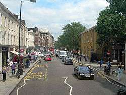 King's Road, looking east towards Sloane Square | |
| Length | 1.9 mi (3.1 km) |
|---|---|
| Location | Chelsea, London, England |
| South end | Sloane Square |
| West end | Waterford Road |
| Other | |
| Known for | Sloane Square tube station, Saatchi Gallery |

King's Road or Kings Road (or sometimes The King's Road, especially when it was the King's private road until 1830), is a major street stretching through Chelsea and Fulham, both in west London. It is associated with 1960s style, and fashion figures such as Mary Quant and Vivienne Westwood. Sir Oswald Mosley's Blackshirt movement had a barracks on the street in the 1930s.[1]
Location
King's Road runs for just under 2 miles (3.2 km) through Chelsea, in the Royal Borough of Kensington and Chelsea, from Sloane Square in the east (on the border with Belgravia and Knightsbridge) and through the Moore Park estate on the border of Chelsea and Fulham opposite Stamford Bridge. Shortly after crossing Stanley bridge the road passes a slight kink at the junction with Waterford Road in Fulham, where it then becomes New King's Road, continuing to Fulham High Street and Putney Bridge; its western end is in the London Borough of Hammersmith and Fulham.
History
King's Road derives its name from its function as a private road used by King Charles II to travel to Kew. It remained a private royal road until 1830, but people with connections were able to use it. Some houses date from the early 18th century. No. 213 has a blue plaque to film director Sir Carol Reed, who lived there from 1948 until his death in 1978. Thomas Arne lived at No. 215 and is believed to have composed "Rule Britannia" there. Ellen Terry lived in the same house from 1904–1920, and also Peter Ustinov; the house is commemorated by a blue plaque also. Photographer Christina Broom was born in 1862 at No 8.
In 1876, the world's first artificial ice rink, the Glaciarium, opened just off King's Road, and later that year it relocated to a building on the street.
During the 1960s the street became a symbol of mod culture, evoking "an endless frieze of mini-skirted, booted, fair-haired angular angels", one magazine later wrote.[2] King's Road was home in the 1960s to the Chelsea Drugstore (originally a chemist with a stylised chrome-and-neon soda fountain upstairs, later a public house, and more recently a McDonalds), and in the 1970s to Malcolm McLaren's boutique, Let It Rock, which was renamed SEX in 1974, and then Seditionaries in 1977. During the hippie and punk eras, it was a centre for counterculture, but has since been gentrified. It serves as Chelsea's high street and has a reputation for being one of London's most fashionable shopping streets. Other celebrated boutiques included Granny Takes a Trip, The Sweet Shop in Blantyre Street just off King's Road at World's End and Stop The Shop, a fashion boutique with a revolving floor.
484 King's Road was the headquarters of Swan Song Records, owned by Led Zeppelin. They left following closure of the company in 1983. King's Road was site of the first UK branch of Starbucks which opened in 1999.
535 King's Road was the headquarters of Cube Records, a late 1960s and early 1970s independent record label. The label folded in the mid 1970s, becoming part of Elektra Records. The building has since been demolished but the new building on the same site still houses a record company.
The road has been represented in popular culture on various occasions: "King's Road" is the title of a song by Tom Petty and the Heartbreakers from the 1981 album Hard Promises and is name-checked in the song "Dick a Dum Dum (King's Road)" which was a hit for Des O'Connor in 1969. In Ian Fleming's novels, James Bond lives in a fashionable unnamed square just off King's Road.
Planning and transport
- Planning
The eastern part of King's Road is identified in the London Plan as one of 35 major centres in Greater London.[3]
- Bus
Buses 11, 19, 22, 49, 211, 319, 328, and C3 all go down King's Road, yet most of these turn off the street at one point or another. The 11 and the 22 are the only routes which run the entirety of King's Road, with the 22 being the only route that runs all the way from Sloane Square to the end of New King's Road in Fulham.
- Rail and Tube
The western end of King's Road is close to Imperial Wharf railway station on the London Overground network, with connections to Willesden Junction and Clapham Junction. Southern also run direct rail services to Milton Keynes Central and East Croydon from this station. At the eastern end of the street is Sloane Square, and Fulham Broadway lies at the western end, on the boundary between Chelsea and Fulham. King's Road, and the area of Chelsea as a whole, is known for having poor links to the London Underground. Due to this, the route of Crossrail 2 is proposed to have an underground station in this area, called King's Road Chelsea.
- River
Chelsea Harbour Pier is also within easy reach of the western end of King's Road, with river bus services provided by London River Services and Thames Executive Charters to Putney and Blackfriars. Further east, the same services are also provided at Cadogan Pier, only a few blocks south of King's Road near the Albert Bridge.
See also
- King's Highway (disambiguation)
- Sloane Ranger
- World's End, Chelsea
- List of eponymous roads in London
- Fulham
- Parsons Green
- Sands End
References
- ↑ My Life, Sir Oswald Mosley, Thomson Nelson & Sons ltd., 1970
- ↑ Seebohm, Caroline (1971-07-19). "English Girls in New York: They Don't Go Home Again". New York. p. 34. Retrieved 6 January 2015.
- ↑ Mayor of London (February 2008). "London Plan (Consolidated with Alterations since 2004)" (PDF). Greater London Authority.
External links
- Audio Walking Tour of King's Road
- The King's Road Cricket & Social Club
- – King's Road London – Local news, community and shopping – Kingsroad.co.uk
Coordinates: 51°29′15″N 0°10′08″W / 51.48737°N 0.168874°W