Kings Mountain, North Carolina
| Kings Mountain, North Carolina | |
|---|---|
| City | |
|
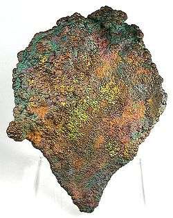
Oxidized botryoidal Hematite with a distinctive multi-colored patina, from Crowders Mountain Iron Prospect near Kings Mountain | |
 Location of Kings Mountain, North Carolina | |
| Coordinates: 35°14′39″N 81°20′33″W / 35.24417°N 81.34250°WCoordinates: 35°14′39″N 81°20′33″W / 35.24417°N 81.34250°W | |
| Country |
|
| State |
|
| County | Cleveland, Gaston |
| Named for | Battle of Kings Mountain |
| Area | |
| • Total | 12.6 sq mi (32.6 km2) |
| • Land | 12.3 sq mi (31.9 km2) |
| • Water | 0.2 sq mi (0.6 km2) |
| Elevation | 1,007 ft (307 m) |
| Population (2010) | |
| • Total | 10,296 |
| • Density | 836/sq mi (322.6/km2) |
| Time zone | Eastern (EST) (UTC-5) |
| • Summer (DST) | EDT (UTC-4) |
| ZIP code | 28086 |
| Area code(s) | 704 |
| FIPS code | 37-35880[1] |
| GNIS feature ID | 0988003[2] |
| Website |
www |
Kings Mountain is a small suburban city within the Charlotte metropolitan area in Cleveland and Gaston counties, North Carolina, United States. Most of the city is in Cleveland County, with a small eastern portion in Gaston County. The population was 10,296 at the 2010 census.[3] The battle of Kings Mountain, was a battle during the revolutionary war. Liberty Mountain, a play done in the local theater, tells all about the battle. The downtown area is home to the museum and police station.
History
Originally the settlement was called White Plains, but when the city was incorporated in 1874, the name was changed. It was decided that "Kings Mountain" would be a more appropriate name since the community was close to the historic Battle of Kings Mountain in York County, South Carolina.
The Central School Historic District, King Street Overhead Bridge, Margrace Mill Village Historic District, Jacob S. Mauney Memorial Library and Teacher's Home, Southern Railway Company Overhead Bridge, and West End Historic District are listed on the National Register of Historic Places.[4][5]
Geography
Kings Mountain is located at 35°14′39″N 81°20′33″W / 35.24417°N 81.34250°W (35.244105, -81.342544).[6] It lies 30 miles (48 km) west of Charlotte along Interstate 85. Gaffney, South Carolina, is 21 miles (34 km) to the southwest along I-85.
According to the United States Census Bureau, the city has a total area of 12.6 square miles (32.6 km2), of which 12.3 square miles (31.9 km2) is land and 0.23 square miles (0.6 km2), or 1.98%, is covered with water.[3]
Demographics
| Historical population | |||
|---|---|---|---|
| Census | Pop. | %± | |
| 1880 | 337 | — | |
| 1890 | 429 | 27.3% | |
| 1900 | 2,062 | 380.7% | |
| 1910 | 2,218 | 7.6% | |
| 1920 | 2,800 | 26.2% | |
| 1930 | 5,632 | 101.1% | |
| 1940 | 6,547 | 16.2% | |
| 1950 | 7,206 | 10.1% | |
| 1960 | 8,008 | 11.1% | |
| 1970 | 8,465 | 5.7% | |
| 1980 | 9,080 | 7.3% | |
| 1990 | 8,763 | −3.5% | |
| 2000 | 9,693 | 10.6% | |
| 2010 | 10,296 | 6.2% | |
| Est. 2015 | 10,760 | [7] | 4.5% |
As of the census[1] of 2000, there were 9,693 people, 3,821 households, and 2,674 families residing in the city. The population density was 1,187.1 people per square mile (458.1/km²). There were 4,064 housing units at an average density of 497.7 per square mile (192.1/km²). The racial makeup of the city was 74.85% White, 21.55% African American, 0.15% Native American, 1.81% Asian, 0.02% Pacific Islander, 0.63% from other races, and 0.99% from two or more races. Hispanic or Latino of any race were 1.43% of the population.
There were 3,821 households out of which 30.7% had children under the age of 18 living with them, 49.4% were married couples living together, 17.2% had a female householder with no husband present, and 30.0% were non-families. 26.8% of all households were made up of individuals and 12.6% had someone living alone who was 65 years of age or older. The average household size was 2.47 and the average family size was 2.98.
In the city the population was spread out with 25.3% under the age of 18, 7.4% from 18 to 24, 27.3% from 25 to 44, 22.4% from 45 to 64, and 17.6% who were 65 years of age or older. The median age was 38 years. For every 100 females there were 85.9 males. For every 100 females age 18 and over, there were 80.4 males.
The median income for a household in the city was $31,415, and the median income for a family was $39,137. Males had a median income of $32,444 versus $22,201 for females. The per capita income for the city was $15,920. About 13.4% of families and 19.2% of the population were below the poverty line, including 29.2% of those under age 18 and 20.7% of those age 65 or over.
Transportation
Kings Mountain lies just to the west of the interchange between Interstate 85, US Highway 74, and US Highway 29.
Kings Mountain is also served by two North Carolina State Highways: NC-161 with service to Bessemer City and York, and NC-216 with service to Cherryville.
Greyhound Lines began scheduled intercity bus service on April 20, 2010. The station is housed at Battleground Petroleum, 726 York Rd., off Interstate 85. The close proximity to I-85 was a major factor in relocating this station from nearby Gastonia, North Carolina.
Notable people
- Otto Briggs (1891–1943), Negro League Baseball player
- Jake Early (1915-1985), Major League Baseball player
- Kevin Mack (born 1962), National Football League player
- John Henry Moss (1919–2009), Minor League Baseball executive and longtime Mayor of Kings Mountain
- Jimmy Wayne (born 1972), country music singer and songwriter
See also
- Kings Mountain National Military Park
- Battle of Kings Mountain
- Parker Hannifin
- Indian (motorcycle)
- Martin Marietta
- Lincoln Academy
References
- 1 2 "American FactFinder". United States Census Bureau. Retrieved 2008-01-31.
- ↑ "US Board on Geographic Names". United States Geological Survey. 2007-10-25. Retrieved 2008-01-31.
- 1 2 "Geographic Identifiers: 2010 Demographic Profile Data (G001): Kings Mountain city, North Carolina". U.S. Census Bureau, American Factfinder. Retrieved March 27, 2013.
- ↑ National Park Service (2010-07-09). "National Register Information System". National Register of Historic Places. National Park Service.
- ↑ "National Register of Historic Places Listings". Weekly List of Actions Taken on Properties: 12/15/14 through 12/19/14. National Park Service. 2014-12-24.
- ↑ "US Gazetteer files: 2010, 2000, and 1990". United States Census Bureau. 2011-02-12. Retrieved 2011-04-23.
- ↑ "Annual Estimates of the Resident Population for Incorporated Places: April 1, 2010 to July 1, 2015". Retrieved July 2, 2016.
- ↑ "Census of Population and Housing". Census.gov. Retrieved June 4, 2015.
External links
|  | ||||||||||||||||||||
|
| |||||||||||||||||||||
Municipalities and communities of Cleveland County, North Carolina, United States | ||
|---|---|---|
| Cities | 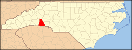 | |
| Towns | ||
| CDP | ||
| Unincorporated communities | ||
| Footnotes | ‡This populated place also has portions in an adjacent county or counties | |
Municipalities and communities of Gaston County, North Carolina, United States | ||
|---|---|---|
| Cities |  | |
| Towns | ||
| Unincorporated communities | ||
| Footnotes | ‡This populated place also has portions in an adjacent county or counties | |