Kigoma
| Kigoma | |
|---|---|
|
Kigoma Railway Station | |
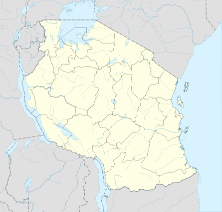 Kigoma Location in Tanzania | |
| Coordinates: 4°53′S 29°38′E / 4.883°S 29.633°E | |
| Country |
|
| Region | Kigoma Region |
| District | Kigoma Ujiji |
| Elevation | 775 m (2,543 ft) |
| Population (2007) | |
| • Total | 135,234 |
| • | 100,000 |
| Time zone | East Africa Time (UTC+3) |
| Climate | Aw |

Kigoma is a town and lake port in western Tanzania, on the eastern shore of Lake Tanganyika and close to the border with Burundi and the Democratic Republic of the Congo. It serves as the capital for the surrounding Kigoma Region and has a population of 135,234 (2007 census) and an elevation of 775 m.
The historic trading town of Ujiji is 6 km south-east of Kigoma.
Kigoma Port
Kigoma is one of the busiest ports on Lake Tanganyika, since historically it was the only one that had a functioning railway connection (the one at Kalemie in DR Congo is not operational), a direct link to the seaport at Dar-es-Salaam. Kigoma Port in Kigoma Bay has a wharf of two hundred metres and several cranes and is equipped to handle shipping containers.[1] However, the bay is suffering from silting up as a result of soil erosion from surrounding hills, and the water depth at wharfside has diminished from 6 m to 1.8 m which threatens the economic future of the port. In May 2007 the Tanzanian Government announced a plan to create an economic zone at the port to stimulate trade.[2]
The MV Liemba sails every week from Kigoma to Mpulungu in Zambia at the southern tip of the lake, stopping at a number of other lakeside towns in Tanzania on the way. The MV Mwongozo sails from Kigoma to Baraka , Uvira and Bujumbura at the northern tip of the lake Tanganyika.
Road connections for Kigoma are poor. A gravel road links the town northeast to the national road network, and earth tracks link north to Burundi and southeast to Sumbawanga.[3]
Kigoma-Dar es Salaam Railway
The Central Line of the Tanzania Railways Corporation runs from Kigoma to the port of Dar-es-Salaam on the Indian Ocean coast via Tabora and Dodoma. It was completed in 1915 when Kigoma was part of German East Africa. In Tabora, there is connection to Mwanza on Lake Victoria, with ferry connections to Uganda. At Tabora you can also travel by train to Mpanda. For a time in early 2010, the line was closed[4] but service has apparently been restored.[5]
Climate

| Climate data for Kigoma | |||||||||||||
|---|---|---|---|---|---|---|---|---|---|---|---|---|---|
| Month | Jan | Feb | Mar | Apr | May | Jun | Jul | Aug | Sep | Oct | Nov | Dec | Year |
| Average high °C (°F) | 27 (80) |
27 (81) |
27 (81) |
27 (81) |
28 (83) |
28 (83) |
28 (83) |
29 (84) |
29 (85) |
29 (84) |
27 (80) |
26 (79) |
28 (82) |
| Average low °C (°F) | 19 (67) |
19 (67) |
19 (67) |
19 (67) |
19 (67) |
18 (64) |
17 (63) |
18 (64) |
20 (68) |
21 (69) |
20 (68) |
19 (67) |
19 (67) |
| Average precipitation mm (inches) | 122 (4.8) |
130 (5) |
150 (5.9) |
130 (5.1) |
43 (1.7) |
5 (0.2) |
3 (0.1) |
5 (0.2) |
18 (0.7) |
48 (1.9) |
142 (5.6) |
135 (5.3) |
927 (36.5) |
| Source: Weatherbase [6] | |||||||||||||
References
- ↑ Tanzania Railways Corporation: Kigoma Port. Retrieved 30 May 2007.
- ↑ Daily News, Tanzania: "500m/- set for Kigoma economic zone." Monday, May 28, 2007. Retrieved 31 May 2007.
- ↑ Michelin Motoring and Tourist Map (2000): "No 955 Africa Central and South". Michelin, Paris.
- ↑ The Economist, Burundi's election; Pretty squalid; East Africa’s weakest new component Retrieved 24 July 2010
- ↑ The Washington Post, A train ride across Tanzania Retrieved 9 October 2010
- ↑ "Weatherbase: Historical Weather for Kigoma, Tanzania". Weatherbase. 2011. Retrieved on November 24, 2011.
Coordinates: 04°53′S 29°38′E / 4.883°S 29.633°E