Khunjerab Pass
| Khunjerab Pass | |
|---|---|
|
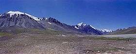
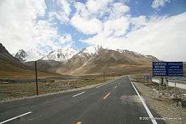
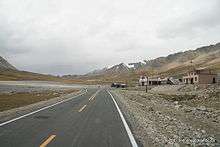
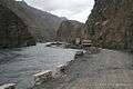
Khunjerab Pass viewed from the Kashmiri side | |
| Elevation | 4,693 m (15,397 ft) |
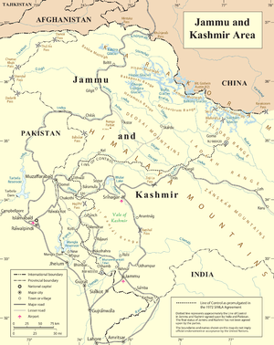
| Location | Xinjiang, China / Gilgit–Baltistan, Pakistan |
| Range | Karakoram Range |
| Coordinates | 36°51′00″N 75°25′40″E / 36.85000°N 75.42778°ECoordinates: 36°51′00″N 75°25′40″E / 36.85000°N 75.42778°E |
| Khunjerab Pass | |||||||
| Chinese name | |||||||
|---|---|---|---|---|---|---|---|
| Traditional Chinese | 紅其拉甫山口 | ||||||
| Simplified Chinese | 红其拉甫山口 | ||||||
| |||||||
| Urdu name | |||||||
| Urdu | درّہ خنجراب | ||||||
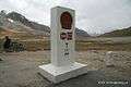
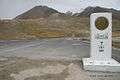
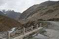
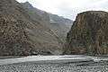
Khunjerab Pass or Khunjerav (elevation 4,693 metres or 15,397 feet) is a high mountain pass in the Karakoram Mountains in a strategic position on the northern border of Pakistan's Gilgit–Baltistan Hunza – Nagar District on the southwest border of the Xinjiang region of China. Its name is derived from two words of the local Wakhi language : 'Khun' means Home and 'Jerav' means a creek coming from spring water/water falling.
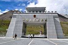
Sino-Pakistani border crossing
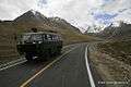
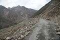
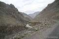
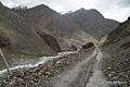
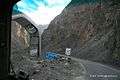
The Khunjerab Pass is the highest paved international border crossing in the world and the highest point on the Karakoram Highway. The roadway across the pass was completed in 1982, and has superseded the unpaved Mintaka and Kilik Passes as the primary passage across the Karakoram Range.
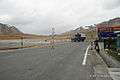
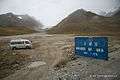
On the Pakistani side, the pass is 42 km (26 mi) from the National Park station and checkpoint in Dih, 75 km (47 mi) from the customs and immigration post in Sost, 270 km (170 mi) from Gilgit, and 870 km (540 mi) from Islamabad.
On the Chinese side, the pass is the southwest terminus of China National Highway 314 (G314) and is 130 km (81 mi) from Tashkurgan, 420 km (260 mi) from Kashgar and some 1,890 km (1,170 mi) from Urumqi. The Chinese port of entry is located 3.5 km (2.2 mi) along the road from the pass in Tashkurgan County.
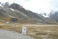
The long, relatively flat pass is often snow-covered[1] during the winter season and as a consequence is generally closed from November 30 to May 1.[2]
Since June 1, 2006, there has been a daily bus service across the boundary from Gilgit, to Kashgar, Xinjiang[3]

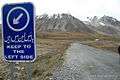
This is one of the international borders where left-hand traffic (Pakistan) changes to right-hand traffic (China) and vice versa.[4]
Railway
In 2007, consultants[5] were engaged to investigate the construction of a railway through this pass to connect China with transport in Pakistani-administered Gilgit-Baltistan. A feasibility study started in November 2009 for a line connecting Havelian 750 km (466 mi) away in Pakistan and Kashgar 350 km (217 mi) in Xinjiang.[6]
See also

Gallery
 UN map of Siachin
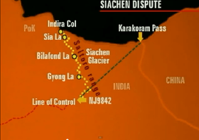 Actual Ground Position Line shown with yellow-colored dotted line


Footnotes
- ↑ http://www.travelntourism.org/pakistan/snowfall-khunjerab-pass-gilgit-baltistan.html
- ↑ "Khunjerab Pass". www.dangerousroads.org. Retrieved 2016-09-18.
- ↑ Road widening work has begun on 600 km (370 mi) of the highway.
- ↑ Right- and left-hand traffic
- ↑ Online Asia Times South Asia Feb 24, 2007. "China-Pakistan rail link on horizon." Syed Fazl-e-Haider.
- ↑ http://www.fallingrain.com/world/CH/13/Kashi.html
References
- Curzon, George Nathaniel. 1896. The Pamirs and the Source of the Oxus. Royal Geographical Society, London. Reprint: Elibron Classics Series, Adamant Media Corporation. 2005. ISBN 1-4021-5983-8 (pbk); ISBN 1-4021-3090-2 (hbk).
- King, John 1989. Karakoram Highway : the high road to China. Hawthorn, Victoria, Lonely Planet Publications. ISBN 0-86442-065-X
| Wikimedia Commons has media related to Khunjerab Pass. |
- Episode 13/30 of the NHK television series The Silk Road, a series originally shown in Japan in the early 1980s.