Khlong Toei District
| Khlong Toei คลองเตย | |
|---|---|
| Khet | |
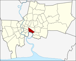 Khet location in Bangkok | |
| Coordinates: 13°42′29″N 100°35′2″E / 13.70806°N 100.58389°ECoordinates: 13°42′29″N 100°35′2″E / 13.70806°N 100.58389°E | |
| Country | Thailand |
| Province | Bangkok |
| Seat | Khlong Toei |
| Khwaeng | 3 |
| Khet established | November 9, 1989 |
| Area | |
| • Total | 13.0 km2 (5.0 sq mi) |
| Population (2015) | |
| • Total | 106,233 |
| • Density | 8,171.76/km2 (21,164.8/sq mi) |
| Time zone | ICT (UTC+7) |
| Postal code |
10110 except parts of Phra Khanong: 10260 |
| Geocode | 1033 |
Khlong Toei (also Klong Toey, Thai: คลองเตย; IPA: [kʰlɔ̄ːŋ tɤ̄ːj]) is a district in central Bangkok, long known for its slum. It is bordered by the Chao Phraya River and contains major port facilities. It is also the site of a major market.
Neighboring districts are (clockwise from the north): Watthana, Phra Khanong, Amphoe Phra Pradaeng of Samut Prakan Province (across the Chao Phraya), Yan Nawa, Sathon, and Pathum Wan.
History

The district was once part of Phra Khanong, but on 9 November 1989 it was separated into a new district. Originally Khlong Toei consisted of six sub-districts, three of which formed the new Watthana District (announced on 14 October 1997, effective 6 March 1998).
The area has a history dating back to the ninth century as a port to cities upstream along the Chao Phraya River, such as Pak Nam Phra Pradaeng (Thai: เมืองปากน้ำพระประแดง) (as opposed to the current Amphoe Phra Pradaeng) built during the King Phutthayotfa Chulalok period. Khlong Thanon Trong (Thai: คลองถนนตรง) was a khlong (canal) and a parallel road built by King Mongkut around 1857. Later, it became known as Khlong Toei and Khlong Hua Lamphong for different sections of the canal. Khlong Toei means the canal of pandan, as the plant grew along the southern bank of the canal. The road was renamed Rama IV Road by King Vajiravudh in 1919. In 1947, a large portion of Khlong Toei canal was filled to expand the Rama IV Road surface.
Administration

The district is divided into three sub-districts (khwaeng). From west to east, these are:
| 1. | Khlong Toei | คลองเตย | from the railway to Sukhumvit Soi 22 |
| 2. | Khlong Tan | คลองตัน | from Sukhumvit Soi 22 to Soi 36 |
| 3. | Phra Khanong | พระโขนง | from Sukhumvit 36 to 52 |
Khlong Toei is both the name of a sub-district and the district in which it lies. Phra Khanong is both a sub-district of Khlong Toei and a district on its own, with only sub-district Bang Chak. Furthermore, all three sub-districts listed above have counterparts with the addition of "nuea" (north) in Watthana District.
Port
Khlong Toei Port, also known as Bangkok Port, was Thailand's only major port for sea transportation of cargo. Its construction began in 1938 and finished after World War II. The port is on the Chao Phraya River, not far from the Gulf of Thailand. Due to its limited capacity and traffic problems caused by semi-trailer trucks, much of its shipping operation has moved to Laem Chabang Port in Chonburi Province since it was opened in July 1981.
Places


Attractions include:
- Bangkok Planetarium
- Science Centre for Education
- Tamnak Plai Noen, the historic residence of Prince Naris, now converted into a small museum.
- Stock Exchange of Thailand Building
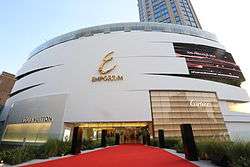
- The Emporium, a luxury shopping center.
- Nana Plaza, a major center for prostitution with go-go and hostess bars.
- Queen Sirikit National Convention Center, served by the Bangkok Metro station of the same name, hosts various exhibitions around the year.
- Benjakitti Park, a public park next to the convention center. It includes a lake and is on land that was formerly occupied by the Tobacco Monopoly, the government's tobacco factory.
- Benjasiri Park, a public park created to commemorate Her Majesty Queen Sirikit's 60th birthday. It is next to the Emporium.
- Chuvit Garden, a public park in the district created by massage parlor tycoon-turned-politician Chuwit Kamolvisit from his own plot of land, about 2,400 m² in size and worth about 1,250 million baht at the time of opening.[1] Opened in December 2005, it is located on Sukhumvit Soi 10.
- Khlong Toei Market, Bangkok's largest wet market.
- PAT Stadium off Sunthon Kosa Road.
- Port Authority of Thailand
- Eastern Bus Terminal (Ekkamai)
- Thailand Tobacco Monopoly
The following places of interest were formerly in Khlong Toei District:
- Lumpinee Boxing Stadium, an indoor Muay Thai arena, now moved to a new location.
- Suan Lum Night Bazaar, closed due to contract expiry, now moved to Suan Lum Night Bazaar Ratchadaphisek.
Transportation
- Bangkok Skytrain (BTS) stations in the district are Nana, Asok (with interchange to Bangkok Metro Sukhumvit station), Phrom Phong, Thong Lo, Ekkamai, Phra Khanong, and On Nut, all along Sukhumvit Road on the BTS Sukhumvit Line.
- Bangkok Metro (MRTA) has stations Khlong Toei, Queen Sirikit National Convention Center and Sukhumvit (interchange to BTS).
- Eastern Bus Terminal (also called Ekkamai Bus Terminal) has inter-city buses to destinations such as Pattaya, Rayong and Trat. It is on Sukhumvit Road, near the Ekkamai BTS station.
Education
The Sacred Heart Convent School is in Khlong Toei.[2]
References
- ↑ "Chuwit opened billion Baht value garden, asking other billionaires to do the Same(in Thai)". manager.co.th. 24 December 2005. Retrieved 11 December 2015.
- ↑ Home Sacred Heart Convent School. Retrieved on 6 March 2013.
External links
- BMA website with the tourist landmarks of Khlong Toei
- Khlong Toei district office (Thai only)
- History of Khlong Toei port
.svg.png)