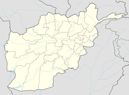
Khash, Nimruz
For other uses, see Khash (disambiguation).
| Khash خاش Ghurghuri | |
|---|---|
| Town | |
 Khash Location | |
| Coordinates: 31°26′38″N 62°38′06″E / 31.444°N 62.635°ECoordinates: 31°26′38″N 62°38′06″E / 31.444°N 62.635°E | |
| Country |
|
| Province | Nimruz Province |
| District | Khash Rod District |
| Elevation | 553 m (1,814 ft) |
| Time zone | +4:30 |
Khash (Persian/Pashto: خاش), also called Ghurghuri (Pashto/Balochi: غورغوري) is a town in the Khash Rod District of Nimruz Province, Afghanistan.
Climate
Khash has a hot desert climate (Köppen BWh), characterised by little precipitation and high variation between summer and winter temperatures. The average temperature in Khash is 21.4 °C, while the annual precipitation averages 62 mm. July is the hottest month of the year with an average temperature of 34.4 °C. The coldest month January has an average temperature of 8.0 °C.
| Climate data for Khash | |||||||||||||
|---|---|---|---|---|---|---|---|---|---|---|---|---|---|
| Month | Jan | Feb | Mar | Apr | May | Jun | Jul | Aug | Sep | Oct | Nov | Dec | Year |
| Average high °C (°F) | 15.4 (59.7) |
18.6 (65.5) |
24.9 (76.8) |
30.9 (87.6) |
36.5 (97.7) |
42.0 (107.6) |
42.7 (108.9) |
41.3 (106.3) |
36.6 (97.9) |
30.8 (87.4) |
23.2 (73.8) |
17.7 (63.9) |
30.05 (86.09) |
| Daily mean °C (°F) | 8.0 (46.4) |
11.1 (52) |
16.8 (62.2) |
22.5 (72.5) |
27.7 (81.9) |
32.8 (91) |
34.4 (93.9) |
32.4 (90.3) |
27.0 (80.6) |
21.0 (69.8) |
13.7 (56.7) |
9.1 (48.4) |
21.38 (70.47) |
| Average low °C (°F) | 0.7 (33.3) |
3.6 (38.5) |
8.8 (47.8) |
14.1 (57.4) |
19.0 (66.2) |
23.7 (74.7) |
26.1 (79) |
23.5 (74.3) |
17.5 (63.5) |
11.2 (52.2) |
4.3 (39.7) |
0.5 (32.9) |
12.75 (54.96) |
| Source: Climate-Data.org[1] | |||||||||||||
References
- ↑ "Climate: Khash - Climate-Data.org". Retrieved 15 September 2016.
This article is issued from Wikipedia - version of the 10/18/2016. The text is available under the Creative Commons Attribution/Share Alike but additional terms may apply for the media files.