Kharkhoda (Haryana)
| Kharkhoda | |
|---|---|
| city | |
 Kharkhoda  Kharkhoda Location in Haryana, India | |
| Coordinates: 28°31′N 76°30′E / 28.52°N 76.5°ECoordinates: 28°31′N 76°30′E / 28.52°N 76.5°E | |
| Country |
|
| State | Haryana |
| District | Sonipat |
| Founded by | Dahiya Badshah |
| Population (2001) | |
| • Total | 18,758 |
| Languages | |
| • Official | Hindi |
| Time zone | IST (UTC+5:30) |
| 131402 | 131402 |
| Vehicle registration | HR 79 |
| Website |
haryana |
Kharkhoda is a city, the administrative headquarters of Kharkhoda Tehsil and a municipal committee in Sonipat district in the Indian state of Haryana.In kharkhoda there is a temple of lord shiva which is very popular within the connected villages at the time of shivratri a large number of tourists comes for visiting the temple. Due to proximity of Delhi ,there is lot of scope of industrial and residential development in the area. HSIIDC acquired 3200 Acres of land to develop Industrial Model Township(IMT). Kundli-Manesar-Palwal (KMP) Expressway is just 1 km away from the city. In October,2015 Chinese Delegation (Wenda Group) of around 35 people visit the city to develop Entertainment Theme City in the area.
Geography
Kharkhauda is located at 28°31′N 76°30′E / 28.52°N 76.5°E.[1] It has an average elevation of 207 metres (682 feet).
Demography
As of 2001 India census, Kharkhoda had a population of 18,758.[2] As a Tehsil it contain 45 villages in which Khanda, Sonipat village is very famous because there are 100 Brick factories (Bhatta) in this village. Tehsil had population of 160083 in villages. Nearby village is Khanda, Sonipat. Males constitute 53% of the population and females 47%. Kharkhoda has an average literacy rate of 89%, higher than the national average of 59.5%: male literacy is 71%, and female literacy is 56%. In Kharkhoda, 16% of the population is under 6 years of age. 57% of the population is saini, 12% is Brahman, 8% is Punjabi, and others are about 20%. Its current population is about 21,302.[3] Kharkhoda can be made subdivision after ongoing census of India.[4] The most common language spoken in Kharkhoda is Haryanvi. Dahiya is major surname in this area.
It said to derive its name from Kharak, meaning a stall. Another tradition connects it with Khara and Dushana, the brothers of Ravana, the rakshasa king of Lanka (now Sri Lanka).
It is located 16 miles to the west from nearby city, Rohtak. Total distance between Kharkhoda to Sonipat is 19 km and Khanda is 5km away. It has an elected municipal body to run the municipal administration of the town, which also contains the headquarters of the tehsil of Kharkhoda. In this historical site, there is a tomb of Syed Sufi and his fair held annually. Also,there is a mandir which is very famous for Parwan ji Maharaj, a spiritual guru.
The town nurses a number of places of public utility of which a college, a civil veterinary hospital, a civil dispensary, a post office and police station are worth mentioning. It is an important grain market.
Very soon Kharkhoda town is going to become Industrial Model Town. Also a new Civil Hospital is under construction at Thana Kalan Road. Also, the new roads are under construction up to the newly constructed bypass all over the town. ITI has been constructed on Matindu Bye pass.
References
- ↑ Falling Rain Genomics, Inc – Kharkhauda. Fallingrain.com. Retrieved on 2012-06-14.
- ↑ "District Sonipat at a glance". sonipat.nic.in.
- ↑ "Kharkhoda, Haryana, India". wolframalpha.com.
- ↑ "Kharkhoda to be made subdivision". tribuneindia.com. 2011-02-21.
Sonipat district topics | ||
|---|---|---|
| Cities and towns | 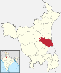 | |
| Education | ||
| Transport | ||
| Lok Sabha constituencies | ||