Khao Suan Kwang District
| Khao Suan Kwang เขาสวนกวาง | |
|---|---|
| Amphoe | |
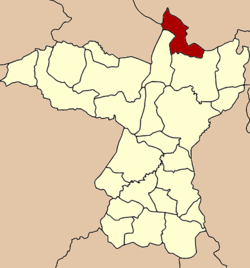 Amphoe location in Khon Kaen Province | |
| Coordinates: 16°51′31″N 102°51′42″E / 16.85861°N 102.86167°ECoordinates: 16°51′31″N 102°51′42″E / 16.85861°N 102.86167°E | |
| Country |
|
| Province | Khon Kaen |
| Seat | Kham Muang |
| Area | |
| • Total | 329.9 km2 (127.4 sq mi) |
| Population (2005) | |
| • Total | 37,169 |
| • Density | 122.7/km2 (318/sq mi) |
| Time zone | THA (UTC+7) |
| Postal code | 40280 |
| Geocode | 4019 |
Khao Suan Kwang (Thai: เขาสวนกวาง, pronounced [kʰǎw sǔa̯n kwāːŋ]) is a district (Amphoe) of Khon Kaen Province, northeastern Thailand.
History
The minor district (King Amphoe) Khao Suan Kwang was established in 1978 by splitting it from Nam Phong district. It was upgraded to a full district on March 16, 1985.[1][2]
Geography
Neighboring districts are (from the south clockwise) Nam Phong and Ubolratana of Khon Kaen Province, Non Sang of Nongbua Lamphu Province, Nong Wua So, Nong Saeng and Non Sa-at of Udon Thani Province.
Administration
The district is subdivided into 5 subdistricts (tambon), which are further subdivided into 56 villages (muban). Khao Suan Kwang is a township (thesaban tambon) which covers parts of tambon Khao Suan Kwang and Kham Muang. There are further 5 Tambon administrative organizations (TAO).
| No. | Name | Thai name | Villages | Inh. | |
|---|---|---|---|---|---|
| 1. | Khao Suan Kwang | เขาสวนกวาง | 11 | 8,849 | |
| 2. | Dong Mueang Aem | ดงเมืองแอม | 15 | 8,838 | |
| 3. | Na Ngio | นางิ้ว | 7 | 5,297 | |
| 4. | Non Sombun | โนนสมบูรณ์ | 10 | 5,772 | |
| 5. | Kham Muang | คำม่วง | 13 | 8,413 |
References
- ↑ History of Khao Suan Kwang at cddweb.cdd.go.th
- ↑ พระราชกฤษฎีกาตั้งอำเภอเขาสวนกวาง อำเภอแปลงยาว อำเภอบ่อทอง อำเภอปะคำ และอำเภอบ้านฉาง พ.ศ. ๒๕๒๘ (PDF). Royal Gazette (in Thai). 102 (33 ก special): 7–9. March 15, 1985.