Khabur River
| Khabur | |
| Arabic: نهر الخابور, Aramaic:ܢܗܪܐ ܕܚܒܘܪ, Kurdish: Çemê Xabûr, Turkish: Habur Nehri, Habor, Chaboras, Hebrew Kebar,Chebar | |
| river | |
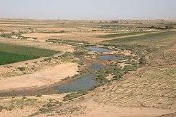 Khabur south of Al-Hasakah | |
| Countries | Syria, Turkey |
|---|---|
| City | Ra's al-'Ayn, Al-Hasakah, Busayrah |
| Source | Ras al-'Ayn |
| - elevation | 350 m (1,148 ft) |
| Mouth | Euphrates |
| - coordinates | 35°8′33″N 40°25′51″E / 35.14250°N 40.43083°ECoordinates: 35°8′33″N 40°25′51″E / 35.14250°N 40.43083°E |
| Length | 486 km (302 mi) |
| Basin | 37,081 km2 (14,317 sq mi) |
| Discharge | |
| - average | 45 m3/s (1,589 cu ft/s) |
| - max | 57 m3/s (2,013 cu ft/s) |
| - min | 2 m3/s (71 cu ft/s) |
| [1][2] | |
The Khabur River (Arabic: الخابور al-khābūr, Kurdish: Xabûr, Syriac: ܚܒܘܪ ḥābur/khābur, Turkish: Habur) is the largest perennial tributary to the Euphrates in Syrian territory. Although the Khabur originates in Turkey, the karstic springs around Ra's al-'Ayn are the river's main source of water. Several important wadis join the Khabur north of Al-Hasakah, together creating what is known as the Khabur Triangle, or Upper Khabur area. From north to south, annual rainfall in the Khabur basin decreases from over 400 mm to less than 200 mm, making the river a vital water source for agriculture throughout history. The Khabur joins the Euphrates near the town of Busayrah.
Geography
The course of the Khabur can be divided in two distinct zones: the Upper Khabur area or Khabur Triangle north of Al-Hasakah, and the Middle and Lower Khabur between Al-Hasakah and Busayrah.
Tributaries
The tributaries to the Khabur are listed from east to west. Most of these wadis only carry water for part of the year.
History
Since the 1930s, numerous archaeological excavations and surveys have been carried out in the Khabur Valley, indicating that the region has been occupied since the Lower Palaeolithic period.[3] Important sites that have been excavated include Tell Halaf, Tell Brak, Tell Leilan, Tell Mashnaqa, Tell Mozan and Tell Barri. The region has given its name to a distinctive painted ware found in northern Mesopotamia and Syria in the early 2nd millennium BCE, called Khabur ware. The region of the Khabur River is also associated with the rise of the Kingdom of the Mitanni that flourished c.1500-1300 BC.
The Khabur River is mentioned in 1 Chronicles 5:26 in the Hebrew Bible: "Tiglath-Pileser ... took the Reubenites, the Gadites and the half tribe of Manasseh into exile. He took them to Halah, Habor (Khabur), Hara and the River Gozan, where they are to this day". (NIV) The identification of the Khabur with the Habor is not contested.
The Khabur river was sometimes identified with the Chebar or Kebar, the location of Tel Abib and setting of several important scenes of the Book of Ezekiel. However, recent scholarship identifies the Chebar as the ka-ba-ru waterway mentioned among the 5th century BCE Murushu archives from Nippur, close to Nippur and the Shatt el-Nil, a silted up canal toward the east of Babylon.[4]
Modern Khabur River Valley
The Khabur River Project, begun in the 1960s, involved the construction of a series of dams and canals. Three dams have been constructed in the Khabur Basin as part of a large irrigation scheme that also includes the Tabqa Dam on the Euphrates. Two dams, Hasakah West and Hasakah East, have been constructed on tributaries to the Khabur between Ra's al-'Ayn and Al-Hasakah. The capacity of the reservoir of Hasakah West is 0.09 km3; that of Hasakah East is 0.2 km3. A third dam, Hassakeh South, was constructed on the Khabur 25 km south of Al-Hasakah. The reservoir of this dam has a capacity of 0.7 km3.[5] The Khabur Valley, which now has about four million acres (16,000 km²) of farmland, is Syria's main wheat-cultivation area. The northeastern part is also the center for Syria's oil production.
References
- ↑ Hole F; Zaitchik, BF (2007). "Policies, plans, practice, and prospects: irrigation in northeastern Syria". Land Degradation & Development. 18 (2): 133–152. doi:10.1002/ldr.772.
- ↑ Burdon, DJ; Safadi, C (1963). "Ras-el-Ain: the great karstic spring of Mesopotamia. An hydrogeological study". Journal of Hydrology. 1: 58–95. doi:10.1016/0022-1694(63)90033-7.
- ↑ Nishiaki, Y. (1992). "Preliminary results of the prehistoric survey in the Khabur Basin, Syria: 1990–91 seasons". Paléorient. 18 (1): 97–102. doi:10.3406/paleo.1992.4566. Retrieved 7 July 2010.
- ↑ Thompson, Henry O. (1992). "Chebar," in ABD. Vol 1: Doubleday. p. 893. ISBN 0-385-19351-3.
- ↑ Mutin, Georges (2003). "Le Tigre et l'Euphrate de la discorde". VertigO (in French). 4 (3): 1–10. doi:10.4000/vertigo.3869. Retrieved 18 December 2009.