Keya Paha County, Nebraska
| Keya Paha County, Nebraska | |
|---|---|
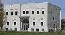 Keya Paha County Courthouse in Springview | |
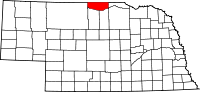 Location in the U.S. state of Nebraska | |
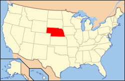 Nebraska's location in the U.S. | |
| Founded | November 4, 1884 |
| Seat | Springview |
| Largest village | Springview |
| Area | |
| • Total | 774 sq mi (2,005 km2) |
| • Land | 773 sq mi (2,002 km2) |
| • Water | 0.8 sq mi (2 km2), 0.1% |
| Population (est.) | |
| • (2013) | 790 |
| • Density | 1.1/sq mi (0/km²) |
| Congressional district | 3rd |
| Time zone | Central: UTC-6/-5 |
| Website |
www |
Keya Paha County (/ˈkɪpəhɔː/ KIP-ə-haw)[1] is a county located in the U.S. state of Nebraska. As of the 2010 census, the population was 824.[2] Its county seat is Springview.[3]
In the Nebraska license plate system, Keya Paha County is represented by the prefix 82 (it had the 82nd-largest number of vehicles registered in the county when the license plate system was established in 1922).
History
Keya Paha County was organized in 1884 from land given by Brown County.[4]
The name "Keya Paha" is taken from the Dakota language; literally translated, it means "turtle hill". The Dakota name for a set of small hills was given to the county and to the Keya Paha River, which runs through it.[5]
Geography
According to the U.S. Census Bureau, the county has a total area of 774 square miles (2,000 km2), of which 773 square miles (2,000 km2) is land and 0.8 square miles (2.1 km2) (0.1%) is water.[6]
Keya Paha County is located in Nebraska's Outback region.[7]
Major highways
Adjacent counties
- Tripp County, South Dakota - north
- Gregory County, South Dakota - northeast
- Boyd County - east
- Holt County - southeast
- Rock County - south
- Brown County - south
- Cherry County - west
- Todd County, South Dakota - northwest
National protected area
Demographics
| Historical population | |||
|---|---|---|---|
| Census | Pop. | %± | |
| 1890 | 3,920 | — | |
| 1900 | 3,076 | −21.5% | |
| 1910 | 3,452 | 12.2% | |
| 1920 | 3,594 | 4.1% | |
| 1930 | 3,203 | −10.9% | |
| 1940 | 3,235 | 1.0% | |
| 1950 | 2,160 | −33.2% | |
| 1960 | 1,672 | −22.6% | |
| 1970 | 1,340 | −19.9% | |
| 1980 | 1,301 | −2.9% | |
| 1990 | 1,029 | −20.9% | |
| 2000 | 983 | −4.5% | |
| 2010 | 824 | −16.2% | |
| Est. 2015 | 804 | [8] | −2.4% |
| U.S. Decennial Census[9] 1790-1960[10] 1900-1990[11] 1990-2000[12] 2010-2013[2] | |||
As of the census[13] of 2000, there were 983 people, 409 households, and 292 families residing in the county. The population density was 1 people per square mile (0/km²); there were 548 housing units at an average density of 1 per square mile (0/km²). The racial makeup of the county was 99.39% White, 0.20% Native American, and 0.41% from two or more races; 3.87% of the population were Hispanic or Latino of any race; 46.7% were of German, 10.6% English, 9.8% American, 7.0% Irish and 6.0% Swedish ancestry according to Census 2000.
There were 409 households out of which 24.90% had children under the age of 18 living with them, 64.30% were married couples living together, 4.40% had a female householder with no husband present, and 28.60% were non-families. 26.20% of all households were made up of individuals and 13.90% had someone living alone who was 65 years of age or older. The average household size was 2.40 and the average family size was 2.91.
In the county the population was spread out with 23.80% under the age of 18, 6.70% from 18 to 24, 23.40% from 25 to 44, 25.40% from 45 to 64, and 20.70% who were 65 years of age or older. The median age was 42 years. For every 100 females there were 101.40 males. For every 100 females age 18 and over, there were 101.90 males.
The median income for a household in the county was $24,911, and the median income for a family was $28,287. Males had a median income of $18,750 versus $19,107 for females. The per capita income for the county was $11,860. About 22.40% of families and 26.90% of the population were below the poverty line, including 34.30% of those under age 18 and 18.80% of those age 65 or over.
Politics
Keya Paha County is the most Republican of all the counties in Nebraska, with 82.7% of its 707 registered voters registered as Republicans.[14] The last Democratic Presidential candidate to win the county was Woodrow Wilson in 1916.[15] and Ben Nelson, in 1994, was the last Democratic gubernatorial candidate to carry the county.[16]
Communities
- Brocksburg
- Burton
- Jamison
- Meadville
- Mills
- Norden
- Riverview
- Springview (county seat)
See also
References
- ↑ McNally, Hannah, and Diana Lambdin Meyer (1997). Nebraska: Off the Beaten Path. Morris Book Publishing LLC. p. 81.
- 1 2 "State & County QuickFacts". United States Census Bureau. Retrieved September 21, 2013.
- ↑ "Find a County". National Association of Counties. Retrieved 2011-06-07.
- ↑ Burr, George L.; Buck, O. O. (1921). History of Hamilton and Clay Counties, Nebraska. S.J. Clarke Publishing Company. p. 123.
- ↑ Fitzpatrick, Lilian Linder (1925). "Nebraska Place-Names". University of Nebraska Department of English. Retrieved 2013-10-16.
- ↑ "2010 Census Gazetteer Files". United States Census Bureau. August 22, 2012. Retrieved December 8, 2014.
- ↑ "About", North Central RC&D. Retrieved 9/17/07
- ↑ "County Totals Dataset: Population, Population Change and Estimated Components of Population Change: April 1, 2010 to July 1, 2015". Retrieved July 2, 2016.
- ↑ "U.S. Decennial Census". United States Census Bureau. Retrieved December 8, 2014.
- ↑ "Historical Census Browser". University of Virginia Library. Retrieved December 8, 2014.
- ↑ "Population of Counties by Decennial Census: 1900 to 1990". United States Census Bureau. Retrieved December 8, 2014.
- ↑ "Census 2000 PHC-T-4. Ranking Tables for Counties: 1990 and 2000" (PDF). United States Census Bureau. Retrieved December 8, 2014.
- ↑ "American FactFinder". United States Census Bureau. Retrieved 2008-01-31.
- ↑ http://www.sos.ne.gov/elec/pdf/10-28-08_Final_VR_Report.pdf
- ↑ Geographie Electorale
- ↑ David Leip Electoral Atlas (Maps for Nebraska gubernatorial races)
 |
Todd County, South Dakota | Tripp County, South Dakota | Gregory County, South Dakota | |
| Cherry County | |
Boyd County | ||
| ||||
| | ||||
| Rock County and Brown County | Holt County |
Municipalities and communities of Keya Paha County, Nebraska, United States | ||
|---|---|---|
| Villages | ||
| Unincorporated communities | ||
| Ghost town | ||
Coordinates: 42°53′N 99°43′W / 42.88°N 99.72°W