Keren, Eritrea
| Keren ከረን كيرين | |
|---|---|
| City | |
 | |
 Keren Location in Eritrea | |
| Coordinates: 15°46′40″N 38°27′29″E / 15.77778°N 38.45806°E | |
| Country |
|
| Region | Anseba |
| District | Keren |
| Elevation | 1,590 m (5,220 ft) |
| Population (2012) | |
| • City | 82,198 |
| • Metro | 146,483 |
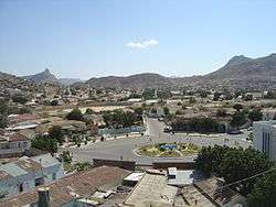
Keren, formerly known as Cheren and Sanhit,[1] is the second-largest city in Eritrea. It is situated around 91 kilometres (57 mi) northwest of Asmara at an elevation of 1,390 metres (4,560 ft) above sea-level. The town sprawls on a wide basin surrounded by granitic mountains on all sides. It serves as the capital of the Anseba region, and is home to the Bilen people.
History
Keren grew around the Eritrean Railway to Asmara. The railway was later dismantled because of the war, although there are plans to rebuild it. It is an important commercial centre and was the scene of regular battles in both World War II and the Eritrean War of Independence. Keren was the site of a key battle between Italian and British troops in February – March 1941.
Demographics
As of 2010, Keren has a population of around 146,483 inhabitants. Residents belong to various, mainly Afroasiatic-speaking ethnic groups, of which the Bilen and Tigre peoples are predominant. The Tigrayans also have a presence.
Climate
Keren's climate is semi-desert hot during summer and cold during winter. The rainy season extends from mid-June to mid-September. From October to February, the town experiences the cool winter season. The climate heats up from March to June, though the nights are pleasant.
| Climate data for Keren | |||||||||||||
|---|---|---|---|---|---|---|---|---|---|---|---|---|---|
| Month | Jan | Feb | Mar | Apr | May | Jun | Jul | Aug | Sep | Oct | Nov | Dec | Year |
| Average high °C (°F) | 28.4 (83.1) |
29.5 (85.1) |
31.3 (88.3) |
33.5 (92.3) |
34.6 (94.3) |
33.1 (91.6) |
28.9 (84) |
27.6 (81.7) |
30.4 (86.7) |
31.4 (88.5) |
29.8 (85.6) |
28.8 (83.8) |
30.61 (87.08) |
| Average low °C (°F) | 12.6 (54.7) |
13.1 (55.6) |
15.1 (59.2) |
16.8 (62.2) |
17.9 (64.2) |
17.8 (64) |
17.6 (63.7) |
17.1 (62.8) |
16.1 (61) |
15.9 (60.6) |
15.0 (59) |
13.6 (56.5) |
15.72 (60.29) |
| Average rainfall mm (inches) | 1 (0.04) |
1 (0.04) |
3 (0.12) |
14 (0.55) |
27 (1.06) |
44 (1.73) |
119 (4.69) |
142 (5.59) |
42 (1.65) |
11 (0.43) |
6 (0.24) |
1 (0.04) |
411 (16.18) |
| Source: Climate-Data[2] | |||||||||||||
Attractions
.jpg)
Attractions in the city include the nineteenth century Tigu Egyptian fort, the St Maryam Deari chapel, lying in a baobab tree, the 1930s former railway station, the old mosque, Sayed Bakri Mausoleum, British Army and Italian Army cemeteries and local markets. The nearby sixth century Debre Sina monastery is also known for its cave dwellings.
Districts
The town's outlying subregions include:
- Elabored
- Geleb Subregion
- Hagaz (Hagat)
- Halhal
- Melabso
Sister cities
References
- ↑ Shinn, David & al. "Hewitt Treaty" in the Historical Dictionary of Ethiopia, p. 214.
- ↑ "Climate-Data : Eritrea". Retrieved 11 July 2013.
Further reading
| Wikimedia Commons has media related to Keren. |
| Wikivoyage has a travel guide for Keren. |
- Hill, Justin (2002), Ciao Asmara, A classic account of contemporary Africa. Little, Brown, ISBN 978-0-349-11526-9. VSO volunteer's story of Eritrea. Hill lived in Keren for two years
- The Globalist Feature, including an extract from Justin Hill's book, Ciao Asmara.
Coordinates: 15°47′N 38°27′E / 15.783°N 38.450°E