Kennedy, Bogotá
| Kennedy | |
|---|---|
| Locality of Bogotá | |
 Location of the locality in the city of Bogotá | |
 Location of the locality in the Capital District of Bogotá | |
| Country |
|
| City | Bogotá D.C. |
| Neighbourhoods | |
| Area | |
| • Total | 38.59 km2 (14.90 sq mi) |
| Elevation | 2,600 m (8,500 ft) |
| Population (2007)[1] | |
| • Total | 979,914 |
| • Density | 25,000/km2 (66,000/sq mi) |
| Time zone | Colombia Standard Time (UTC-5) |
| Website | Official website |
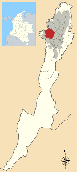
Kennedy, or Ciudad Kennedy, is the eighth locality of Bogotá, capital of Colombia. It is located in the south-west of the city and is the most populous of all localities being home to 14% of the city's residents.
General information
Borders
North: The Fucha river, bordering the Fontibón locality.
South: Autopista Sur and the Tunjuelito River, bordering the localities of Ciudad Bolívar and Tunjuelito
East: Avenida 68, bordering the locality of Puente Aranda.
West: Río Bogotá, with the municipality of Mosquera.
Hydrology
The locality is bordered on two sides by the Fucha and Bogotá rivers. In addition to these, it has some wetlands, including El Tintal.
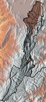
Topography
Kennedy is relatively flat, due to its location on the Bogotá savannah.
Transportation
Major routes serving the locality include Avenida Primero de Mayo, Avenida Ciudad de Villavicencio, Avenida Boyaca, Carrera 68 (Congreso Eucarístico), Carrera 86, and Calle 44 Sur, Avenida Ciudad de Cali.
The locality is served by the city's mass transit system, TransMilenio, on its Avenida de Las Américas line to Portal de las Américas. As a terminus station is located within the locality, several feeder routes run throughout the various neighborhoods, including Casablanca, la Ciudadela El Recreo, la Biblioteca El Tintal, Patio Bonito, Corabastos, and Castilla.
A large portion of the road network is in poor repair.
Points of interest
- Plazoleta de Banderas (a public square showing the flags of the Americas).
- El Tintal public library
- Lago Timiza park
- Central de Abastos (super manzana several blocks full of vendors and great food)
Neighborhoods
The neighborhoods of Kennedy are: Castilla, Ciudad Roma, Ciudad Kennedy, Timiza, Patio Bonito, Alquería, Britalia, Tintal, Class, El Rubí, Mandalay, La Fragua, Villa Alsacia, El Carmelo, Casablanca, Villa Andrea, Alfonso Lopez, Villas de Kennedy, El Gran Colombiano, Techo, Villa Claudia, El Socorro and Tintalito.
History
Ciudad Kennedy formed part of the land settled by Muisca as far back as 6th century BC, and its historic name is Techotyba. The Spanish, through the Conquest of 1537, utilized this land area for farms and cattle ranches. The 20th century brought about further transformation, with urbanization starting in the 1930s. In 1948, Bavaria opened its main brewery in Kennedy.
In 1961, an urbanization project was undertaken, financed in part by the Alianza para el Progreso (Alliance for Progress). The locality was known as Ciudad Techo until 1963, when the name was changed in honor of the assassinated John F. Kennedy, who visited Bogotá in 1961 and supported the Alliance for Progress.
Economy
The western and southern parts of the locality are developed as commercial and industrial zones, including the Bavaria brewery. There is also a location of the SENA technical school, and various shopping areas.
References
- ↑ (Spanish) Population 2007 - DANE
External links
| Wikimedia Commons has media related to Kennedy, Bogotá. |
- (Spanish) Official site of City of Bogotá
- (Spanish) National University of Colombia site about Kennedy.
 | Administrative subdivision in 19 localities | 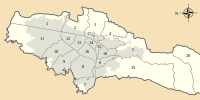 | |
|---|---|---|---|
| Metropolitan Area | |||
| Geography | |||
| |||
Coordinates: 4°38′37″N 74°09′12″W / 4.64361°N 74.15333°W