Keminmaa
| Kivalot | ||
|---|---|---|
| Municipality | ||
| Keminmaan kunta | ||
 | ||
| ||
 Location of Keminmaa in Finland | ||
| Coordinates: 65°48′N 024°33′E / 65.800°N 24.550°ECoordinates: 65°48′N 024°33′E / 65.800°N 24.550°E | ||
| Country | Finland | |
| Region | Lapland | |
| Sub-region | Kemi–Tornio sub-region | |
| Government | ||
| • Municipal manager | Mauri Posio | |
| Area (2011-01-01)[1] | ||
| • Total | 645.79 km2 (249.34 sq mi) | |
| • Land | 625.06 km2 (241.34 sq mi) | |
| • Water | 20.73 km2 (8.00 sq mi) | |
| Area rank | 191st largest in Finland | |
| Population (2016-03-31)[2] | ||
| • Total | 8,383 | |
| • Rank | 125th largest in Finland | |
| • Density | 13.41/km2 (34.7/sq mi) | |
| Population by native language[3] | ||
| • Finnish | 99.4% (official) | |
| • Swedish | 0.1% | |
| • Others | 0.4% | |
| Population by age[4] | ||
| • 0 to 14 | 18.9% | |
| • 15 to 64 | 65.6% | |
| • 65 or older | 15.5% | |
| Time zone | EET (UTC+2) | |
| • Summer (DST) | EEST (UTC+3) | |
| Municipal tax rate[5] | 20.5% | |
| Website | www.keminmaa.fi | |
Keminmaa is a municipality of Finland.
The municipality has a population of 8,383 (31 March 2016)[2] and covers an area of 645.79 square kilometres (249.34 sq mi) of which 20.73 km2 (8.00 sq mi) is water.[1] The population density is 13.41 inhabitants per square kilometre (34.7/sq mi).
Villages
Hirmula, Ilmola, Itäkoski, Jokisuu, Laurila, Lautiosaari, Liedakkala, Maula, Pörhölä, Ruottala (mostly on Tornio's territory), Sompujärvi, Törmä, Viitakoski.
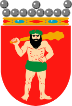
Coat of arms
Blazon: Gules with a springing Silver salmon, holding a padlock in its mouth.
Notable people from Keminmaa
- Peter Franzén, Finnish actor
- Ari Koch, Finnish sculptor
- Veikko Lesonen, Finnish businessman and investor
- Markus Pessa, Finnish Emeritus professor at the Tampere University of Technology and the founder and former director of the Optoelectronics Research Centre at that same university.
- Joonas Piippola, Finnish ballroom dancer, dance teacher and choreographer
- Tomi Putaansuu, the Finnish singer of band Lordi, lived in Keminmaa when he was a child
- Nicolaus Rungius, local 17th century vicar whose mummified body is nowadays a tourist attraction in Keminmaa church
- Hannu Tihinen, Finnish football player
- Otto Vallenius, Finnish opera singer and painter
- Paavo Väyrynen, Finnish politician
Climate
| Climate data for Keminmaa | |||||||||||||
|---|---|---|---|---|---|---|---|---|---|---|---|---|---|
| Month | Jan | Feb | Mar | Apr | May | Jun | Jul | Aug | Sep | Oct | Nov | Dec | Year |
| Average high °C (°F) | −8 (17) |
−7 (19) |
−2 (28) |
3 (37) |
10 (50) |
16 (60) |
18 (65) |
16 (61) |
11 (51) |
4 (39) |
−2 (28) |
−7 (20) |
4 (40) |
| Average low °C (°F) | −16 (4) |
−14 (6) |
−10 (14) |
−4 (24) |
2 (36) |
8 (47) |
11 (52) |
9 (48) |
4 (40) |
−1 (30) |
−8 (18) |
−14 (7) |
−2 (28) |
| Average precipitation cm (inches) | 64 (25) |
56 (22) |
53 (21) |
41 (16) |
36 (14) |
38 (15) |
38 (15) |
41 (16) |
43 (17) |
53 (21) |
61 (24) |
61 (24) |
584 (230) |
| Source: Weatherbase [6] | |||||||||||||
References
- 1 2 "Area by municipality as of 1 January 2011" (PDF) (in Finnish and Swedish). Land Survey of Finland. Retrieved 9 March 2011.
- 1 2 "Ennakkoväkiluku sukupuolen mukaan alueittain, maaliskuu.2016" (in Finnish). Statistics Finland. Retrieved 31 March 2016.
- ↑ "Population according to language and the number of foreigners and land area km2 by area as of 31 December 2008". Statistics Finland's PX-Web databases. Statistics Finland. Retrieved 29 March 2009.
- ↑ "Population according to age and gender by area as of 31 December 2008". Statistics Finland's PX-Web databases. Statistics Finland. Retrieved 28 April 2009.
- ↑ "List of municipal and parish tax rates in 2011". Tax Administration of Finland. 29 November 2010. Retrieved 13 March 2011.
- ↑ "Weatherbase: Historical Weather for Kemi, Finland (closest city on record to Keminmaa, Finland)". Weatherbase. 2013. Retrieved on April 18, 2013.
External links
![]() Media related to Keminmaa at Wikimedia Commons
Media related to Keminmaa at Wikimedia Commons
- Municipality of Keminmaa – Official website
This article is issued from Wikipedia - version of the 9/19/2016. The text is available under the Creative Commons Attribution/Share Alike but additional terms may apply for the media files.

