Keewaywin First Nation
| Kee-Way-Win | |
|---|---|
| Indian reserve | |
| Kee-Way-Win Indian Reserve | |
 Kee-Way-Win | |
| Coordinates: 52°59′N 92°48′W / 52.983°N 92.800°WCoordinates: 52°59′N 92°48′W / 52.983°N 92.800°W | |
| Country |
|
| Province |
|
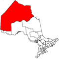
| District | Kenora |
| First Nation | Keewaywin |
| Area[1] | |
| • Land | 189.78 km2 (73.27 sq mi) |
| Population (2011)[1] | |
| • Total | 340 |
| • Density | 1.8/km2 (5/sq mi) |
| Website | keewaywin.firstnation.ca |
Keewaywin is a small Oji-Cree First Nation band government in Northern Ontario, located north of Red Lake, Ontario. It is connected to Sandy Lake First Nation by Sandy Lake. It is part of the Keewaytinook Okimakanak Council (Northern Chiefs) and the Nishnawbe Aski Nation. Sandy Lake First Nation Band members separated from Sandy Lake First Nation to form Keewaywin First Nation. The Indian reserve is entirely surrounded by territory of the Unorganized Kenora District.
Keewaywin is policed by the Nishnawbe-Aski Police Service, an Aboriginal-based service.
References
- 1 2 "Kee-Way-Win census profile". 2011 Census of Population. Statistics Canada. Retrieved 28 May 2015.
 |
Unorganized Kenora Sandy Lake |
| ||
| Unorganized Kenora | |
Unorganized Kenora | ||
| ||||
| | ||||
| Unorganized Kenora |
This article is issued from Wikipedia - version of the 9/12/2015. The text is available under the Creative Commons Attribution/Share Alike but additional terms may apply for the media files.