Keego Harbor, Michigan
| Keego Harbor, Michigan | |
|---|---|
| City | |
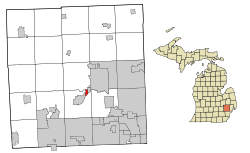 Location of Keego Harbor, Michigan | |
| Coordinates: 42°36′29″N 83°20′38″W / 42.60806°N 83.34389°WCoordinates: 42°36′29″N 83°20′38″W / 42.60806°N 83.34389°W | |
| Country | United States |
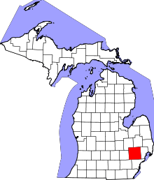
| State | Michigan |
| County | Oakland |
| Government | |
| • Type | Council-Manager |
| • Mayor | Robert Kalman |
| • City Manager | Linda Voll |
| • City council | John Newberry, Tom Berman, Sid Rubin, Joel Yoder |
| Area[1] | |
| • Total | 0.54 sq mi (1.40 km2) |
| • Land | 0.50 sq mi (1.29 km2) |
| • Water | 0.04 sq mi (0.10 km2) 7.41% |
| Elevation | 932 ft (284 m) |
| Population (2010)[2] | |
| • Total | 2,970 |
| • Estimate (2012[3]) | 3,003 |
| • Density | 5,940.0/sq mi (2,293.4/km2) |
| Time zone | EST (UTC-5) |
| • Summer (DST) | EDT (UTC-4) |
| ZIP code | 48320 |
| Area code(s) | 248 |
| FIPS code | 26-42460[4] |
| GNIS feature ID | 0629495[5] |
| Website | City of Keego Harbor |
Keego Harbor is a city in Oakland County in the U.S. state of Michigan. The population was 2,970 at the 2010 census.[6] The city originated as a real estate investment and planned resort established by Pontiac lawyer Joseph E. Sawyer circa 1900. The name Keego is said to mean "big fish" in an Indian language. The harbor is Dollar Lake, that was connected to Cass Lake via a new canal that developer Sawyer had dug when the town was created. The community lies along Cass Lake, one of the lakes that make up the lakes district of western Oakland County, an area renowned for its water recreation resources.
Geography
According to the United States Census Bureau, the city has a total area of 0.54 square miles (1.40 km2), of which 0.50 square miles (1.29 km2) is land and 0.04 square miles (0.10 km2) is water.[1]
Demographics
| Historical population | |||
|---|---|---|---|
| Census | Pop. | %± | |
| 1960 | 2,761 | — | |
| 1970 | 3,092 | 12.0% | |
| 1980 | 3,083 | −0.3% | |
| 1990 | 2,932 | −4.9% | |
| 2000 | 2,769 | −5.6% | |
| 2010 | 2,970 | 7.3% | |
| Est. 2015 | 3,029 | [7] | 2.0% |
2010 census
As of the census[2] of 2010, there were 2,970 people, 1,292 households, and 721 families residing in the city. The population density was 5,940.0 inhabitants per square mile (2,293.4/km2). There were 1,473 housing units at an average density of 2,946.0 per square mile (1,137.5/km2). The racial makeup of the city was 84.1% White, 6.2% African American, 0.3% Native American, 2.3% Asian, 4.0% from other races, and 3.1% from two or more races. Hispanic or Latino of any race were 10.8% of the population.
There were 1,292 households of which 32.3% had children under the age of 18 living with them, 36.1% were married couples living together, 14.0% had a female householder with no husband present, 5.7% had a male householder with no wife present, and 44.2% were non-families. 36.1% of all households were made up of individuals and 7% had someone living alone who was 65 years of age or older. The average household size was 2.30 and the average family size was 3.08.
The median age in the city was 35.6 years. 24.8% of residents were under the age of 18; 7.9% were between the ages of 18 and 24; 33.6% were from 25 to 44; 26.1% were from 45 to 64; and 7.6% were 65 years of age or older. The gender makeup of the city was 50.3% male and 49.7% female.
2000 census
As of the census[4] of 2000, there were 2,769 people, 1,223 households, and 664 families residing in the city. The population density was 5,388.9 per square mile (2,096.3/km²). There were 1,317 housing units at an average density of 2,563.1 per square mile (997.1/km²). The racial makeup of the city was 94.08% White, 0.61% African American, 1.16% Native American, 1.05% Asian, 1.26% from other races, and 1.84% from two or more races. Hispanic or Latino of any race were 4.37% of the population.
There were 1,223 households out of which 30.2% had children under the age of 18 living with them, 38.1% were married couples living together, 11.7% had a female householder with no husband present, and 45.7% were non-families. 37.4% of all households were made up of individuals and 5.2% had someone living alone who was 65 years of age or older. The average household size was 2.26 and the average family size was 3.07.
In the city the population was spread out with 24.9% under the age of 18, 7.7% from 18 to 24, 41.1% from 25 to 44, 18.7% from 45 to 64, and 7.6% who were 65 years of age or older. The median age was 33 years. For every 100 females there were 108.5 males. For every 100 females age 18 and over, there were 105.3 males.
The median income for a household in the city was $46,552, and the median income for a family was $49,015. Males had a median income of $37,031 versus $34,038 for females. The per capita income for the city was $26,305. About 5.2% of families and 5.1% of the population were below the poverty line, including 6.0% of those under age 18 and 2.4% of those age 65 or over.
Education
Keego Harbor is within the West Bloomfield School District.[9]
References
- 1 2 "US Gazetteer files 2010". United States Census Bureau. Retrieved 2012-11-25.
- 1 2 "American FactFinder". United States Census Bureau. Retrieved 2012-11-25.
- ↑ "Population Estimates". United States Census Bureau. Retrieved 2013-06-03.
- 1 2 "American FactFinder". United States Census Bureau. Retrieved 2008-01-31.
- ↑ U.S. Geological Survey Geographic Names Information System: Keego Harbor, Michigan
- ↑ "Race, Hispanic or Latino, Age, and Housing Occupancy: 2010 Census Redistricting Data (Public Law 94-171) Summary File (QT-PL), Keego Harbor city, Michigan". U.S. Census Bureau, American FactFinder 2. Retrieved August 19, 2011.
- ↑ "Annual Estimates of the Resident Population for Incorporated Places: April 1, 2010 to July 1, 2015". Retrieved July 2, 2016.
- ↑ "Census of Population and Housing". Census.gov. Retrieved June 4, 2015.
- ↑ "District Overview." (Archive) West Bloomfield School District. Retrieved on September 8, 2013.
External links
| Topics |  | |
|---|---|---|
| Detroit | ||
| Municipalities over 80,000 | ||
| Municipalities 40,000 to 80,000 | ||
| Cultural enclaves | ||
| Satellite cities | ||
| Counties in MSA | ||
| Counties in CSA | ||