Kediet ej Jill
| Kediet ej Jill | |
|---|---|
|
Mt. Kediet ej Jill, Mauritania - seen from space | |
| Highest point | |
| Elevation | 915 m (3,002 ft) |
| Listing | Country high point |
| Coordinates | 22°32′25″N 12°35′22″W / 22.54028°N 12.58944°WCoordinates: 22°32′25″N 12°35′22″W / 22.54028°N 12.58944°W |
| Geography | |
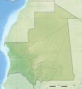 Kediet ej Jill Location of Kediet ej Jill in Mauritania | |
| Location | Mauritania |
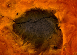
Kediet ej Jill is a mountain in Tiris Zemmour, Mauritania, with the city of Zouérat on its east and Fderick at west. At 915 m (3,002 ft) tall, Kediet ej Jill is the highest peak in Mauritania.
The entire mountain is made of magnetite which gives its blue colour.
Due to the magnetic field, compasses cannot function on the mountain. Similar magnetic fields allowed the discovery of other deposits in the region (magnetite guelbs) in the 1960s.
External links
- Kediet ej Jill, Tiris Zemmour, Mauritania
- "Kdeyyat ej Joul, Mauritania". Peakbagger.com.
This article is issued from Wikipedia - version of the 7/5/2016. The text is available under the Creative Commons Attribution/Share Alike but additional terms may apply for the media files.