Keansburg, New Jersey
| Keansburg, New Jersey | |
|---|---|
| Borough | |
| Borough of Keansburg | |
| Nickname(s): "Gem of the Bayshore"[1] | |
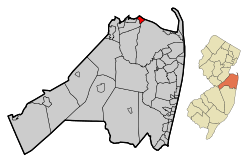 Map of Keansburg in Monmouth County. Inset: Location of Monmouth County highlighted in the State of New Jersey. | |
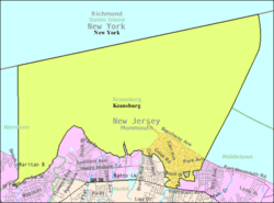 Census Bureau map of Keansburg, New Jersey | |
| Coordinates: 40°26′54″N 74°08′45″W / 40.448279°N 74.145823°WCoordinates: 40°26′54″N 74°08′45″W / 40.448279°N 74.145823°W[2][3] | |
| Country |
|
| State |
|
| County | Monmouth |
| Incorporated | April 17, 1917 |
| Named for | John Kean |
| Government[4] | |
| • Type | Faulkner Act (Council-Manager) |
| • Body | Borough Council |
| • Mayor | Thomas Foley (term ends June 30, 2020)[5][6] |
| • Administrator | Raymond B. O'Hare[7] |
| • Clerk | Thomas P. Cusick[8] |
| Area[2] | |
| • Total | 16.792 sq mi (43.492 km2) |
| • Land | 1.069 sq mi (2.769 km2) |
| • Water | 15.723 sq mi (40.723 km2) 93.63% |
| Area rank |
166th of 566 in state 11th of 53 in county[2] |
| Elevation[9] | 0 ft (0 m) |
| Population (2010 Census)[10][11][12] | |
| • Total | 10,105 |
| • Estimate (2015)[13] | 9,873 |
| • Rank |
244th of 566 in state 20th of 53 in county[14] |
| • Density | 9,452.3/sq mi (3,649.6/km2) |
| • Density rank |
38th of 566 in state 3rd of 53 in county[14] |
| Time zone | Eastern (EST) (UTC-5) |
| • Summer (DST) | Eastern (EDT) (UTC-4) |
| ZIP code | 07734[15][16] |
| Area code(s) | 732 exchanges: 471, 495, 787[17] |
| FIPS code | 3402536480[2][18][19] |
| GNIS feature ID | 0885265[2][20] |
| Website |
keansburgnj |
Keansburg (pronounced "KEENS-burg"[21]) is a borough in Monmouth County, New Jersey, United States. As of the 2010 United States Census, the borough's population was 10,105,[10][11][12] which represented a decline of 627 (-5.8%) from the 10,732 counted in the 2000 Census, which had in turn declined by 337 (-3.0%) from the 11,069 counted in the 1990 Census.[22]
Keansburg was formed as a borough by an act of the New Jersey Legislature on March 26, 1917, from portions of both Middletown Township and Raritan Township (now Hazlet), based on the results of a referendum held on April 17, 1917.[23]
The borough is part of the Bayshore Regional Strategic Plan, an effort by nine municipalities in northern Monmouth County to reinvigorate the area's economy by emphasizing the traditional downtowns, dense residential neighborhoods, maritime history, and the natural beauty of the Raritan Bay coastline.
History
The land that is now Keansburg was originally home to the Lenni Lenape Native Americans.
On September 3, 1609, the Half Moon, captained by Henry Hudson, is said to have landed on the shores of present-day Keansburg (although some historians argue that the landing and forthcoming explained events took place at the tip of Sandy Hook). Crewmen of the ship were attacked by the Native Americans when they departed the ship, and John Colman was killed, making him what is said to be the first European to be felled by a Native American arrow.[24] He is believed to have been buried in the area that is today the intersection of Carr Avenue and Beachway in an area known as "Colman's Point".
In the time between 1609 and the early 18th century, the land was gradually purchased from the Lenni Lenape with other surrounding areas. The area was inhabited by Dutch, English, and Scottish settlers. In the 18th century, farming proved to be successful on Keansburg's land, with specialties being pears, apples and corn (maize).
In this time, the settlement took on the name of Waackaack (pronounced "Way-kay-ack"), which came from the term "Wakioak" in the Lenape language meaning "Land of Plenty".[25] The area was also widely known as Tanner's Landing from the early 18th century until approximately 1820, so named for the pier at the end of what was Tanner's Landing Road (now Main Street). Tanner's Landing was a principal port for the area for many years.[26][27]
The are adopted its second official name of Granville, which derived from the importance of the Phillips Mill, and the grain-producing farms in the region. The name held until the 1880s. During the century, Granville became home to its own church, two lighthouses and small businesses. Roadways were beginning to form from repeated use of horse and buggies. The beach was already a favorite to visitors. Population was about 300 people, who mostly farmed and clammed for a living.
On Sunday, March 22, 1877, at "half past 9 o'clock," Granville welcomed the newly assigned pastor of the Granville Methodist Episcopal Church, William W. Ramsay. He later stated: "I arrived at the Granville Methodist Episcopal Church in Keansburg as pastor for the ensuing year. I soon learned that the hamlet consisted of about 300 inhabitants, whose occupations were mainly devoted to clamming & farming."[28] At 19 years of age, Ramsay was slated to serve in the church for just one year. His success at the helm of church led to another year in Granville, after which he decided to make the village his permanent home. Ramsay and his wife, Eliza S. Wood, purchased the land that is 69 Church Street and opened a general store in 1881. In the coming years, Ramsay took greater and greater interest in Granville and eventually arranged a petition to establish a post office. The list of 132 names was passed on to John Kean of Elizabeth, a candidate for Congress. His efforts led to the opening of the post office in 1884, with Mrs. Ramsay serving as its first postmaster. That year, the name Keansburg was adopted in Kean's honor.[21][29] A school was built at the cost of $30,000 in 1890 and sat on what is today the corner of Myrtle Avenue and Church Street (now Fallon Manor).
Further development continued with the creation of postcards depicting the village and land purchases, including acquisitions by William A. Gehlhaus and the Keansburg Beach Company. The Keansburg Steamboat Company was founded in 1910 primarily by Gelhaus as a means of providing transportation for New Yorkers who were interested in buying homes in Keansburg. In 1893, Gelhaus purchased a bakery business in Atlantic Highlands which he operated with his brothers until 1905. At that time he entered the real estate business in Keansburg. He was president of the New Point Comfort Beach Company which he formed with Jesse Sculthorp and Howard Roberts. The company owned a large real estate development in Keansburg and in 1906 laid out the Beachway. On June 18, 1909, the New Point Comfort Beach Company bought the steamboat Accomack in Norfolk, Virginia, and started a scheduled run from New York to Keansburg on July 1 that was intended as a way to bring prospective property buyers to Keansburg. Another real estate developer, Keansburg Heights Development Co., bought several thousand tickets. By July 21, more than $1,500 worth of tickets had been sold at $0.35 each.[30] As the town became more populated, the Keansburg Beach Company sold off most of the surrounding land on Beachway Ave., keeping "just the boardwalk and amusement area."[31]
Tourists from New York City would ferry over and spend the weekend or summer vacation to escape the city heat, until Hurricane Donna wiped out much of the waterfront area in 1960.[32] In 1969, the borough spent $7.9 million on the Bayshore Hurricane Protection Plan, which had been developed with state and federal funding from The New Jersey Bureau of Navigation and the United States Army Corps of Engineers. The redevelopment plan increased the size of the beaches to protect against future storms.[33] A number of fires in the 1980s destroyed several structures on the North side of Beachway Avenue. The Dance Hall Auditorium, Keansburg Bowling Alley and the Casino Theater were destroyed by fire during this time.[34]
The Gelhaus family re-acquired the Keansburg Amusement Park in 1995, following a 20-year absence after Henry Gelhaus had sold the property in 1972. The return of the Gelhaus family as proprietors of the amusement park sparked a resurgence of interest in the town. Upgrades were made to the amusement park grounds and a water park was constructed. Runaway rapids was opened in 1996 on the site of the former Crystal Pool.[35] The Keansburg Waterfront Public Library, founded in 2004, was the result of a concerted effort on the part of townspeople and the borough government to provide a high quality library with resources that address the needs and interests of the community.[36] In 2012, the town added a $3 million desalination plant with Federal Stimulus Funds and a low interest loan from the N.J. Environmental Infrastructure Trust, which greatly improved the quality of the water supply. The town had previously stopped providing well water, as saltwater intrusion into the aquifer had exceeded environmental protection standards. The new facility removes contaminants from the water supply through reverse osmosis.[37]
Geography
According to the United States Census Bureau, the borough had a total area of 16.792 square miles (43.492 km2), including 1.069 square miles (2.769 km2) of land and 15.723 square miles (40.723 km2) of water (93.63%).[2][3]
Unincorporated communities, localities and place names located partially or completely within the borough include Beacon Beach, Point Comfort and Tiltons Corner.[38]
The borough has land borders with the Monmouth County municipalities of Hazlet Township, Middletown Township and Union Beach; and has maritime borders with Aberdeen Township and Keyport, and the New York City borough of Staten Island across Raritan Bay.[39] A small piece of Middletown Township measuring 13 acres (5.3 ha) is an exclave completely surrounded by Keansburg.[40]
Demographics
| Historical population | |||
|---|---|---|---|
| Census | Pop. | %± | |
| 1920 | 1,321 | — | |
| 1930 | 2,190 | 65.8% | |
| 1940 | 2,904 | 32.6% | |
| 1950 | 5,559 | 91.4% | |
| 1960 | 6,854 | 23.3% | |
| 1970 | 9,720 | 41.8% | |
| 1980 | 10,613 | 9.2% | |
| 1990 | 11,069 | 4.3% | |
| 2000 | 10,732 | −3.0% | |
| 2010 | 10,105 | −5.8% | |
| Est. 2015 | 9,873 | [13][41] | −2.3% |
| Population sources: 1920[42] 1920-1930[43] 1930-1990[44] 2000[45][46] 2010[10][11][12] | |||
Census 2010
At the 2010 United States Census, there were 10,105 people, 3,805 households, and 2,409 families residing in the borough. The population density was 9,452.3 per square mile (3,649.6/km2). There were 4,318 housing units at an average density of 4,039.1 per square mile (1,559.5/km2). The racial makeup of the borough was 84.17% (8,505) White, 6.57% (664) Black or African American, 0.23% (23) Native American, 1.70% (172) Asian, 0.08% (8) Pacific Islander, 4.04% (408) from other races, and 3.22% (325) from two or more races. Hispanics or Latinos of any race were 14.77% (1,493) of the population.[10]
There were 3,805 households, of which 29.7% had children under the age of 18 living with them, 36.8% were married couples living together, 19.2% had a female householder with no husband present, and 36.7% were non-families. 30.1% of all households were made up of individuals, and 8.6% had someone living alone who was 65 years of age or older. The average household size was 2.58 and the average family size was 3.24.[10]
In the borough, 23.4% of the population were under the age of 18, 9.4% from 18 to 24, 28.6% from 25 to 44, 27.7% from 45 to 64, and 10.9% who were 65 years of age or older. The median age was 36.8 years. For every 100 females there were 95.6 males. For every 100 females age 18 and over, there were 90.8 males.[10] The Census Bureau's 2006-2010 American Community Survey showed that (in 2010 inflation-adjusted dollars) median household income was $39,206 (with a margin of error of +/- $6,629) and the median family income was $52,128 (+/- $8,098). Males had a median income of $43,125 (+/- $8,899) versus $33,098 (+/- $4,163) for females. The per capita income for the borough was $21,246 (+/- $1,964). About 14.4% of families and 16.1% of the population were below the poverty line, including 21.3% of those under age 18 and 22.0% of those age 65 or over.[47]
Census 2000
As of the 2000 United States Census[18] there were 10,732 people, 3,872 households, and 2,563 families residing in the borough. The population density was 9,954.4 people per square mile (3,836.7/km2). There were 4,269 housing units at an average density of 3,959.7 per square mile (1,526.2/km2). The racial makeup of the borough was 93.31% White, 2.13% African American, 0.10% Native American, 1.23% Asian, 0.07% Pacific Islander, 1.74% from other races, and 1.42% from two or more races. Hispanic or Latino of any race were 7.95% of the population.[45][46]
There were 3,872 households out of which 35.3% had children under the age of 18 living with them, 42.2% were married couples living together, 17.6% had a female householder with no husband present, and 33.8% were non-families. 27.4% of all households were made up of individuals and 10.1% had someone living alone who was 65 years of age or older. The average household size was 2.71 and the average family size was 3.35.[45][46]
In the borough the population was spread out with 27.2% under the age of 18, 9.5% from 18 to 24, 31.2% from 25 to 44, 20.8% from 45 to 64, and 11.2% who were 65 years of age or older. The median age was 34 years. For every 100 females there were 95.3 males. For every 100 females age 18 and over, there were 90.3 males.[45][46]
The median income for a household in the borough was $36,383, and the median income for a family was $45,438. Males had a median income of $37,229 versus $28,398 for females. The per capita income for the borough was $17,417. About 15.5% of families and 17.7% of the population were below the poverty line, including 23.5% of those under age 18 and 18.4% of those age 65 or over.[45][46]
Parks and recreation
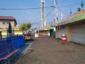
- Keansburg Amusement Park
- Runaway Rapids Waterpark
- Henry Hudson Trail
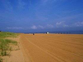
- Raritan Bayshore Waterfront Park[48]
- John Donohue III Park
- Keansburg Firemen's Memorial Park was established in May 1938[49]
- Forest Park
- St. John's Park
- World War II Memorial Park
Government
Local government
Keansburg operates within the Faulkner Act, formally known as the Optional Municipal Charter Law, under the Council-Manager form of municipal government. Keansburg is governed by a five-member Borough Council, elected at-large in non-partisan voting as part of the May municipal election to four-year terms of office on a staggered basis, with either two or three seats coming up for election in even years.[4] In March 1974, voters passed a referendum by 1,508 to 1,142 that expanded the council from three members to its current five.[32] At a reorganization meeting after each election, the council selects a mayor and deputy mayor from among its members.
As of 2016, members of the Keansburg Borough Council are Mayor George F. Hoff (term ends June 30, 2020), Deputy Mayor Thomas M. Foley (2020), Arthur V. Boden (2018), James "Jim" Cocuzza, Sr. (2018) and Sean D. Tonne (2020).[5][50][51][52][53]
Federal, state and county representation
Keansburg is located in the 6th Congressional District[54] and is part of New Jersey's 13th state legislative district.[11][55][56]
New Jersey's Sixth Congressional District is represented by Frank Pallone (D, Long Branch).[57] New Jersey is represented in the United States Senate by Cory Booker (D, Newark, term ends 2021)[58] and Bob Menendez (D, Paramus, 2019).[59][60]
For the 2016–2017 session (Senate, General Assembly), the 13th Legislative District of the New Jersey Legislature is represented in the State Senate by Joseph M. Kyrillos (R, Middletown Township) and in the General Assembly by Amy Handlin (R, Middletown Township) and Declan O'Scanlon (R, Little Silver).[61] The Governor of New Jersey is Chris Christie (R, Mendham Township).[62] The Lieutenant Governor of New Jersey is Kim Guadagno (R, Monmouth Beach).[63]
Monmouth County is governed by a Board of Chosen Freeholders consisting of five members who are elected at-large to serve three year terms of office on a staggered basis, with either one or two seats up for election each year as part of the November general election. At an annual reorganization meeting held in the beginning of January, the board selects one of its members to serve as Director and another as Deputy Director.[64] As of 2014, Monmouth County's Freeholders are Freeholder Director Lillian G. Burry (R, Colts Neck Township; term ends December 31, 2014),[65] Freeholder Deputy Director Gary J. Rich, Sr. (R, Spring Lake; 2014),[66] Thomas A. Arnone (R, Neptune City; 2016),[67] John P. Curley (R, Middletown Township; 2015)[68] and Serena DiMaso (R, Holmdel Township; 2016).[69][70] Constitutional officers elected on a countywide basis are County Clerk M. Claire French (Wall Township),[71] Sheriff Shaun Golden (Farmingdale)[72] and Surrogate Rosemarie D. Peters (Middletown Township).[73]
Politics
As of March 23, 2011, there were a total of 5,435 registered voters in Keansburg, of which 1,429 (26.3%) were registered as Democrats, 742 (13.7%) were registered as Republicans and 3,262 (60.0%) were registered as Unaffiliated. There were two voters registered to other parties.[74]
In the 2012 presidential election, Democrat Barack Obama received 59.4% of the vote (1,604 cast), ahead of Republican Mitt Romney with 39.1% (1,056 votes), and other candidates with 1.6% (42 votes), among the 2,733 ballots cast by the borough's 5,673 registered voters (31 ballots were spoiled), for a turnout of 48.2%.[75][76] In the 2008 presidential election, Republican John McCain received 48.5% of the vote (1,782 cast), ahead of Democrat Barack Obama with 48.1% (1,769 votes) and other candidates with 1.4% (53 votes), among the 3,677 ballots cast by the borough's 6,248 registered voters, for a turnout of 58.9%.[77] In the 2004 presidential election, Republican George W. Bush received 52.1% of the vote (1,995 ballots cast), outpolling Democrat John Kerry with 46.6% (1,783 votes) and other candidates with 0.5% (36 votes), among the 3,827 ballots cast by the borough's 6,588 registered voters, for a turnout percentage of 58.1.[78]
In the 2013 gubernatorial election, Republican Chris Christie received 71.0% of the vote (1,106 cast), ahead of Democrat Barbara Buono with 27.3% (426 votes), and other candidates with 1.7% (26 votes), among the 1,592 ballots cast by the borough's 5,368 registered voters (34 ballots were spoiled), for a turnout of 29.7%.[79][80] In the 2009 gubernatorial election, Republican Chris Christie received 59.3% of the vote (1,169 ballots cast), ahead of Democrat Jon Corzine with 32.6% (643 votes), Independent Chris Daggett with 6.0% (118 votes) and other candidates with 1.5% (30 votes), among the 1,970 ballots cast by the borough's 5,738 registered voters, yielding a 34.3% turnout.[81]
Emergency services
The current Keansburg Police Department was created under an ordinance adopted in November 1926 which consisted of five members. The area known as Keansburg was under the authority of a Police Marshal prior to 1926. Before 1917, the area was patrolled by both Raritan Township and Middletown Township. The borough's first Police Marshal was James Gilligan, who was appointed in 1917 who served until his retirement in August 1943. The Chief of Police is James K. Pigott, who succeeded Raymond O'Hare who served from 1985 - 2012.[82]
Keansburg is served by two volunteer fire companies, Keansburg Fire Company No. 1 and New Point Comfort Fire Company No. 1.[83]
Keansburg Fire Company #1, located on the corner of Main Street and Manning Place, was incorporated on October 13, 1912, making it the first fire company in the community.[84]
New Point Comfort Volunteer Fire Company was organized in 1912 and incorporated on August 2, 1913 at the New Point Comfort Hotel located on Beachway Avenue. The company was first named the New Point Comfort Chemical Engine Company, and was later renamed the New Point Comfort Fire Company #1 in 1921. Having its first building on Oak Street, it later moved to a larger property at 192 Carr Avenue in 1959, where it is currently located.[85]
The borough's two volunteer companies make up the Keansburg Fire Department, which was established in 1923. The chiefs of the two companies rotate as Chief and Assistant Chief of the Keansburg Fire Department. In even years the Chief of the Keansburg Fire Company #1 serves as Chief of the Keansburg Fire Department and the Chief of the New Point Comfort Volunteer Fire Company serving as Assistant Chief, while the roles are reversed in odd-numbered years.[85]
In November 1998, the fire company established the Keansburg EMS and housed it on their property, where it is now a separate organization, responding to over 1,600 calls each year in only a one-square-mile area.[86]
Education
Students in Kindergarten through twelfth grade are served by the Keansburg School District. The district is one of 31 former Abbott districts statewide,[87] which are now referred to as "SDA Districts" based on the requirement for the state to cover all costs for school building and renovation projects in these districts under the supervision of the New Jersey Schools Development Authority.[88][89] As of the 2011-12 school year, the district's four schools had an enrollment of 1,656 students and 198.1 classroom teachers (on an FTE basis), for a student–teacher ratio of 8.36:1.[90]
Schools in the district (with 2011-12 enrollment data from the National Center for Education Statistics[91]) are Port Monmouth Road Intermediate School[92] (608 students in grades PreK - 2), Joseph C. Caruso Intermediate School[93] (225; 3- 4), Joseph R. Bolger Middle School[94] (430; 5-8) and Keansburg High School[95] (393; 9-12).[96]
Transportation
Roads and highways
As of May 2010, the borough had a total of 27.53 miles (44.31 km) of roadways, of which 25.00 miles (40.23 km) were maintained by the municipality, 2.41 miles (3.88 km) by Monmouth County and 0.12 miles (0.19 km) by the New Jersey Department of Transportation.[97]
Route 36 runs along the borough's southern border. The Garden State Parkway is accessible via NJ 36 in neighboring Hazlet Township.
Public transportation
New Jersey Transit offers local bus service on the 817 route.[98]
Notable people
People who were born in, residents of, or otherwise closely associated with Keansburg include:
- James Coonan (born 1946), leader of the Irish gang known as the Westies.[99][100]
- James P. Maher (1865-1946), New York City Congressman from 1911 to 1921 who was elected Mayor of Keansburg in 1926.[101]
- Jason Mewes (born 1974), actor.[102][103]
- Lou Taylor Pucci (born 1985), actor.[104]
- Horace M. Thorne (1918–1944), awarded the Medal of Honor for valor during World War II.[105]
- Roger "Hurricane" Wilson (born 1963), electric blues guitarist, singer and songwriter.[106]
References
- ↑ Kuperinsky, Amy. "'The Jewel of the Meadowlands'?: N.J.'s best, worst and weirdest town slogans", NJ Advance Media for NJ.com, January 22, 2015. Accessed July 12, 2016. "Keansburg, in Monmouth County, is 'Gem of the Bayshore'."
- 1 2 3 4 5 6 2010 Census Gazetteer Files: New Jersey County Subdivisions, United States Census Bureau. Accessed May 21, 2015.
- 1 2 US Gazetteer files: 2010, 2000, and 1990, United States Census Bureau. Accessed September 4, 2014.
- 1 2 2012 New Jersey Legislative District Data Book, Rutgers University Edward J. Bloustein School of Planning and Public Policy, March 2013, p. 67.
- 1 2 Borough Council, Borough of Keansburg. Accessed February 23, 2015.
- ↑ 2016 New Jersey Mayors Directory, New Jersey Department of Community Affairs. Accessed June 14, 2016. As of date accessed, Thomas M. Foley is listed as mayor with a term-end date of June 30, 2016
- ↑ Borough Manager, Borough of Keansburg. Accessed July 15, 2016.
- ↑ Municipal Clerk, Borough of Keansburg. Accessed July 15, 2016.
- ↑ U.S. Geological Survey Geographic Names Information System: Borough of Keansburg, Geographic Names Information System. Accessed March 6, 2013.
- 1 2 3 4 5 6 DP-1 - Profile of General Population and Housing Characteristics: 2010 for Keansburg borough, Monmouth County, New Jersey, United States Census Bureau. Accessed July 26, 2012.
- 1 2 3 4 Municipalities Grouped by 2011-2020 Legislative Districts, New Jersey Department of State, p. 7. Accessed January 6, 2013.
- 1 2 3 Profile of General Demographic Characteristics: 2010 for Keansburg borough, New Jersey Department of Labor and Workforce Development. Accessed July 26, 2012.
- 1 2 PEPANNRES - Annual Estimates of the Resident Population: April 1, 2010 to July 1, 2015 - 2015 Population Estimates for New Jersey municipalities, United States Census Bureau. Accessed May 22, 2016.
- 1 2 GCT-PH1 Population, Housing Units, Area, and Density: 2010 - State -- County Subdivision from the 2010 Census Summary File 1 for New Jersey, United States Census Bureau. Accessed December 4, 2012.
- ↑ Look Up a ZIP Code for Keansburg, NJ, United States Postal Service. Accessed July 26, 2012.
- ↑ Zip Codes, State of New Jersey. Accessed August 24, 2013.
- ↑ Area Code Lookup - NPA NXX for Keansburg, NJ, Area-Codes.com. Accessed February 4, 2015.
- 1 2 American FactFinder, United States Census Bureau. Accessed September 4, 2014.
- ↑ A Cure for the Common Codes: New Jersey, Missouri Census Data Center. Accessed July 26, 2012.
- ↑ US Board on Geographic Names, United States Geological Survey. Accessed September 4, 2014.
- 1 2 Felzenberg, Alvin. Governor Tom Kean: From the New Jersey Statehouse to the 9-11 Commission, p. 5. Rutgers University Press, 2006. ISBN 0813539862. Accessed July 25, 2012. "In 1884, after congressman and future U.S. senator John Kean, Tom Kean's great-uncle, obtained a post office for a growing Monmouth County community in his district, the village named itself Keansburg in his honor. By the time it incorporated as a borough in 1917, local residents had taken to pronouncing it Keensburg."
- ↑ Table 7. Population for the Counties and Municipalities in New Jersey: 1990, 2000 and 2010, New Jersey Department of Labor and Workforce Development, February 2011. Accessed July 26, 2012.
- ↑ Snyder, John P. The Story of New Jersey's Civil Boundaries: 1606-1968, Bureau of Geology and Topography; Trenton, New Jersey; 1969. p. 180. Accessed July 26, 2012.
- ↑ Roberts, Sam. "New York's Coldest Case: A Murder 400 Years Old", The New York Times, September 4, 2009. Accessed July 26, 2012. "It was on Sept. 6, 1609 — 400 years ago Sunday — when this, the first recorded murder in what became metropolitan New York, was committed. Colman was killed only four days after the first Dutch and English sailors arrived."
- ↑ Harnes, John A. "Of Wakioak and 'clam diggers'", Asbury Park Press, July 18, 2002. Accessed April 10, 2007. "Since the Lenni-Lenape Indians called the area Wakioak, which meant 'land of plenty,' this area of Monmouth County south of Raritan Bay has been called many names, including: Colman's Point, Middletown, Granville, Raritan and finally Keansburg, when the community's first post office was created through the efforts of Rep. John Kean and the Rev. William Ramsay."
- ↑ "Keansburg High School History of Keansburg, at Chapter 5 (Story of the Seas)". Accessed July 23, 2007. "In the early days TANNER'S LANDING, now Main Street Beach, was at the foot of TANNERS LANDING ROAD (Main Street). This was a principle (sic) road going through Monmouth County, as it attached to the "KINGS HIGHWAY", the Landing itself being a Major freight port of the countryside. The first steamboat that came into Monmouth County was to use this landing, it was a sidewheel boat which was commanded by Captain Pennoyer. The Tanner's landing was used as a principal port as late as 1820...Tanners landing was a bee-hive of activity around the Revolutionary War period, because it was a Major port."
- ↑ "Map of Tanner's Landing, 1851", Keansburg Historical Society.
- ↑ Freda, Jerry. The History of Keansburg: The Land of Plenty, page 24, 1976
- ↑ Hutchinson, Viola L. The Origin of New Jersey Place Names, New Jersey Public Library Commission, May 1945. Accessed September 2, 2015.
- ↑ Library & Archives Manuscript Collections: Collection 17 - Keansburg Steamboat Company Records, 1910-1914, Monmouth County Historical Society. Accessed August 6, 2012
- ↑ Freda, Jerry; The History of Keansburg: The Land of Plenty, page 28, 1976
- 1 2 Graham, Mollie F. "Keansburg and Union Beach: A brief history", Asbury Park Press, September 3, 2007. Accessed August 24, 2013.
- ↑ Gabrielan, p. 41.
- ↑ Gabrielan, pp. 46-47.
- ↑ Gabrielan, p. 48.
- ↑ Frigdore, Sherry. "Keansburg officials dedicate unfinished waterfront library", Asbury Park Press, July 1, 2004. p. B3.
- ↑ Biese, Alex. "Keansburg water gets tastier as desalination plant starts operating", Asbury Park Press, April 9, 2012.
- ↑ Locality Search, State of New Jersey. Accessed May 21, 2015.
- ↑ Areas touching Keansburg, MapIt. Accessed July 14, 2015.
- ↑ O'Dea, Colleen. "The List: Donuts, Holes, and Exclaves -- New Jersey's Weird Geography", NJ Spotlight, March 24, 2014. Accessed July 14, 2015. "Middletown Township... But then there's a third section of the township located in Keansburg , a small neighborhood of only about 13 acres separated from the majority of Middletown by a baseball field."
- ↑ Census Estimates for New Jersey April 1, 2010 to July 1, 2015, United States Census Bureau. Accessed May 22, 2016.
- ↑ Compendium of censuses 1726-1905: together with the tabulated returns of 1905, New Jersey Department of State, 1906. Accessed August 24, 2013.
- ↑ Fifteenth Census of the United States : 1930 - Population Volume I, United States Census Bureau, p. 717. Accessed July 26, 2012.
- ↑ Table 6. New Jersey Resident Population by Municipality: 1930 - 1990, New Jersey Department of Labor and Workforce Development. Accessed June 28, 2015.
- 1 2 3 4 5 Census 2000 Profiles of Demographic / Social / Economic / Housing Characteristics for Keansburg borough, New Jersey, United States Census Bureau. Accessed July 26, 2012.
- 1 2 3 4 5 DP-1: Profile of General Demographic Characteristics: 2000 - Census 2000 Summary File 1 (SF 1) 100-Percent Data for Keansburg borough, Monmouth County, New Jersey, United States Census Bureau. Accessed July 26, 2012.
- ↑ DP03: Selected Economic Characteristics from the 2006-2010 American Community Survey 5-Year Estimates for Keansburg borough, Monmouth County, New Jersey, United States Census Bureau. Accessed July 26, 2012.
- ↑ Raritan Bayshore Waterfront Park, Monmouth County Parks System.
- ↑ Staff. "Keansburg and Union Beach: A brief history", Asbury Park Press, September 3, 2007. Accessed September 1, 2014.
- ↑ 2016 Municipal Data Sheet, Borough of Keansburg. Accessed July 15, 2016.
- ↑ Monmouth County Directory 2016, Monmouth County, New Jersey. Accessed July 14, 2016.
- ↑ May 10, 2016 Municipal Elections Official Results, Monmouth County, New Jersey, updated May 12, 2016. Accessed July 14, 2016.
- ↑ Municipal Elections May 13, 2014 Unofficial Results, Monmouth County, New Jersey Clerk, updated May 15, 2014. Accessed July 14, 2016.
- ↑ Plan Components Report, New Jersey Redistricting Commission, December 23, 2011. Accessed January 6, 2013.
- ↑ 2016 New Jersey Citizen's Guide to Government, p. 59, New Jersey League of Women Voters. Accessed July 20, 2016.
- ↑ Districts by Number for 2011-2020, New Jersey Legislature. Accessed January 6, 2013.
- ↑ Directory of Representatives: New Jersey, United States House of Representatives. Accessed January 5, 2012.
- ↑ About Cory Booker, United States Senate. Accessed January 26, 2015. "He now owns a home and lives in Newark's Central Ward community."
- ↑ Biography of Bob Menendez, United States Senate, January 26, 2015. "He currently lives in Paramus and has two children, Alicia and Robert."
- ↑ Senators of the 114th Congress from New Jersey. United States Senate. Accessed January 26, 2015. "Booker, Cory A. - (D - NJ) Class II; Menendez, Robert - (D - NJ) Class I"
- ↑ Legislative Roster 2016-2017 Session, New Jersey Legislature. Accessed January 17, 2016.
- ↑ "About the Governor". State of New Jersey. Retrieved 2010-01-21.
- ↑ "About the Lieutenant Governor". State of New Jersey. Retrieved 2010-01-21.
- ↑ Monmouth County Government, Monmouth County, New Jersey. Accessed February 4, 2014.
- ↑ Freeholder Lillian G. Burry, Monmouth County, New Jersey. Accessed February 4, 2014.
- ↑ Freeholder Gary J. Rich Sr., Monmouth County, New Jersey. Accessed February 4, 2014.
- ↑ Freeholder Director Thomas A. Arnone, Monmouth County, New Jersey. Accessed February 4, 2014.
- ↑ Freeholder John P. Curley, Monmouth County, New Jersey. Accessed February 4, 2014.
- ↑ Freeholder Deputy Director Serena DiMaso, Monmouth County, New Jersey. Accessed February 4, 2014.
- ↑ Freeholder Gary J. Rich Sr., Monmouth County, New Jersey. Accessed February 4, 2014.
- ↑ About the County Clerk, M. Claire French, Monmouth County, New Jersey. Accessed February 4, 2014.
- ↑ Sheriff Shaun Golden, Monmouth County Sheriff's Office. Accessed February 4, 2014.
- ↑ Monmouth County Surrogate, Monmouth County, New Jersey. Accessed February 4, 2014.
- ↑ Voter Registration Summary - Monmouth, New Jersey Department of State Division of Elections, March 23, 2011. Accessed December 2, 2012.
- ↑ "Presidential General Election Results - November 6, 2012 - Monmouth County" (PDF). New Jersey Department of Elections. March 15, 2013. Retrieved December 24, 2014.
- ↑ "Number of Registered Voters and Ballots Cast - November 6, 2012 - General Election Results - Monmouth County" (PDF). New Jersey Department of Elections. March 15, 2013. Retrieved December 24, 2014.
- ↑ 2008 Presidential General Election Results: Monmouth County, New Jersey Department of State Division of Elections, December 23, 2008. Accessed December 2, 2012.
- ↑ 2004 Presidential Election: Monmouth County, New Jersey Department of State Division of Elections, December 13, 2004. Accessed December 2, 2012.
- ↑ "Governor - Monmouth County" (PDF). New Jersey Department of Elections. January 29, 2014. Retrieved December 24, 2014.
- ↑ "Number of Registered Voters and Ballots Cast - November 5, 2013 - General Election Results - Monmouth County" (PDF). New Jersey Department of Elections. January 29, 2014. Retrieved December 24, 2014.
- ↑ 2009 Governor: Monmouth County, New Jersey Department of State Division of Elections, December 31, 2009. Accessed December 2, 2012.
- ↑ Police Department, Borough of Keansburg. Accessed August 23, 2013.
- ↑ Fire & EMS, Borough of Keansburg. Accessed July 26, 2012.
- ↑ Home page, Keansburg Fire Co. #1. Accessed July 26, 2012.
- 1 2 Some History of our Fire Company, New Point Comfort Volunteer Fire Co No. 1. Accessed July 26, 2012. "It wasn't until 1923 when the Fire Department was officially formed and the command structure of one Fire Chief originated. On the even years, the Keansburg Fire Company #1 (est 1912) holds the Chief's position and on the odd years New Point Comfort has the Chief. Each fire company has their own Chief, who is known as the Asst Fire Chief on their opposite years."
- ↑ About Us, Keansburg EMS. Accessed September 1, 2014.
- ↑ Abbott School Districts, New Jersey Department of Education. Accessed June 15, 2016.
- ↑ What are SDA Districts?, New Jersey Schools Development Authority. Accessed August 14, 2012. "SDA Districts are 31 special-needs school districts throughout New Jersey. They were formerly known as Abbott Districts, based on the Abbott v. Burke case in which the New Jersey Supreme Court ruled that the State must provide 100 percent funding for all school renovation and construction projects in special-needs school districts.... The districts were renamed after the elimination of the Abbott designation through passage of the state's new School Funding Formula in January 2008."
- ↑ SDA Districts, New Jersey Schools Development Authority. Accessed August 14, 2012.
- ↑ District information for Keansburg School District, National Center for Education Statistics. Accessed September 1, 2014.
- ↑ School Data for the Keansburg School District, National Center for Education Statistics. Accessed September 1, 2014.
- ↑ Port Monmouth Road Intermediate School, Keansburg School District. Accessed August 24, 2013.
- ↑ Joseph C. Caruso Intermediate School, Keansburg School District. Accessed August 24, 2013.
- ↑ Joseph R. Bolger Middle School, Keansburg School District. Accessed August 24, 2013.
- ↑ Keansburg High School, Keansburg School District. Accessed August 24, 2013.
- ↑ New Jersey School Directory for the Keansburg School District, New Jersey Department of Education. Accessed September 1, 2014.
- ↑ Monmouth County Mileage by Municipality and Jurisdiction, New Jersey Department of Transportation, May 2010. Accessed July 24, 2014.
- ↑ Monmouth County Bus / Rail Connections, New Jersey Transit, backed up by the Internet Archive as of July 26, 2010. Accessed August 6, 2012.
- ↑ Leith, Rod. ""Gang's Ex-Leader Testifying Before U.S. Grand Jury", The Record (Bergen County), July 20, 1986. Accessed August 13, 2007. "The Westies reportedly are headed by James 'Jimmy' Coonan, a Keansburg man who, investigators said, has been associated both with Paul Castellano and John Gotti, who assumed control of the Gambino family after Castellano's murder last Dec. 16."
- ↑ English. T. J. The Westies: Inside New York's Irish Mob, p. 111. Macmillan Publishers, 1991. ISBN 0312924291. "The last few years had been good to Jimmy Coonan. Since his marriage a year ago, in 1974, he'd moved out of the neighborhood to a modest, two-story house just across the river in Keansburg, New Jersey, a quiet, lily-white middle-class suburb."
- ↑ James P. Maher, Biographical Directory of the United States Congress. Accessed August 9, 2012.
- ↑ Sudol, Karen. "Attention leads actor to switch drug rehab facilities", Asbury Park Press, June 14, 2003. Accessed July 26, 2012. "Jason Mewes, the actor best known for portraying Red Bank actor/ director Kevin Smith's pot-smoking sidekick in movies, said his fame and notoriety have been getting in the way of his drug treatment. As a result, the 28-year-old former Keansburg and Highlands resident transferred Tuesday to the Endeavor House on the Bay, a drug addiction treatment center in Keyport."
- ↑ Jason Mewes arrest report, The Smoking Gun, accessed April 10, 2007.
- ↑ 25 NEW FACES OF INDIE FILM 2004, Filmmaker, Summer 2004. Accessed July 24, 2007. "Pucci, who grew up in Keansburg, N.J., appeared in increasingly larger parts at the Sayreville Main Street Theatre Company before landing a part in The Sound of Music on Broadway."
- ↑ Medal of Honor recipients: World War II (T-Z), United States Army. Accessed December 27, 2007.
- ↑ Hicks, Robert. "Roger 'Hurricane' Wilson", AllMusic. Accessed February 9, 2016. "Roger 'Hurricane' Wilson is just overwhelmed by the transformative power of the blues.... He began playing guitar at age nine in Keansburg, NJ, where he attended public school and performed in the school band."
External links
| Wikivoyage has a travel guide for Keansburg. |
Sources
- Gabrielan, Randall. Images of America: Keansburg, Arcadia Publishing, 1997. ISBN 0738538361.
