Keanae, Hawaii
| Keanae, Hawaii | |
|---|---|
| unincorporated community | |
 | |
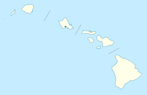 Keanae, Hawaii Location within the state of Hawaii | |
| Coordinates: 20°51′7″N 156°8′17″W / 20.85194°N 156.13806°WCoordinates: 20°51′7″N 156°8′17″W / 20.85194°N 156.13806°W | |
| Country | United States |
| State | Hawaii |
| County | Maui |
| Time zone | Hawaii-Aleutian (HAST) (UTC-10) |
| • Summer (DST) | HADT (UTC-9) |
| ZIP codes | 96713 |
Keanae is an unincorporated community in Maui County on the island of Maui in the U.S. state of Hawaii. Ke‘anae is a peninsula known best for being one of Hawaii‘s major taro farm growing regions. Keanae shares the zip code of 96708 with Ha‘iku.
Islands, municipalities, and communities of Maui County, Hawaii, United States | ||
|---|---|---|
| CDPs | 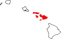 | |
| Unincorporated communities | ||
| Footnotes | ‡This populated place also has portions in an adjacent county or counties | |
This article is issued from Wikipedia - version of the 1/20/2014. The text is available under the Creative Commons Attribution/Share Alike but additional terms may apply for the media files.