Keçiören
| Keçiören | |
|---|---|
| District | |
|
A view of FTZ Shopping Mall in Keçiören | |
 Location of Keçiören within Turkey. | |
 Keçiören Location of Keçiören within Turkey. | |
| Coordinates: 40°00′N 32°52′E / 40.000°N 32.867°ECoordinates: 40°00′N 32°52′E / 40.000°N 32.867°E | |
| Country |
|
| Region | Central Anatolia |
| Province | Ankara Province |
| Government | |
| • Governor | Mustafa Güler |
| • Mayor | Mustafa Ak (AKP) |
| Area[1] | |
| • District | 189.88 km2 (73.31 sq mi) |
| Elevation | 850 m (2,790 ft) |
| Population (2012)[2] | |
| • Urban | 840,809 |
| • District | 840,809 |
| • District density | 4,400/km2 (11,000/sq mi) |
| Time zone | EET (UTC+2) |
| • Summer (DST) | EEST (UTC+3) |
| Postal code | 06xxx |
| Area code(s) | 0312 |
| Licence plate | 06 |
| Website | www.kecioren.bel.tr |

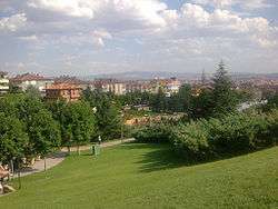
Keçiören is a metropolitan district of Ankara Province in the Central Anatolia region of Turkey, a crowded district in the northern part of the city of Ankara. According to 2010 census, population of the district center is 817,262[3][4] The district covers an area of 190 km2 (73 sq mi),[5] and the average elevation is 850 m (2,789 ft). The Çubuk River runs through the middle of the district.
Etymology
The name Keçiören comes from "keçi" (goat) and "ören" (ruins). Ankara is famous for its goat (Ankara Keçisi), which is used as a source of Angora clothings such as Angora sweatshirts. The area was used for stock breeding long before it became a suburban area.
Politics
Until the 1950s this was a green and pleasant area outside the city, but in recent years has become a large district of housing for Ankara's working class. The Prime Minister Tayyip Erdoğan has his Ankara residence within the district. The area is also a well known location for far right nationalists.
Sports
The sports club Keçiörengücü is based in Keçiören.
Prominent neighbourhoods
Places of interest
Mustafa Kemal Atatürk's headquarters during the Turkish War of Independence, today used by the department of meteorology
The current administration has made efforts to decorate the mass of dull concrete that the area mainly consists of. The new buildings include a huge artificial waterfall and many other pools and fountains, and a concrete replica of the Hungarian Esztergom Castle.
Gondola lift
Keçiören has a two-station aerial lift, the Keçiören Gondola, which connects the neighborhoods Tepebaşı (Cumhuriyet station) and Kavacık Subayevleri (Atatürk station). As of November 2013, it is the only in Ankara and Turkey's longest urban gondola lift line with its length of 1,653 m (5,423 ft).[6][7]
Famous locals
- Melih Gökçek, politician and the mayor of Ankara
- Selahattin Bıyıklı, kick-box champion
Keçiören children's games
To many Turkish people the name Keçiören evokes a popular children's TV outdoor game show (similar to the British It's a Knockout) of the 1980s, which was recorded in the district.
Twin towns – Sister cities
The following places are sister cities to Keçiören:
Notes
- ↑ "Area of regions (including lakes), km²". Regional Statistics Database. Turkish Statistical Institute. 2002. Retrieved 2013-03-05.
- ↑ "Population of province/district centers and towns/villages by districts - 2012". Address Based Population Registration System (ABPRS) Database. Turkish Statistical Institute. Retrieved 2013-02-27.
- ↑ Statistical Institute
- ↑ GeoHive. "Statistical information on Turkey's administrative units" Check
|url=value (help). Retrieved 2008-03-31. - ↑ Statoids. "Statistical information on districts of Turkey". Retrieved 2008-05-03.
- ↑ "Teleferik Hakkında" (in Turkish). Keçiören Belediyesi Teleferik Tesisleri. Retrieved 2013-11-12.
- ↑ "Şirket Profili" (in Turkish). Keçiören Belediyesi Teleferik Tesisleri. Retrieved 2013-11-12.
References
- Falling Rain Genomics, Inc. "Geographical information on Keçiören, Turkey". Retrieved 2008-03-31.
- Kenthaber.com. "General information on Keçiören, Ankara" (in Turkish). Retrieved 2008-03-31.
External links
- District State Website (Turkish)
- District governor's official website (Turkish)
- District municipality's official website (Turkish)
- District Service Website (English)