Prague 19
Not to be confused with Gbely.
| Prague 19 (Praha 19) | |||
| Municipal District of Prague Administrative District of Prague | |||
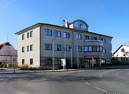 Prague 19 town hall | |||
|
|||
| Official name: Městská část Praha 19 | |||
| Country | Czech Republic | ||
|---|---|---|---|
| Region | Prague, the Capital City | ||
| Coordinates | 50°8′0″N 14°32′58″E / 50.13333°N 14.54944°ECoordinates: 50°8′0″N 14°32′58″E / 50.13333°N 14.54944°E | ||
| Area | 5.99 km2 (2 sq mi) | ||
| Population | 6,149 (2008) | ||
| Density | 1,027/km2 (2,660/sq mi) | ||
| Mayor | Pavel Žďárský | ||
| Timezone | CET (UTC+1) | ||
| - summer (DST) | CEST (UTC+2) | ||
| Postal code | 197 00 | ||
 Location of Prague 19 in Prague | |||
| Website: http://www.praha-kbely.cz | |||

Prague 19, also known as Kbely (German Gbel), is a municipal district (městská část) in Prague. It is located in the north-eastern part of the city. It is formed by one cadastre Kbely. As of 2008, there were 6,149 inhabitants living in Prague 19.
The administrative district (správní obvod) of the same name consists of municipal districts Prague 19, Satalice and Vinoř.
See also
External links
This article is issued from Wikipedia - version of the 5/29/2016. The text is available under the Creative Commons Attribution/Share Alike but additional terms may apply for the media files.