Kato Airport
| Kato Airport | |||||||||||
|---|---|---|---|---|---|---|---|---|---|---|---|
| IATA: KTO – ICAO: SYKT | |||||||||||
| Summary | |||||||||||
| Serves | Kato | ||||||||||
| Elevation AMSL | 2,299 ft / 701 m | ||||||||||
| Coordinates | 4°39′00″N 59°49′50″W / 4.65000°N 59.83056°WCoordinates: 4°39′00″N 59°49′50″W / 4.65000°N 59.83056°W | ||||||||||
| Map | |||||||||||
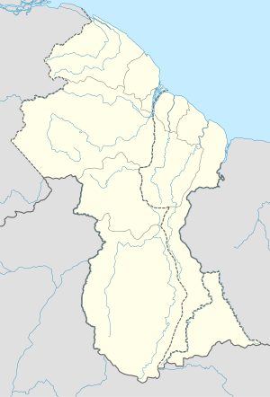 KTO Location in Guyana | |||||||||||
| Runways | |||||||||||
| |||||||||||
Kato Airport (IATA: SYKT, ICAO: KTO) is an airport serving the village of Kato, in the Potaro-Siparuni Region of Guyana.
The Kato non-directional beacon (Ident: KTO) is 1 kilometre (0.62 mi) east of the field.[3]
See also
 Guyana portal
 Aviation portal
- List of airports in Guyana
- Transport in Guyana
References
- ↑ Bing Maps - Kato
- ↑ Airport information for KTO at Great Circle Mapper.
- ↑ SkyVector Aeronautical Charts
External links
This article is issued from Wikipedia - version of the 5/30/2016. The text is available under the Creative Commons Attribution/Share Alike but additional terms may apply for the media files.