Kassala
| Kassala كسلا | |
|---|---|
 | |
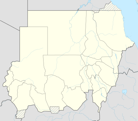 Kassala Location in Sudan | |
| Coordinates: 15°27′N 36°24′E / 15.450°N 36.400°E | |
| Country |
|
| State | Kassala State |
| Population (2008) | |
| • Total | 419,030 |
Kassala (Arabic: كسلا, Arabic pronunciation: ['kasalaː]; Italian: Cassala) is the capital of the state of Kassala in eastern Sudan. Its 2008 population was recorded to be 419,030.[1] Built on the banks of the Gash River, it is a market town and is famous for its fruit gardens. Many of its inhabitants are from the Hadendoa group, with others being of Rashaida origin. It was formerly a railroad hub, however, as of 2006 there was no operational railway station in Kassala and much of the track leading to and from the town has been salvaged or fallen into disrepair. Kassala's location along the main Khartoum-Port Sudan highway makes it an important trade center.
History
The city was originally created as a military camp for the Ottoman soldiers of Egyptian viceroy Muhammad Ali in 1840 during his military offensive into Sudan. In 1885, Kassala was subsequently captured by the Mahdists. In 1894, after the Battle of Kassala the Italians captured the city. In 1897, the Kingdom of Italy returned Kassala to the Kingdom of Egypt. In 1899, Kassala fell under the purview of Anglo-Egyptian Sudan until Sudanese independence in 1956.
In July 1940, during the East African Campaign, Italian forces advancing from Italian East Africa forced a small British garrison to withdraw from Kassala. The Italians then occupied the city with a brigade-sized unit. In mid-January 1941, the Italians withdrew from the city and a British garrison returned.

In 1956, the Anglo-Egyptian Sudan became the Republic of the Sudan. Since the 1960s, the city has been the destination of large numbers of Ethiopian and Eritrean refugees fleeing conflict and war. Since the beginning of the Second Sudanese Civil War in the 1980s, it has also been refuge of internally displaced Sudanese fleeing conflicts in the Nuba Mountains, and south and west of the country. About 160,000 of these IDPs settled on the outskirts of the town.
Climate
| Climate data for Kassala (1961–1990, extremes 1901–present) | |||||||||||||
|---|---|---|---|---|---|---|---|---|---|---|---|---|---|
| Month | Jan | Feb | Mar | Apr | May | Jun | Jul | Aug | Sep | Oct | Nov | Dec | Year |
| Record high °C (°F) | 41.7 (107.1) |
43.5 (110.3) |
45.3 (113.5) |
46.0 (114.8) |
47.0 (116.6) |
47.6 (117.7) |
42.5 (108.5) |
41.6 (106.9) |
43.0 (109.4) |
47.0 (116.6) |
41.1 (106) |
40.2 (104.4) |
47.6 (117.7) |
| Average high °C (°F) | 33.7 (92.7) |
35.2 (95.4) |
38.3 (100.9) |
40.8 (105.4) |
41.6 (106.9) |
39.8 (103.6) |
36.1 (97) |
34.9 (94.8) |
36.8 (98.2) |
38.7 (101.7) |
37.0 (98.6) |
34.4 (93.9) |
37.3 (99.1) |
| Daily mean °C (°F) | 25.1 (77.2) |
26.2 (79.2) |
29.2 (84.6) |
31.9 (89.4) |
33.7 (92.7) |
32.7 (90.9) |
30.0 (86) |
29.1 (84.4) |
30.4 (86.7) |
31.5 (88.7) |
29.2 (84.6) |
26.1 (79) |
29.6 (85.3) |
| Average low °C (°F) | 16.5 (61.7) |
17.2 (63) |
20.1 (68.2) |
23.0 (73.4) |
25.8 (78.4) |
25.7 (78.3) |
23.9 (75) |
23.4 (74.1) |
24.0 (75.2) |
24.3 (75.7) |
21.4 (70.5) |
17.9 (64.2) |
21.9 (71.4) |
| Record low °C (°F) | 5.0 (41) |
7.4 (45.3) |
8.9 (48) |
11.1 (52) |
16.2 (61.2) |
18.5 (65.3) |
18.4 (65.1) |
17.2 (63) |
18.0 (64.4) |
15.7 (60.3) |
11.1 (52) |
6.4 (43.5) |
5.0 (41) |
| Average precipitation mm (inches) | 0.0 (0) |
0.0 (0) |
0.3 (0.012) |
2.0 (0.079) |
8.8 (0.346) |
27.9 (1.098) |
76.0 (2.992) |
85.0 (3.346) |
40.5 (1.594) |
9.9 (0.39) |
0.8 (0.031) |
0.0 (0) |
251.2 (9.89) |
| Average precipitation days (≥ 0.1 mm) | 0.1 | 0.0 | 0.1 | 0.6 | 2.0 | 3.5 | 7.7 | 8.9 | 4.4 | 1.6 | 0.2 | 0.0 | 29.1 |
| Average relative humidity (%) | 46 | 40 | 33 | 27 | 30 | 39 | 55 | 60 | 54 | 42 | 41 | 46 | 42.8 |
| Mean monthly sunshine hours | 306.9 | 288.4 | 313.1 | 315.0 | 310.0 | 282.0 | 266.6 | 266.6 | 288.0 | 310.0 | 303.0 | 297.6 | 3,547.2 |
| Percent possible sunshine | 88 | 88 | 83 | 84 | 77 | 70 | 67 | 69 | 79 | 84 | 88 | 87 | 80 |
| Source #1: NOAA[2] | |||||||||||||
| Source #2: Meteo Climat (record highs and lows)[3] | |||||||||||||
Current status

The Kassala region now has a child mortality rate twice that of the Darfur region.
The city is home to Kassala University, a public university established in 1990 to replace the East University, and an important institution for development in the east of Sudan.[4]
Sister cities
See also
References
- ↑ "GeoHive". Archived from the original on 2007-02-08. Retrieved 2007-02-08.
- ↑ "Kassala Climate Normals 1961–1990". National Oceanic and Atmospheric Administration. Retrieved January 18, 2016.
- ↑ "Station Kassala" (in French). Meteo Climat. Retrieved 22 October 2016.
- ↑ "Kassala University". Sudan Daily Vision. Retrieved 2011-09-17.
External links
| Wikivoyage has a travel guide for Kassala. |
| Wikimedia Commons has media related to Kassala. |
- Kassala program, Ockenden International
Coordinates: 15°27′N 36°24′E / 15.450°N 36.400°E