Kashmar
| Kashmar کاشمر | |
|---|---|
| city | |
|
Kashmar | |
 Kashmar | |
| Coordinates: 35°14′18″N 58°27′56″E / 35.23833°N 58.46556°ECoordinates: 35°14′18″N 58°27′56″E / 35.23833°N 58.46556°E | |
| Country |
|
| Province | Razavi Khorasan |
| County | Kashmar |
| Bakhsh | Central |
| Elevation | 1,063 m (3,488 ft) |
| Population (2006) | |
| • Total | 81,527 |
| Time zone | IRST (UTC+3:30) |
| • Summer (DST) | IRDT (UTC+4:30) |
| Kashmar at GEOnet Names Server | |
.JPG)
Kashmar (Persian: کاشمر, also Romanized as Kāshmar; formerly ترشیز Torshīz or سلطانآباد Soltanabad)[1] is a city in and the capital of Kashmar County, in Razavi Khorasan Province, Iran. Kashmar is located near the river Sish Taraz in the western part of the province, and 217 kilometres (135 mi) south of the province's capital Mashhad, in Iran, from east to Bardaskan, west to Torbat-e Heydarieh, north to Nishapur, south to Gonabad. Until two centuries ago, this city was named Torshiz (ترشیز) and was the birthplace of Sheikh Ahmad-e Jami. At the 2006 census, its population was 81,527, in 21,947 families.[2]
There are three centers of higher education in this city, Payame Nur University (a distant education system), the Azad University of Kashmar, and the Jahad Daneshgahy University of Kashmar.
The city is a major producer of raisins and has about 40 types of grapes. It is also internationally recognised for exporting saffron, and handmade Persian rugs.
There are many places of interest in this city like "Aramgah Seyyed murtaza" and "Bagh Mazar" and "Aramgahe seyyed mohammade Abed" and "Aramgahe modarres".
The history of this city comes back to Zoroaster and Sarv-e Abarqu, the Cypress of Kashmar (see also oldest tree). It seems that this is the single miracle of this prophet there are many fables about this.
Climate
Köppen-Geiger climate classification system classifies its climate as cold semi-arid (BSk).[3]
| Climate data for Kashmar | |||||||||||||
|---|---|---|---|---|---|---|---|---|---|---|---|---|---|
| Month | Jan | Feb | Mar | Apr | May | Jun | Jul | Aug | Sep | Oct | Nov | Dec | Year |
| Average high °C (°F) | 9.5 (49.1) |
12.4 (54.3) |
16.8 (62.2) |
22.3 (72.1) |
29.2 (84.6) |
34 (93) |
35.7 (96.3) |
36.2 (97.2) |
31.9 (89.4) |
25.9 (78.6) |
18.1 (64.6) |
12 (54) |
23.67 (74.62) |
| Daily mean °C (°F) | 3.3 (37.9) |
6.1 (43) |
10.3 (50.5) |
15.3 (59.5) |
21.2 (70.2) |
25.6 (78.1) |
27.9 (82.2) |
27.4 (81.3) |
22.9 (73.2) |
17 (63) |
10.3 (50.5) |
5.3 (41.5) |
16.05 (60.91) |
| Average low °C (°F) | −2.9 (26.8) |
−0.1 (31.8) |
3.9 (39) |
8.4 (47.1) |
13.3 (55.9) |
17.3 (63.1) |
20.2 (68.4) |
18.6 (65.5) |
13.9 (57) |
8.2 (46.8) |
2.6 (36.7) |
−1.4 (29.5) |
8.5 (47.3) |
| Average precipitation mm (inches) | 29 (1.14) |
24 (0.94) |
31 (1.22) |
37 (1.46) |
17 (0.67) |
2 (0.08) |
0 (0) |
0 (0) |
0 (0) |
6 (0.24) |
13 (0.51) |
19 (0.75) |
178 (7.01) |
| Source: Climate-Data.org, altitude: 1057m[3] | |||||||||||||
Notable people
- Alireza Faghani (b. 1978), football referee
- Mohammad Khazaee
- Andranik Madadian (Andy), musician
- Fereydoun Jeyrani director
Gallery
 A taxi and its driver.
References
- ↑ Kashmar can be found at GEOnet Names Server, at this link, by opening the Advanced Search box, entering "-3069992" in the "Unique Feature Id" form, and clicking on "Search Database".
- ↑ "Census of the Islamic Republic of Iran, 1385 (2006)". Islamic Republic of Iran. Archived from the original (Excel) on 2011-11-11.
- 1 2 "Climate: Kashmar - Climate graph, Temperature graph, Climate table". Climate-Data.org. Retrieved 17 September 2013.
External links
-
 Media related to Kashmar at Wikimedia Commons
| Capital | 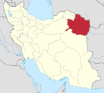 | ||||||||||||||||||||||||||||||||||||||||||||||||||||||||||||||||||||||||||||||
|---|---|---|---|---|---|---|---|---|---|---|---|---|---|---|---|---|---|---|---|---|---|---|---|---|---|---|---|---|---|---|---|---|---|---|---|---|---|---|---|---|---|---|---|---|---|---|---|---|---|---|---|---|---|---|---|---|---|---|---|---|---|---|---|---|---|---|---|---|---|---|---|---|---|---|---|---|---|---|---|
| Counties (A-Q) and cities | |||||||||||||||||||||||||||||||||||||||||||||||||||||||||||||||||||||||||||||||
| Counties (R-Z) and cities | |||||||||||||||||||||||||||||||||||||||||||||||||||||||||||||||||||||||||||||||
| Landmarks |
| ||||||||||||||||||||||||||||||||||||||||||||||||||||||||||||||||||||||||||||||
| populated places | |||||||||||||||||||||||||||||||||||||||||||||||||||||||||||||||||||||||||||||||
| Capital | |||||||||||||||||||||||||||||||||||
|---|---|---|---|---|---|---|---|---|---|---|---|---|---|---|---|---|---|---|---|---|---|---|---|---|---|---|---|---|---|---|---|---|---|---|---|
| Districts |
| ||||||||||||||||||||||||||||||||||