Karukh District
| Karukh کرخ | |
|---|---|
| District | |
 Karukh Location within Afghanistan | |
| Coordinates: 34°30′41″N 62°37′39″E / 34.5113°N 62.6276°E | |
| Country |
|
| Province | Herat Province |
| Area | |
| • Total | 2,010 km2 (780 sq mi) |
| Population (2012)[1] | |
| • Total | 62,000 |
Karukh District[2] is situated in the northeastern part of Herat Province, Afghanistan. It borders Kushk District to the northwest, Kushki Kuhna District to the north and Badghis Province to the northeast. To the east is Obe District. To the south is Pashtun Zarghun District and Injil District is situated to the west. The population is 62,000 (year 2012).[1] The district center is the town of Karukh.
Infrastructure
Only the road from province centre to the district centre has been asphalted and inside the district all the roads are in bad condition. 40% of the roads are open to traffic in all seasons of the year.[2]
External links
- Map of Settlements IMMAP, September 2011
References
- 1 2 "Settled Population of Herat Province" (PDF). Central Statistics Organization. Retrieved 20 January 2016.
- 1 2 "Summary of District Development Plan" (PDF). Karukh District Development Assembly. Retrieved 20 January 2016.
| Capital | 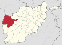 | |
|---|---|---|
| Districts | ||
| Cities | ||
| Landmarks |
| |
This article is issued from Wikipedia - version of the 8/12/2016. The text is available under the Creative Commons Attribution/Share Alike but additional terms may apply for the media files.