Karoi
| Karoi | |
|---|---|
 Karoi | |
| Coordinates: 16°48′36″S 29°42′00″E / 16.81000°S 29.70000°ECoordinates: 16°48′36″S 29°42′00″E / 16.81000°S 29.70000°E | |
| Country | Zimbabwe |
| Province | Mashonaland West |
| District | Hurungwe District |
| City | Karoi Municipality |
| Elevation | 1,275 m (4,183 ft) |
| Population (2004 Estimate) | |
| • Total | 25,030 |
| Time zone | CET (UTC+1) |
| • Summer (DST) | CEST (UTC+1) |
| Climate | Cwa |
Karoi is a town in Zimbabwe.
Location
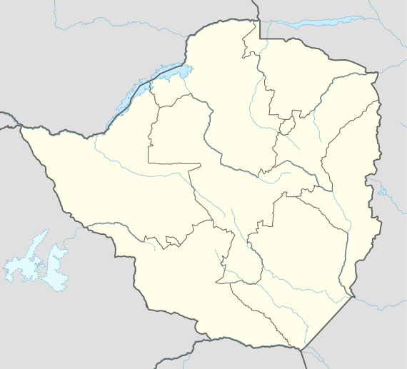
Karoi is located in Karoi District, Mashonaland West Province, in central northern Zimbabwe. It is located approximately 85 kilometres (53 mi), by road, northwest of Chinhoyi, the nearest large town, and the location of the provincial headquarters.[1] This location lies about 200 kilometres (120 mi), northwest of Harare, Zimbabwe's capital and largest city.[2] Karoi lies along the main road, Highway A-1, between Harare and Chirundu, at the International border with the Republic of Zambia, about 170 kilometres (110 mi), further northwest of Karoi.[3] The coordinates of Karoi are: 16° 48' 36.00"S, 29° 42' 0.00"E (Latitude:16.8100; Longitude:29.7000).
Overview
In addition to the offices of Karoi Town Council, the town is also the location of the headquarters of Karoi District Administration. The surrounding countryside is farmland, where tobacco is the primary cash crop. In 2011, the Tobacco Industry and Marketing Board (TIMB) permitted Mashonaland Tobacco Company (MTC) to open auction floors and buy tobacco in the town, but controversy arose in 2012 about purchases from uncontracted farmers.[4]
There are two hotels in the town: Karoi Hotel in the center of town and Twin River Inn, about 1.6 kilometres (0.99 mi), north of town, on the road to Kariba, approximately 135 kilometres (84 mi), northwest of Karoi.[5] The main secondary schools in Karoi are Karoi High School and Chikangwe High School. The farming village of Tengwe lies about 30 kilometres (19 mi), southwest of Karoi. Royal Bank Zimbabwe, a commercial bank, maintains a branch in Karoi.[6]
History
The name Karoi means "little witch". In 1945 Karoi became the designated area for mainly caucasian war veterans who obtained government assistance to embark on farming. They engaged mainly in tobacco farming. Tobacco is still the main cash crop in Karoi District.
Population
During the 1992 national census, the population of the town of Karoi was estimated at 14,763. In 2004, the population estimate was 25,030.[7] Karoi has a suburb called Chikangwe, located about 2 kilometres (1.2 mi), east of the central business district.
Climate
| Climate data for Karoi (1961–1990, extremes 1951–present) | |||||||||||||
|---|---|---|---|---|---|---|---|---|---|---|---|---|---|
| Month | Jan | Feb | Mar | Apr | May | Jun | Jul | Aug | Sep | Oct | Nov | Dec | Year |
| Record high °C (°F) | 35.8 (96.4) |
33.6 (92.5) |
31.7 (89.1) |
33.6 (92.5) |
30.9 (87.6) |
28.0 (82.4) |
28.1 (82.6) |
31.2 (88.2) |
34.7 (94.5) |
35.7 (96.3) |
36.5 (97.7) |
33.7 (92.7) |
36.5 (97.7) |
| Average high °C (°F) | 25.8 (78.4) |
25.6 (78.1) |
25.8 (78.4) |
25.6 (78.1) |
24.1 (75.4) |
22.2 (72) |
22.2 (72) |
24.6 (76.3) |
27.8 (82) |
29.5 (85.1) |
28.0 (82.4) |
26.0 (78.8) |
25.6 (78.1) |
| Daily mean °C (°F) | 20.6 (69.1) |
20.3 (68.5) |
20.0 (68) |
18.9 (66) |
16.8 (62.2) |
14.7 (58.5) |
14.6 (58.3) |
16.6 (61.9) |
20.1 (68.2) |
22.2 (72) |
21.9 (71.4) |
20.7 (69.3) |
18.9 (66) |
| Average low °C (°F) | 16.9 (62.4) |
16.8 (62.2) |
15.9 (60.6) |
14.0 (57.2) |
11.2 (52.2) |
8.7 (47.7) |
8.2 (46.8) |
9.9 (49.8) |
13.0 (55.4) |
16.0 (60.8) |
16.9 (62.4) |
16.9 (62.4) |
13.7 (56.7) |
| Record low °C (°F) | 13.4 (56.1) |
13.0 (55.4) |
10.7 (51.3) |
7.3 (45.1) |
4.9 (40.8) |
1.9 (35.4) |
2.1 (35.8) |
3.6 (38.5) |
5.3 (41.5) |
8.1 (46.6) |
10.7 (51.3) |
12.2 (54) |
1.9 (35.4) |
| Average rainfall mm (inches) | 178.6 (7.031) |
191.6 (7.543) |
111.9 (4.406) |
39.8 (1.567) |
6.7 (0.264) |
1.7 (0.067) |
2.0 (0.079) |
1.1 (0.043) |
4.5 (0.177) |
19.7 (0.776) |
73.4 (2.89) |
173.1 (6.815) |
804.1 (31.657) |
| Average rainy days | 17 | 16 | 11 | 4 | 2 | 1 | 0 | 0 | 1 | 3 | 9 | 15 | 79 |
| Mean monthly sunshine hours | 182.9 | 165.2 | 210.8 | 240.0 | 266.6 | 258.0 | 282.1 | 300.7 | 294.0 | 275.9 | 222.0 | 176.7 | 2,874.9 |
| Mean daily sunshine hours | 5.9 | 5.9 | 6.8 | 8.0 | 8.6 | 8.6 | 9.1 | 9.7 | 9.8 | 8.9 | 7.4 | 5.7 | 7.9 |
| Source #1: World Meteorological Organization,[8] NOAA (sun and mean temperature, 1961–1990)[9] | |||||||||||||
| Source #2: Meteo Climat (record highs and lows)[10] | |||||||||||||
See also
References
- ↑ Road Distance Between Chinhoyi And Karoi With Map
- ↑ Map Showing Karoi And Harare With Distance Marker
- ↑ Road Distance Between Karoi And Chirundu With Map
- ↑ "Tobacco auction floors, MTC clash", ZBC, 12 May 2012
- ↑ Map Showing Karoi And Kariba With Distance Marker
- ↑ Branches of Royal Bank Zimbabwe
- ↑ Pupulation Estimate In 2004
- ↑ "World Weather Information Service – Karoi". World Meteorological Organization. Retrieved 12 May 2016.
- ↑ "Karoi Climate Normals 1961–1990". National Oceanic and Atmospheric Administration. Retrieved 10 June 2016.
- ↑ "Station Karoi" (in French). Meteo Climat. Retrieved 10 June 2016.