Karimganj
| Karimganj করিমগঞ্জ | |
|---|---|
| town | |
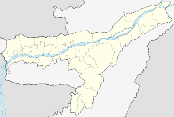 Karimganj  Karimganj Location in Assam, India | |
| Coordinates: 24°52′N 92°21′E / 24.87°N 92.35°ECoordinates: 24°52′N 92°21′E / 24.87°N 92.35°E | |
| Country |
|
| State | Assam |
| District | Karimganj |
| Government | |
| • Body | Karimganj Municipality Board |
| Elevation | 13 m (43 ft) |
| Population (2001) | |
| • Total | 56,854 |
| Languages | |
| • Predominant | Bengali |
| • Official | Bengali |
| Time zone | IST (UTC+5:30) |
| PIN | 788710 |
| ISO 3166 code | IN-AS |
| Vehicle registration | AS |
| Website |
karimganj |
Karimganj (Bengali: করিমগঞ্জ) Town is a town in the Karimganj District of the Indian state of Assam. It is the administrative headquarters and main town of the district.

Geography
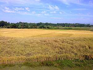
Karimganj town is located on the northern fringe of the district adjoining Bangladesh, flanked on two sides by the Kushiyara River and Longai river, Karimganj town is located just on the Bangladesh border with the river Kushiara flowing in between. One prominent feature of the place is a long canal called Noti Khal meandering across the town. Earlier, it used to be a connecting river way between Kushiara and Longai facilitating river communication and also balancing of water-levels between the two rivers. Now, however, this canal has been blocked at several places through embankments and land-fills to pave way for road transport and construction works.
Karimganj town is located at 24°52′N 92°21′E / 24.87°N 92.35°E.[1] The area of Karimganj town is 6.09 km2. It has an average elevation of 13 metres (42 feet).
Transport
The distance of Karimganj town from Guwahati, the state capital of Assam, is approximately 330 km by road and about 350 km by rail. Distance of other important places are:
- Silchar - 55 km,
- Shillong - 220 km,
- Agartala - 250 km.

The broad gauge lines connecting Tripura with Assam pass through the Karimganj town railway station. Badarpur railway station is the biggest railway junction of Karimganj.
History
Karimganj became a subdivision of Sylhet District of British India in late nineteenth century. It was severed from Sylhet during Partition of India and was included in India as a part of Cachar district in Assam. In 1983, Karimganj became a district of Assam with its headquarters at Karimganj Town.
Demographics
As of 2001 India census,[2] Karimganj Municipality had a population of 52,316. However, if we consider from the nature of urban characteristics total population of the city may gone up to 100,000, because many parts of the town still fall under the jurisdiction of Gram Panchayats. Males constitute 51% of total population and females 49%. Karimganj has an average literacy rate of 83%, higher than the national average of 59.5%: male literacy is 87%, and female literacy is 79%. In Karimganj, 9% of the population is under 6 years of age. Bengali is the official language of the district.
Politics
Karimganj consists of five assembly constituencies: Karimganj North and Karimganj South, Badarpur, Patharkandi, and Ratabari; all of which are part of Karimganj (Lok Sabha constituency).[3]
Media
Local newspaper
Notable People
- Syed Mujtaba Ali (1904-1974), a Bengali writer, academician, scholar and linguist.
- Raisaheb Umesh Chandra Dutta, Academician

Maulana Abdul Jalil Choudhury (RH), Principal- Deorail Title MADRASSA Badarpur, Ex MLA ,Assam & 1st Ameer E Shariat- North- East India Emarat E Shariah & Nadwatut Tameer. and Scholars
- Prof Bani Prasanna Mishra
- Prof Md Fokhrul Islam
- Prof Sujit Nandi Purkayastha, MS
- Prof Sujit Chaudhury
- Prof Partha Sarathi Mishra
- Prof Kamal Uddin Ahmed
- Prof Sib Tapan Basu
- Prof Sad Uddin Chaudhury
- Dr K M Baharul Islam, Professor at Indian Institute of Management Kashipur, Fellow, Indian Institute of Advanced Study (2016-2018)
See also
- Government Boys' HS School Ground, the town's cricket ground
- Karimganj (Lok Sabha constituency)
References
- ↑ Falling Rain Genomics, Inc - Karimganj
- ↑ "Census of India 2001: Data from the 2001 Census, including cities, villages and towns (Provisional)". Census Commission of India. Archived from the original on 16 June 2004. Retrieved 1 November 2008.
- ↑ "List of Parliamentary & Assembly Constituencies" (PDF). Assam. Election Commission of India. Retrieved 5 October 2008.
External links
| Topics | |
|---|---|
| History | |
| Districts & Divisions |
|
| Geography | |
| Culture | |
| Arts, Literature, Music Cinema |
|
| People | |
| Notable surnames |
|
| Urban centres | |
| |
(Bengali: করিমগঞ্জ)