Kaplan, Louisiana
| Kaplan, Louisiana | |
| City | |
| Nickname: Gateway to the Coastal Wetlands | |
| Country | United States |
|---|---|
| State | Louisiana |
| Parish | Vermilion |
| Elevation | 16 ft (4.9 m) |
| Coordinates | 30°00′16″N 92°17′09″W / 30.00444°N 92.28583°WCoordinates: 30°00′16″N 92°17′09″W / 30.00444°N 92.28583°W |
| Area | 2.2 sq mi (5.7 km2) |
| - land | 2.2 sq mi (6 km2) |
| - water | 0.0 sq mi (0 km2), 0% |
| Population | 5,177 (2000) |
| Density | 2,298.6/sq mi (887.5/km2) |
| Mayor | Kirk Champagne (D) |
| Timezone | CST (UTC-6) |
| - summer (DST) | CDT (UTC-5) |
| Area code | 337 |
 Location of Kaplan in Louisiana | |
 Location of Louisiana in the United States | |
Kaplan is a small city in Vermilion Parish, Louisiana, United States. The population was 5,177 at the 2000 census. It is part of the Abbeville Micropolitan Statistical Area.
History
In 1896, the Holy Rosary Catholic Church was established in the growing European-American settlement. Most of the people were Acadian, so the main language was French.[1] The town was named after Abrom Kaplan, who bought the Jim Todd Plantation in 1901. The town Kaplan grew quickly and was established in 1902. The following year, residents created the first school.[2]
On July 14, 1906, the first Bastille Day Celebration was held. In 1911, the Eleazar Theater was built. In 1916, the Kaplan Telephone Company began. In 1920, the school was rebuilt.[2]
The Kaplan Herald has been in continuous publication since 1956 as the Kaplan Journal. When Conrad Kaplan purchased the newspaper in 1965, he named it the Kaplan Herald. It remained under his ownership till his death in 1992 when Louisiana State Newspaper purchased the Kaplan Herald from his estate.
Geography
Kaplan is located at 30°0′16″N 92°17′9″W / 30.00444°N 92.28583°W (30.004548, -92.285964).[3]
According to the United States Census Bureau, the city has a total area of 2.2 square miles (5.7 km2), all of it land.
Demographics
| Historical population | |||
|---|---|---|---|
| Census | Pop. | %± | |
| 1910 | 315 | — | |
| 1920 | 876 | 178.1% | |
| 1930 | 1,653 | 88.7% | |
| 1940 | 2,838 | 71.7% | |
| 1950 | 4,562 | 60.7% | |
| 1960 | 5,267 | 15.5% | |
| 1970 | 5,540 | 5.2% | |
| 1980 | 5,016 | −9.5% | |
| 1990 | 4,535 | −9.6% | |
| 2000 | 5,177 | 14.2% | |
| 2010 | 4,600 | −11.1% | |
| Est. 2015 | 4,617 | [4] | 0.4% |
As of the census[6] of 2000, there were 5,177 people, 2,069 households, and 1,342 families residing in the city. The population density was 2,298.6 people per square mile (888.4/km²). There were 2,265 housing units at an average density of 1,005.7 per square mile (388.7/km²). The racial makeup of the city was 85.13% White, 12.92% African American, 0.17% Native American, 0.50% Asian, 0.02% Pacific Islander, 0.21% from other races, and 1.04% from two or more races. Hispanic or Latino of any race were 1.20% of the population.
There were 2,069 households out of which 31.6% had children under the age of 18 living with them, 46.3% were married couples living together, 14.2% had a female householder with no husband present, and 35.1% were non-families. 30.9% of all households were made up of individuals and 17.0% had someone living alone who was 65 years of age or older. The average household size was 2.45 and the average family size was 3.06.
In the city the population was spread out with 25.8% under the age of 18, 9.4% from 18 to 24, 25.5% from 25 to 44, 19.5% from 45 to 64, and 19.7% who were 65 years of age or older. The median age was 37 years. For every 100 females there were 86.8 males. For every 100 females age 18 and over, there were 80.3 males.
The median income for a household in the city was $22,535, and the median income for a family was $30,236. Males had a median income of $29,387 versus $19,198 for females. The per capita income for the city was $12,340. About 25.0% of families and 33.5% of the population were below the poverty line, including 48.3% of those under age 18 and 32.3% of those age 65 or over.
Notable people
- Iron Eyes Cody (of Sicilian descent, portrayed Native Americans as actor)
- Sammy Kershaw (American Country and Western music singer and songwriter; two-time candidate for lieutenant governor of Louisiana)
- Jonathan W. Perry (former Kaplan city council member and state representative for Vermilion and Cameron parishes - Current State Senator)
References
- ↑ "Kaplan", Official Website
- 1 2 www.vrml.k12.la.us "Kaplan: The Gateway to the Coastal Wetlands", Vermilion Parish Website Archived October 22, 2008, at the Wayback Machine.
- ↑ "US Gazetteer files: 2010, 2000, and 1990". United States Census Bureau. 2011-02-12. Retrieved 2011-04-23.
- ↑ "Annual Estimates of the Resident Population for Incorporated Places: April 1, 2010 to July 1, 2015". Retrieved July 2, 2016.
- ↑ "Census of Population and Housing". Census.gov. Archived from the original on May 11, 2015. Retrieved June 4, 2015.
- ↑ "American FactFinder". United States Census Bureau. Archived from the original on 2013-09-11. Retrieved 2008-01-31.
External links
- Encyclopedia of Southern Jewish Communities - Kaplan, Louisiana
- Abrom Kaplan's Cajun Dream, Forward June 28, 2013
- Le Musée de Kaplan
- Vermilion Parish Tourist Commission
- Vermilion Historical Society
Municipalities and communities of Vermilion Parish, Louisiana, United States | ||
|---|---|---|
| Cities | 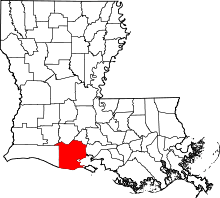 | |
| Town | ||
| Village | ||
| Unincorporated communities | ||
| Footnotes | ‡This populated place also has portions in an adjacent parish or parishes | |