Kanjhawala
| Kanjhawala | |
|---|---|
| village | |
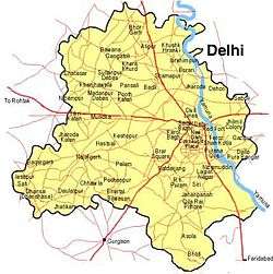
 Kanjhawala Location in India | |
| Coordinates: 28°43′36″N 77°00′09″E / 28.72674°N 77.00248°ECoordinates: 28°43′36″N 77°00′09″E / 28.72674°N 77.00248°E | |
| Country |
|
| State | Delhi |
| District | North West |
| Population (2001) | |
| • Total | 8,700 |
| Languages | |
| • Official | Hindi, English |
| Time zone | IST (UTC+5:30) |
Kanjhawala is a village in North West district in the Indian state of Delhi.
Demographics
As of the 2001 India census,[1] Kanjhawala had a population of 8700. Males constitute 54% of the population and females 46%. Kanjhawala has an average literacy rate of 66%, higher than the national average of 59.5%: male literacy is 74%, and female literacy is 58%. In Kanjhawala, 16% of the population is under 6 years of age.
Kanjhawala is the biggest village of Dabas Gotra in the whole Jat community. Dabas mainly migrated from Rajasthan state in the year 1105 and settled here.
People from every religion and caste are now part of this village, which is the center of four industrial areas: Bawana, Mundka, Rani khera, and Bahadur Garh. People from every part of India are now resident in Kanjhawala village and its area. The District commissioner (DC), Sub-Divisional Magistrate's Office and the Revenue Court for North-west Delhi are all situated in Kanjhawala on main road MDR-8.
The most common language spoken is Haryanvi, along with Hindi.
Geography
The Mahabharat Kalin Khandav Prasth Van is situated 1.5 km away from Kanjhawala village in Ladpur village area, which is now known as Dada Pobhara.
References
- ↑ "Census of India 2001: Data from the 2001 Census, including cities, villages and towns (Provisional)". Census Commission of India. Archived from the original on 2004-06-16. Retrieved 2008-11-01.