Kangilinnguit
| Kangilinnguit Grønnedal | |
|---|---|
|
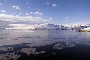
Fjord icefloes, view from Kangilinnguit | |
 Kangilinnguit Location within Greenland | |
| Coordinates: 61°14′00″N 48°05′55″W / 61.23333°N 48.09861°WCoordinates: 61°14′00″N 48°05′55″W / 61.23333°N 48.09861°W | |
| State |
|
| Constituent country |
|
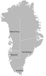
| Municipality |
|
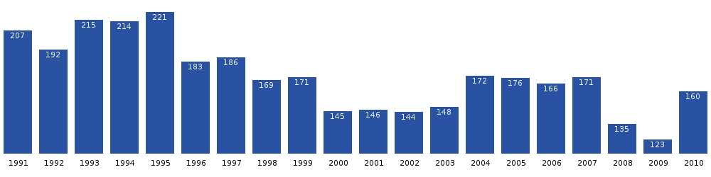
| Population (2010) | |
| • Total | 160 |
| Time zone | UTC-03 |
| Postal Code | 3905 Nuussuaq |
| Kangilinnguit Heliport | |||||||||||
|---|---|---|---|---|---|---|---|---|---|---|---|
| IATA: JGR – ICAO: BGGD | |||||||||||
| Summary | |||||||||||
| Airport type | Military | ||||||||||
| Elevation AMSL | 95 ft / 29 m | ||||||||||
| Helipads | |||||||||||
| |||||||||||

Kangilinnguit or Kangilínguit, formerly Grønnedal, is a settlement and a naval base in Greenland's Sermersooq municipality, located at the mouth of Arsuk Fjord[1] in southwestern Greenland. The settlement had 160 inhabitants in 2010,[2] most of whom are Danish Navy personnel, attached to Island Command Greenland headquarters.[3] A road – roughly 5 kilometers long – between Kangilinnguit and Ivittuut make them the only towns in Greenland connected by roads. It was the only populous settlement within the former Ivittuut Municipality.
For the former U.S. Naval Operating Facility there, see Bluie West Seven.
History
Kangilinnguit was founded as "Green Valley" by the United States Navy during the Second World War to protect the highly strategic cryolite quarry in the former settlement of Ivittuut. The U.S. Navy turned the base over to the Danish Navy in August 1951. During the early years of the Cold War, the base was used by anti-submarine warfare ships of NATO, which tracked Soviet Navy submarines in the North Atlantic.
Since at least the mid-1990s, the Danish Navy has proposed saving money on the headquarters staff of Island Command Greenland out of isolated Grønnedal by relocating most of the 65 members either to the Greenlandic capital at Nuuk or bringing them back to Aarhus in Jutland. However, the Greenlandic government has successfully lobbied to keep the command intact in order to boost the local economy.
Under the terms of the "2010-2014 Danish Defense Agreement" approved by the Danish parliament on 24 June 2009, the Greenland Command will absorb the (nearly defunct) Faroe Island Command. The combined command will be placed in Nuuk under the name of "Arctic Command".
Population
References
| Wikimedia Commons has media related to Kangilinnguit. |
- ↑ "Greenland and the Arctic". By Etain O'Carroll and Mark Elliott. Lonely Planet 2005. ISBN 1-74059-095-3.
- ↑ Statistics Greenland (Danish)
- ↑ Danish Agency for Science, Technology and Innovation
- ↑ Statistics Greenland
External links
- Website of the Greenland Command at Kangilinnguit (Danish)
- arsukfjorden.gl − local web site with maps (Danish)