Kamrup district
| Kamrup district কামৰূপ জিলা | |
|---|---|
| District of Assam | |
| Country | India |
| State | Assam |
| Administrative division | Lower Assam |
| Headquarters | Amingaon |
| Government | |
| • Lok Sabha constituencies | Gauhati Lok Sabha constituency |
| Area | |
| • Total | 6,882 km2 (2,657 sq mi) |
| Population (2011) | |
| • Total | 35,96,292 |
| • Density | 520/km2 (1,400/sq mi) |
| • Urban | 235,264 |
| Demographics | |
| • Literacy | 70.95 per cent |
| • Sex ratio | 914 |
| Major highways | National Highway 31, National Highway 37 |
| Average annual precipitation | 1,400 mm |
| Website | Official website |
Kamrup district (Pron:ˈkæmˌrəp or ˈkæmˌru:p); also Kamrup rural district is an administrative district in the state of Assam in India formed by bifurcating old Kamrup district into two in the year 2003; other being Kamrup Metropolitan district, named after region it constitute. The district, along with Nalbari and Barpeta together form the Kamrup region, has Kamrupi culture and language.
History
Kamrup Rural district created by bifurcating Old Kamrup district in 2003.
Geography and environment

Overview
Kamrup district occupies an area of 4,345 square kilometres (1,678 sq mi),[1] comparatively equivalent to Australia's Kangaroo Island.[2] Kamrup district has some territorial disputes with neighbouring West Khasi Hills district, Meghalaya, including that over the village of Langpih.[3]
Hydrography
In the immediate neighborhood of the Brahmaputra the land is low, and exposed to annual inundation. In this marshy tract reeds and canes flourish luxuriantly, and the only cultivation is that of rice. At a comparatively short distance from the river banks the ground begins to rise in undulating knolls towards the mountains of Bhutan on the north, and towards the Khasi hills on the south. The hills south of the Brahmaputra in some parts reach the height of 800 feet (240 m). The Brahmaputra, which divides the district into two nearly equal portions, is navigable by river steamers throughout the year, and receives several tributaries navigable by large native boats in the rainy season. The chief of these are the Manas, Chaul Khoya and Barnadi on the north, and the Kulsi and Dibru on the south bank.
Flora and fauna
In 1989 Kamrup district became home to the Dipor Bil Wildlife Sanctuary, which has an area of 4.1 km2 (1.6 sq mi).[4] There is also a plantation where seedlings of teak, sal, sissu, sum, and nahor are reared, and experiments are being made with the caoutchouc tree.
Demographics
Population
According to the 2011 census Kamrup district has a population of 1,517,202,[5] roughly equal to the West African country of Gabon[6] or the US state of Hawaii.[7] This gives it a ranking of 327th in India (out of a total of 640).[5] The district has a population density of 436 inhabitants per square kilometre (1,130/sq mi) .[5] Its population growth rate over the decade 2001-2011 was 15.67%.[5] Kamrup has a sex ratio of 946 females for every 1000 males,[5] and a literacy rate of 72.81%.[5]
Religion
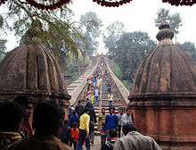
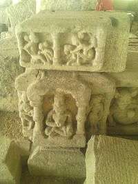
The district has followers of Hinduism, Islam, Christianity, Buddhism and Animism. The ancient temples of Kamakhya and Hajo attracts many pilgrims from all quarters. The people of Kamrup also donated a sacred Arya Avalokiteśvara statue to Stakna Monastery in Ladakh.[8]
Language
Major language spoken natively is Kamrupi with pockets of Amri, a Tibeto-Burman language related with Karbi, with 1,25,000 speakers;[9] Tiwa (Lalung) and A'Tong, also Tibeto-Burman spoken by 10,000 people, found mostly in southern parts bordering Meghalaya.[10]
Economy
The staple crop of the district is rice, of which there are three crops. The indigenous manufactures are confined to the weaving of silk and cotton cloths for home use, and to the making of brass cups and plates. The chief exports are rice, oil seeds, timber and cotton; the imports are fine rice, salt, piece goods, sugar, betel nuts, coconuts and hardware. A section of the Assam-Bengal railway starts from Guwahati, and a branch of the Eastern Bengal railway has recently been opened to the opposite bank of the river. A metalled road runs due south from Guwahati to Shillong.
See also
References
- ↑ Srivastava, Dayawanti et al. (ed.) (2010). "States and Union Territories: Assam: Government". India 2010: A Reference Annual (54th ed.). New Delhi, India: Additional Director General, Publications Division, Ministry of Information and Broadcasting (India), Government of India. p. 1116. ISBN 978-81-230-1617-7.
- ↑ "Island Directory Tables: Islands by Land Area". United Nations Environment Program. 1998-02-18. Retrieved 2011-10-11.
Kangaroo Island
- ↑ "Meghalaya flexes muscle on Assam boundary", Zee News, 2008-11-22, retrieved 2012-08-11
- ↑ Indian Ministry of Forests and Environment. "Protected areas: Assam". Retrieved 25 September 2011.
- 1 2 3 4 5 6 "District Census 2011". Census2011.co.in. 2011. Retrieved 2011-09-30.
- ↑ US Directorate of Intelligence. "Country Comparison:Population". Retrieved 2011-10-01.
Gabon 1,576,665
- ↑ "2010 Resident Population Data". U. S. Census Bureau. Retrieved 2011-09-30.
Hawaii 1,360,301
- ↑ "Stakna Gompa". Buddhist-temples.com. Retrieved 19 October 2009.
- ↑ M . Paul Lewis, ed. (2009). "Amri Karbi: A language of India". Ethnologue: Languages of the World (16th ed.). Dallas , Texas: SIL International. Retrieved 2011-09-28.
- ↑ M . Paul Lewis, ed. (2009). "A'Tong: A language of India". Ethnologue: Languages of the World (16th ed.). Dallas, Texas: SIL International. Retrieved 2011-09-28.
Bibliography
- Bannerje, A C (1992). "Chapter 1: The New Regime, 1826-31". In Barpujari, H K. The Comprehensive History of Assam: Modern Period. IV. Guwahati: Publication Board, Assam. pp. 1–43.
- Hunter, William Wislon (1879). A Statistical Account of Assam. 1. Trübner & co. Retrieved 2012-12-13.
-
 This article incorporates text from a publication now in the public domain: Chisholm, Hugh, ed. (1911). "article name needed". Encyclopædia Britannica (11th ed.). Cambridge University Press.
External links
 |
Baksa district Nalbari district |
Udalguri district Darrang district |
| |
| Goalpara district | |
Morigaon district | ||
| ||||
| | ||||
| East Garo Hills district, Meghalaya | West Khasi Hills district, Meghalaya | Ri-Bhoi district, Meghalaya |
| Topics | |
|---|---|
| History | |
| Districts & Divisions |
|
| Geography | |
| Culture | |
| Arts, Literature, Music Cinema |
|
| People | |
| Notable surnames |
|
| Urban centres | |
| |
Coordinates: 26°20′N 91°15′E / 26.333°N 91.250°E