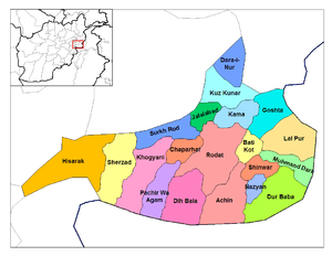
Kama District
Coordinates: 34°24′45″N 70°38′20″E / 34.41250°N 70.63889°E Kama is a district in Nangarhar Province, Afghanistan, to the east of Jalalabad. Its population, which is 100% Pashtun, was estimated at 180,000 in 2012. The district centre is the village of Sanger Srye Kama.kama have more than 55000 students in 2012. The districts includes most of the Kama valley, connecting Jalalabad with the other cities of country as well as with Khyber Pass.
Health
In 2008, The Provincial Reconstruction Team in Nangarhar province built a hospital in Kama district. This hospital will serve to the neighboring districts as well as possible. Moreover, Kama district has a number of Basic Health Clinics (BHCs), which provide services to the residents.
Sports
Beside other local sports, cricket is the developing sport across the district. Kama has a number of local teams who always organizes the tournaments.
Media
Kama district is in a location that can receive the transmission of local televisions and radios from Jalalabad city. On June 15, 2013 a private FM radio Qalam which means pen in Pashto language was launched in Kama district. Qalam radio has 8-hour educational, social and entertainment programs in 24 hours and it could be heard by neighboring districts as well.
References
- http://www.isaf.nato.int/article/news/hospital-brings-health-care-to-rural-afghans.html
- http://www.pajhwok.com/en/2012/05/07/new-cricket-stadium-build-jalalabad-video
- http://www.pajhwok.com/en/2013/06/15/qalam-radio-goes-air-nangarhar
External links
- Map of Kama district (PDF)