Kaff al-Jaa
| Kaff al-Jaa كاف الجاع | |
|---|---|
| Village | |
|
A neighborhood of Kaff al-Jaa | |
 Kaff al-Jaa | |
| Coordinates: 35°5′8″N 36°12′26″E / 35.08556°N 36.20722°E | |
| Country |
|
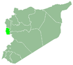
| Governorate | Tartus |
| District | Baniyas |
| Subdistrict | Al-Qadmus |
| Population (2004 census)[1] | |
| • Total | 2,068 |
| Time zone | EET (UTC+2) |
| • Summer (DST) | EEST (UTC+3) |

Kaff al-Jaa (Arabic: كاف الجاع, pronounced Kāf al Jā`; also spelled Kaf al-Jaz) is a village in northwestern Syria, administratively part of the Tartus Governorate, located northeast of Tartus. Nearby localities include al-Qadmus to the west, Deir Mama to the northeast, Masyaf to the east, Wadi al-Oyun to the south and Hammam Wasel to the southwest. According to the Syria Central Bureau of Statistics, Kaff al-Jaa had a population of 2,068 in the 2004 census.[1] Its inhabitants are predominantly Alawites.[2]
The surrounding area is marked by the mountains. The highest mountain of Kaff al-Jaa is the Alcaadboon, with a height of 1,194 meters.
References
- 1 2 General Census of Population and Housing 2004. Syria Central Bureau of Statistics (CBS). Idlib Governorate. (Arabic)
- ↑ Balanche, Fabrice (2006). La région alaouite et le pouvoir syrien (PDF) (in French). Karthala Editions. ISBN 2845868189.
Capital: Tartus | ||||||||
|  | |||||||
|
| ||||||||
| ||||||||
| ||||||||
This article is issued from Wikipedia - version of the 6/2/2015. The text is available under the Creative Commons Attribution/Share Alike but additional terms may apply for the media files.