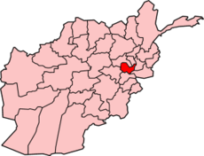
Kabul Province
| Kabul کابل | |
|---|---|
| Province | |
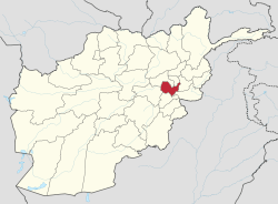 Map of Afghanistan with Kabul highlighted | |
| Coordinates (Capital): 34°00′N 69°00′E / 34.00°N 69.00°ECoordinates: 34°00′N 69°00′E / 34.00°N 69.00°E | |
| Country |
|
| Capital | Kabul |
| Government | |
| • Governor | Hamid Akram |
| Area | |
| • Total | 4,461.6 km2 (1,722.6 sq mi) |
| Population (2015)[1] | |
| • Total | 4,372,977 |
| • Density | 980/km2 (2,500/sq mi) |
| Time zone | UTC+4:30 |
| ISO 3166 code | AF-KAB |
| Main languages |
Pashto Dari |
Kābul (Pashto: کابل Kābəl, Persian: کابل Kābol), situated in the east of the country, is one of the thirty-four provinces of Afghanistan. The capital of the province is Kabul city, which is also Afghanistan's capital. The population of the Kabul Province is nearly 4 million people as of 2012,[2] of which almost 80 percent live in the urban areas.[3] The current governor of the province is Hamid Akram.
Geography

Kabul is located between Latitude 34-31' North and Longitude 69-12' East at an altitude of 1800 m (6000 feet) above sea level, which makes it one of the world's highest capital cities. Kabul is strategically situated in a valley surrounded by high mountains at crossroads of north-south and east-west trade routes. One million years ago the Kabul region was surrounded from south-east between Lowgar and Paghman Mountains; Charikar in the north and the Ningai Ghar mountains in the west. This region formed an icy sea. Some deep wells in the region of today's Poli Charkhi in the east part of city are the evidence of that time. Kabul is surrounded by Koh-e Paghman Mountain from the east, Koh-e Qrough Mountain from the south-west and Koh-e Shirdarwaza Mountain from the north-east. Kabul has only one river which is called Kabul River. Kabul River rises at the Paghman Mountain toward South Pass about 70 km (43 mi) west of Kabul. It flows in an easterly direction, past Kabul, and through Jalalabad city, and then on to Dakka where it enters Pakistani territory and finally runs into the Indus at Attock.
The climate within region of Kabul is considered to be arid to semi-arid steppe. Because of the very low amounts of precipitation, especially from May to November, Kabul can be very dry and dusty. Extreme temperature changes occur from night to day, season to season, and from place to place. The chief characteristic of Afghanistan's climate is a blue cloudless sky with over 300 days of sunshine yearly. Even during the winter, skies usually remain clear between snowfalls, which are on average 15–30 cm (5.9–11.8 in) annually. The daily temperature for Kabul city in winter is −1 °C (30 °F) and in summer 24 °C (75 °F). The coldest month of the year is January and the hottest month is July. The maximum temperature has been recorded as +42.7 °C in July and the minimum as -26.3 °C in January.
History
Kabul's history dates back more than 3,500 years. It was once the center of Zoroastrianism[4] and subsequently also a home for Buddhists and Hindus.
The native citizens of Kabul as per the records of the British Museum are Pashtuns and Tajiks.
The city was invaded by Arab Muslims in the 7th century by introducing Islam but was slowly taken back by the Hindu Shahi's of Kabul. It was re-invaded by the Saffarids and Samanids in the 9th century followed by Mahmud of Ghaznavi in the 11th century, when the Hindu Shahi King Jay Pala committed suicide. It became part of the Ghurids after defeating the Ghaznavids, and later it was invaded by the Mongols under Genghis Khan.
Timur, founder of the Timurid dynasty, invaded the region in 14th century and developed it into a major trading center. In 1504, the city fell to Babur from the north of the country and was made into his capital, which became one of the principal cities of his later Mughal Empire. In 1525, Babur described Kabulistan in his memoirs by writing that:
In the country of Kābul there are many and various tribes. Its valleys and plains are inhabited by Tūrks, Aimāks, and Arabs. In the city and the greater part of the villages, the population consists of Tājiks (called "Sarts" by Babur). Many other of the villages and districts are occupied by Pashāis, Parāchis, Tājiks, Berekis, and Afghans. In the hill-country to the west, reside the Hazāras and Nukderis. Among the Hazāra and Nukderi tribes, there are some who speak the Moghul(mongol) language. In the hill-country to the north-east lies Kaferistān, such as Kattor and Gebrek. There are eleven or twelve different languages spoken in Kābul: Arabic, Persian, Tūrki, Moghuli, Hindi, Afghani, Pashāi, Parāchi, Geberi, Bereki, and Lamghāni...[5]— Baburnama, 1525 AD
For much of its time Kabul was independent until it became part of the Durrani Empire in 1747. During the First Anglo-Afghan War in 1839, the British army invaded the area but withdrew in 1842, although thousands of them were killed during a surprise ambush on their way to Jalalabad. In retaliation another British force partly burned Kabul before retreating back to British India. The British again occupied the city during the Second Anglo-Afghan War in 1879, after their resident staff were massacred there, but withdrew about a year later when they installed Emir.
In 1919, King Amanullah Khan rose to power during the Third Anglo-Afghan War when Afghanistan's capital and its eastern city of Jalalabad were air raided by the No. 31 and 114 squadrons of the British Royal Air Force in May 1919.[6][7] Amanullah Khan defeated the British and began modernization of the country after the signing of the Treaty of Rawalpindi. In the late 1920s, switching of power took place until Zahir Shah became the youngest new King.
In the 1960s and 1970s, Kabul was known as the Paris of central Asia as it was transforming into a European style city. Once the jewel of Asia, a very progressive and moderately modern capital. Kabul in those days had, modern cinemas, cafes, formal French gardens, schools, libraries, universities, fine boutiques. The inhabitants of Kabul known as "Kabulis" were highly educated, modern, progressive and cosmopolitan people. Where women and men attended primary school, high school and university. Mini-jupes (mini skirts) were a common sight in the 1970s. Highly educated, culturally aware and yet religious at the same time, there was never an issue with not having your hair covered or the clothes you wore in the Kabul of the 1960s and 1970s. This progressive peaceful society lasted until foreign interference occurred in the late 1970s plummeting the country to what Afghanistan has become today. In December 1979, Soviet armed forces landed at Kabul International Airport to help bolster the PDPA-led government of Afghanistan.

Kabul became the Soviet command center for approximately 10 years during their stay in Afghanistan. In February 1989, Soviet forces withdrew from Afghanistan after they were defeated by the Mujahideens. In spring of 1992 the government of Mohammad Najibullah collapsed, Kabul fell into the hands of Mujahideen forces. Destruction increased as the coalition of the parties broke into rival warring factions, and much of Kabul was damaged. In 1996 the Taliban took over the region and started a new strict Islamic Sharia rule which restricted most forms of education, entertainment, women from working, men from shaving beards, and many normal human activities or hobbies.
Less than a month after the September 11 attacks in the United States, in October 2001, the United States armed forces assisted by British Armed Forces provided massive air support to United Front (Northern Alliance) ground forces during Operation Enduring Freedom. The Taliban abandoned Kabul and the United Front came to take control of the city. In December 2001 Kabul became the capital of the Afghan Transitional Administration, which transformed to the present Government of Afghanistan that is led by President Hamid Karzai.
In early 2002 a NATO-led International Security Assistance Force (ISAF) was deployed in Kabul and from there they began taking over other parts of the country. The war-torn city began to see some positive development as millions of expats returned to the country. Its population has grown from about 500,000 in 2001 to over 3 million by 2007. Many foreign embassies re-opened, especially the biggest U.S. Embassy. Afghan government institutions were also re-developed and modernized. Since 2008 the newly trained Afghan National Police (ANP) and the Afghan National Army (ANA) are in charge of security in the area, while NATO also has a heavy presence but are not patrolling the streets anymore.
While the city is being developed, it is also the scene of occasional deadly suicide bombings and explosions carried out by the Haqqani network, Taliban's Quetta Shura, Hezb-i Islami, Al Qaeda, and other anti-government elements who are allegedly supported and guided by Pakistan's Inter-Services Intelligence (ISI) spy network.[8]
Politics
Kabul has been long known for its politics and different warlords. It was under the control of many political groups and warlords when Mohammad Najibullah's government collapsed. Kabul city was in the hands of many political groups who fought for power until it was taken over by the Taliban in 1996 and its politics was changed. Kabul's politics become more aligned with the Islamic regime and new laws were introduced by the Taliban. There was only one leader for Afghanistan Mullah Omar, the head of Taliban who ran Kabul's political party until the US invaded on October 7, 2001. New laws and humanities came in effect to enable Kabul to recover from the destruction caused by the Taliban. Loya Jirga took place to solve the current political problems and situations in Kabul and introduce new laws. Kabul citizens have been given the right to vote.
After being re-scheduled twice, Afghanistan's presidential elections were held on October 9, 2004. Over 8 million Afghans voted in the elections. The Joint Electoral Management Body of Afghanistan certified the elections on November 3, and declared Hamid Karzai, the interim President, the winner with 55.4% of the vote. Karzai's strongest opponent, Yunus Qanuni, received 16.3% of the vote. The elections were not without controversy; allegations of fraud and ballot stuffing were brought up by many of the presidential candidates including Yunus Qanuni. Many felt that Hamid Karzai had an unfair advantage over the other candidates as he had access to financial and logistical resources that many of the other candidates did not have. A panel of international experts was set up to investigate the matter. The panel did find evidence of voting irregularities, however, they said that it was not enough to affect the outcome of the elections. Some people claimed that they were forced to vote for the current president and some claim that they were paid to do so.
With help from the United States and the United Nations, Afghanistan adopted its new constitution, establishing the country as an Islamic Republic, in early January 2004. According to the constitution, the Afghan government consists of a powerful and popularly elected President, two Vice Presidents, and a National Assembly consisting of two houses: the House of People (Wolesi Jirga), and the House of Elders (Meshrano Jirga). There is also an independent Judiciary branch consisting of the Supreme Court (Stara Mahkama), High Courts and Appeal Courts. The President appoints the members of the Supreme Court with the approval of the Wolesi Jirga. Assembly elections were planned for late 2005.
Economy
Kabul's products include: natural gas, cotton, wool, carpets, agriculture, and some small production companies. Kabul has trade partnerships with the UK, France, Germany, United States, India, South Korea, Turkmenistan, Kenya, Russia, Pakistan, China, Iran. Kabul's economy was influenced by the America and has increased by almost 3500% after shrinking for 25 years. A new currency was introduced to Afghans which helped the economy. New business was in the new regime. Many American industries were interested in the new Kabul and many new companies have since then opened their branches in Kabul. The Kabul City Centre Mall was built and has nearly 100 shops.[9]
The economy is at a boom level and is increasing dramatically. Housing costs are rising as are employee wages. The cost of living has increased dramatically which is a problem for the non-educated Afghans, who cannot support themselves. The UN helps Afghans in need of help by providing aid, food and school materials for schools. Many international aid organizations are contributing to the Afghan economy.
Tourism
In the 1960s and 70s most of Kabul's economy depended on tourism. Kabul had textile, cotton production, and carpet production industries, but most of its economy came through tourism which it lost during its destruction.
Demographics and administration

The total population of Kabul province is 3,950,300,[10][11] of which about 80 percent live in the urban areas (mainly in the Kabul metropolitan area) while the remaining 20 percent are rural residents.[3]
The city of Kabul is multi-ethnic, with 45% Tajik, 25% Pashtun, 25% Hazara, 2% Uzbeks, 1% Baloch, 1% Turkmen, and 1% others.[12] Dari and Pashto language are widely used in the region although Dari serves as the lingua franca. Multilingualism is common throughout the area, particularly among the Pashtun people.
Districts
| District | Capital | Population | Area[13] | Ethnic data (%)[14] | Notes |
|---|---|---|---|---|---|
| Bagrami | Bagrami | 85,000 | Pashtuns (majority) Tajiks[15] | ||
| Chahar Asyab | Qalai Naeem | 32,500 | Pashtuns, Tajiks[16] | ||
| Deh Sabz | Tarakhel | 47,900 | 55% Pashtuns 45% Tajiks[17] | ||
| Farza | Dehnawe Farza | 19,100 | Pashtuns and Tajiks[18] | Created in 2005 from Mir Bacha Kot District | |
| Guldara | Guldara | 25,213 | 80% Tajiks 20% Pashtuns[19] | ||
| Istalif | Istalif | 29,800 | Tajik[20] | ||
| Kabul | Kabul | 3,289,000[2] | 45% Tajiks, 25% Pashtuns, 25% Hazaras, 2% Uzbeks,1 % Baloch, 1% Turkmen, and 1% Hindu[12] | ||
| Kalakan | Kalakan | 26,900 | Predominantly Tajik, some Pashtun[21] | ||
| Khaki Jabbar | Khak-i Jabbar | 75,000 | 65% Pashtuns 35% Tajiks[22] | ||
| Mir Bacha Kot | Mir Bacha Kot | 46,300 | Predominantly Tajik, some Pashtun[23] | Sub-divided in 2005 | |
| Mussahi | Mussahi | 30,000 | Pashtuns, Tajiks[24] | ||
| Paghman | Paghman | 150,000 | 60% Pashtuns 40% Tajiks[25] | ||
| Qarabagh | Qara Bagh | 67,700 | 60% Tajiks 40% Pashtuns[26] | ||
| Shakardara | Shakar Dara | 72,900 | Tajik majority[27] | ||
| Surobi | Surobi | 150,000 | 75% Pashtuns 3% Tajiks and the rest are Pashais[28] |
Transportation
Transportation in Kabul is improving as the numbers of new vehicles and experienced drivers are increasing. There is public transportation service in the Kabul vicinity, but many roads are in disrepair. Drivers are also impeded by the large number of cyclists. More vehicles are seen in the city because people are purchasing cars. Taxi cabs are found everywhere in the city, also in most of the districts of Kabul.
Kabul's Milli Bus (National Bus) system, which has about 800 buses, provides service to the city and nearby areas. There are several new highways in the province, and the government has scheduled to rebuild most of the smaller roads. Funding for the roads comes from current drivers who must pay toll charges for driving on highways and major roads. The money is collected by the government through issuing motorists monthly, quarterly or annual inspection certificates that are affixed to the windshield of their vehicles.
Trucks are used to transport goods from one district to another, or to other cities of the country. The Afghan government, with the help of foreign companies or organizations, have begun work on many of Kabul's roads. Auto companies like Honda, Toyota, Ford Motor Company, and Chevrolet have also been reintroduced in Kabul.
Healthcare
The percentage of households with clean drinking water fell from 65% in 2005 to 56% in 2011.[29] The percentage of births attended to by a skilled birth attendant increased from 46% in 2005 to 73% in 2011.[29]
Education
The overall literacy rate (6+ years of age) fell from 58% in 2005 to 47% in 2011.[29] The overall net enrolment rate (6–13 years of age) increased from 46% in 2005 to 65% in 2011.[29]
Kabul is Afghanistan's center for education. People from all the provinces of the country come to Kabul for education. There are many schools and universities that have opened doors for men and women. In the 1970s, about 55% of Kabul's population was educated without materials or proper learning resources to get a proper education, but nowadays most of the young children are sent to work by their parents to support their living costs. The education rate has declined dramatically during the last 20 years. Most of the schools in Kabul were set as battle points during the wars and have been demolished.
List of Universities in Kabul

- Kabul University
- Polytechnical University of Kabul
- National Military Academy of Afghanistan
- Kabul Medical University
- Kardan University
- American University of Afghanistan
- Bakhtar University
- Salam University
- Dawat University
- Karwan University
- Rana Institute of Higher Education
- Afghanistan Technical Vocational Institute
- Maryam University
- Kateb University
List of schools in Kabul

- Habibia High School (British-Afghan school founded in 1904 as Habibya College)
- Aisha-i-Durani School (or Mädchengymnasium Aysha-e Durani) and Wirtschaftsgymnasium für Mädchen Jamhuriat (German-Afghan schools for girls)
- Ahmad Shah Baba High School (for boys, named after Ahmad Shah Durrani)
- Amani High School (German-Afghan school for boys founded in 1924)
- Durkhanai High School (for girls)
- Ghazi High School (for boys, names after Amanullah Khan)
- Ghulam Haider Khan High School
- International School of Kabul
- Lycée Esteqlal and Lycée Malalaï (French lycées founded in 1922 and 1932 respectively)
- Malalai High School (for girls, named after Malalai Anna)
- Malika Soraya High School (for girls, named after Queen Soraya Tarzi)
- Naderia High School (For Boys)
- Nazo Ana High School (for girls, named after Nazo Tokhi)
- Raman Baba High School (for boys, named after Rahman Baba)
- Sultana Razia High School (for girls)
Sports

Kabul is the center of annual buzkashi and football tournaments, where teams from all over of Afghanistan, and sometimes from neighboring Pakistan, Iran, Uzbekistan, and Tajikistan participate. Sports is a daily routine for employees in Afghanistan, when they all join each other in tournaments and matches, specially soccer games. Golf is played at the Kabul Golf Club, which is a short drive from the capital near the Qargha water park.
Afghanistan national football team also participated in many Asian Soccer Leagues. Many Afghans who were living as refugees in Pakistan and India repatriated, and they brought the game of cricket with them. Afghanistan now has a national cricket team that plays internationally. The Province itself is represented in Afghan domestic cricket by the Kabul Province cricket team, who were the inaugural winners of the 2010 Etisalat 50 over tournament.
There are also basketball, volleyball, golf, handball, boxing, taekwondo, weightlifting, bodybuilding, track and field, skating, bowling, snooker, and chess, teams in Kabul, which participate in tournaments locally and go on tours to other Asian countries. One of the oldest and most popular stadiums in Kabul is the Ghazi Stadium, where tournaments, concerts, and national celebrations take place. The Kabul National Cricket Stadium is under construction as of 2011. The Ghazi Stadium is also currently going through a reconstruction programme whereby a new design and a new system will be established for the stadium. Schools and universities encourage participation in team sports, and Afghans are being trained in Kabul for the next Olympic Games.
See also
References
- ↑ Afghanistan at Geohive
- 1 2 Afghanistan Statistical Yearbook 2012/13 (PDF), Central Statistics Office Afghanistan
- 1 2 "Kabul Provincial Profile", NABP (National Area-Based Development Programme), Ministry of Rural Rehabilitation and Development, Islamic Republic of Afghanistan, "Archived copy" (PDF). Archived from the original (PDF) on 2011-07-27. Retrieved 2010-05-05.
- ↑ SOUTH ASIA | Kabul: City of lost glories. BBC News (2001-11-12). Retrieved on 2010-10-19.
- ↑ Zahir ud-Din Mohammad Babur (1525). "Events Of The Year 910". Memoirs of Babur. Packard Humanities Institute. Retrieved 2010-08-22.
- ↑ "The Road to Kabul: British armies in Afghanistan, 1839-1919". National Army Museum. Retrieved 2011-02-11.
- ↑ "Afghanistan 1919-1928: Sources in the India Office Records". British Library. Retrieved 2011-02-11.
1919 (May), outbreak of Third Anglo-Afghan War. British bomb Kabul and Jalalabad;
- ↑ "U.S. blames Pakistan agency in Kabul attack". Reuters. September 22, 2011. Archived from the original on September 25, 2011. Retrieved 2011-09-22.
- ↑ Afghans Head for the Mall - IWPR Institute for War & Peace Reporting. Iwpr.net. Retrieved on 2010-10-19.
- ↑ "Settled Population of Kabul province by Civil Division, Urban, Rural and Sex-2012-13" (PDF). Islamic Republic of Afghanistan: Central Statistics Organization. Retrieved 2014-01-16.
- ↑ "Area and administrative Population". Central Statistics Office, Afghanistan Statistical Yearbook 2012/13. Archived from the original (PDF) on 2015-12-17. Retrieved 2014-01-16.
- 1 2 "2003 National Geographic Population Map" (PDF). Thomas Gouttierre, Center For Afghanistan Studies, University of Nebraska at Omaha; Matthew S. Baker, Stratfor. National Geographic Society. November 2003. Retrieved 2010-06-27.
- ↑ Afghanistan Geographic & Thematic Layers
- ↑ Ethnic demographic statistics taken from http://www.aims.org.af
- ↑ http://www.aims.org.af/afg/dist_profiles/unhcr_district_profiles/centra/kabul/bagrami.pdf[]
- ↑ UNHCR Sub-Office Central Region - District Profile - Char Asiab (PDF) Retrieved on 2011-1-22.
- ↑ UNHCR Sub-Office Central Region - District Profile - Deh Sabz (PDF) Retrieved on 2011-1-22.
- ↑ UNHCR Sub-Office Central Region - District Profile - Farza (PDF) Retrieved on 2011-1-22.
- ↑ http://www.mrrd-nabdp.org/attachments/article/138/Kabul_Guldara%20English%20summary%20finalized.pdf
- ↑ UNHCR Sub-Office Central Region - District Profile - Istalif (PDF) Retrieved on 2011-1-22.
- ↑ UNHCR Sub-Office Central Region - District Profile - Kalakan (PDF) Retrieved on 2011-1-22.
- ↑ UNHCR Sub-Office Central Region - District Profile - Khak-e-Jabbar (PDF) Retrieved on 2011-1-22.
- ↑ UNHCR Sub-Office Central Region - District Profile - Mir Bacha Kot (PDF) Retrieved on 2011-1-22.
- ↑ UNHCR Sub-Office Central Region - District Profile - Mussahi (PDF) Retrieved on 2011-1-22.
- ↑ UNHCR Sub-Office Central Region - District Profile - Paghman (PDF) Retrieved on 2011-1-22.
- ↑ UNHCR Sub-Office Central Region - District Profile - Qarabagh (PDF) Retrieved on 2011-1-22.
- ↑ UNHCR Sub-Office Central Region - District Profile - Shakardara (PDF) Retrieved on 2011-1-22.
- ↑ UNHCR Sub-Office Central Region - District Profile - Sarobi (PDF) Retrieved on 2011-1-22.
- 1 2 3 4 Archive, Civil Military Fusion Centre, https://www.cimicweb.org/AfghanistanProvincialMap/Pages/Kabul.aspx
External links
| Wikimedia Commons has media related to Kabul Province. |
 |
Parwan Province | Kapisa Province | | |
| Wardak Province | |
Laghman Province | ||
| ||||
| | ||||
| Logar Province | Nangarhar Province |