Junagadh
| Junagadh જૂનાગઢ | |
|---|---|
|
Gate of the city of Junagadh | |
  Junagadh | |
| Coordinates: 21°31′12″N 70°27′47″E / 21.520°N 70.463°ECoordinates: 21°31′12″N 70°27′47″E / 21.520°N 70.463°E | |
| Country | India |
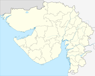
| State | Gujarat |
| District | Junagadh |
| Government | |
| • Body | Junagadh Municipal Corporation |
| • Mayor | Jitendrabhai Hirpara |
| • Municipal Commissioner | B. K. Thacker |
| • Member of Legislative Assembly | Mahendra Mashru |
| • Member of Parliament | Rajesh Chudasama |
| Area | |
| • Total | 160 km2 (60 sq mi) |
| Area rank | 7th |
| Elevation | 107 m (351 ft) |
| Population (2011)[1] | |
| • Total | 5,17,350 |
| • Density | 3,200/km2 (8,400/sq mi) |
| Time zone | IST (UTC+5:30) |
| PIN | 362 00X[2] |
| Telephone code | 0285 |
| Vehicle registration | GJ-11 |
| Language | Gujarati, Hindi, English |
| Civic agency | Junagadh Municipal Corporation |
| Website |
www |

Junagadh ![]() pronunciation (Gujarati: જુનાગઢ) is the headquarters of Junagadh district in the Indian state of Gujarat. The city is the 7th largest in Gujarat, located at the foot of the Girnar hills, 355 km south west of state capital Gandhinagar and Ahmedabad. Literally translated, Junagadh means "Old Fort". An alternate etymology gives the name as coming from "Yonagadh", literally "City of the Yona (Greeks)," referring to the ancient inhabitants of the city under the Indo-Greek Kingdom. It is also known as "Sorath", the name of the earlier Princely State of Junagadh.[3] After a brief struggle between India and Pakistan, Junagadh joined India on 9 November 1947. It was a part of Saurashtra state and later Bombay state. In 1960, after the Maha Gujarat movement, it became part of newly formed Gujarat state.
pronunciation (Gujarati: જુનાગઢ) is the headquarters of Junagadh district in the Indian state of Gujarat. The city is the 7th largest in Gujarat, located at the foot of the Girnar hills, 355 km south west of state capital Gandhinagar and Ahmedabad. Literally translated, Junagadh means "Old Fort". An alternate etymology gives the name as coming from "Yonagadh", literally "City of the Yona (Greeks)," referring to the ancient inhabitants of the city under the Indo-Greek Kingdom. It is also known as "Sorath", the name of the earlier Princely State of Junagadh.[3] After a brief struggle between India and Pakistan, Junagadh joined India on 9 November 1947. It was a part of Saurashtra state and later Bombay state. In 1960, after the Maha Gujarat movement, it became part of newly formed Gujarat state.
History
Mauryan dynasty
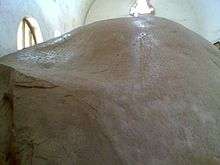
An impressive fort, Uparkot, located on a plateau in the middle of town, was originally built during the Mauryan dynasty by Chandragupta in 319 BCE The fort remained in use until the 6th century, when it was abandoned for some 300 years, then rediscovered in 976 CE. The fort was besieged 16 times over an 800-year period. One unsuccessful siege lasted twelve years.
There is an inscription with fourteen Edicts of Ashoka on a large boulder within 2 kilometres (1.2 mi) of Uperkot Fort.[4] The inscriptions carry Brahmi script in a language similar to Pali and date back to 250 BCE. On the same rock there are inscriptions in Sanskrit added around 150 CE by Mahakshatrap Rudradaman I, the Saka (Scythian) ruler of Malwa, a member of the Western Kshatrapas dynasty.[5] Another inscription dates from about 450 CE and refers to Skandagupta, the last Gupta emperor. Old rock-cut Buddhist "caves" in this area, dating from well before 500 CE, have stone carvings and floral work. There are also the Khapra Kodia Caves north of the fort, and the Bava Pyara caves south of the fort. Bava Pyara caves contains artworks of both Buddhism and Jainism.
The Maitraka dynasty ruled Gujarat from 475 to 767 CE. The founder of the dynasty, General Bhatarka, military governor of Saurashtra peninsula under the Gupta empire, established himself as the independent ruler of Gujarat around the last quarter of the 5th century.
Solanki dynasty
In the 11th and 12th centuries, the Solanki dynasty ruled Gujarat. The two large step wells (vavs) at Uperkot Fort were both commissioned by Rah Navghan I (1025-1044 CE). Muslims conquered Gujarat in 1299 and the Sultanate of Gujarat was founded in 1407. Mahmud Begada (Mahmud Shah I) invaded Junagadh in 1467. The city was annexed to the Gujarat Sultanate; the city foundation was laid for Mahmudabad in 1497. Strong embankments were raised along the river, and the city was adorned with a palace, handsome buildings and extensive gardens. When the Portuguese took over the ports of Diu and Daman in the 16th century, a fifteen-foot cannon, made in Egypt in 1531, was abandoned at Uperkot Fort by a Turkish admiral opposing the Portuguese forces at Diu.
Chudasama Dynasty
The Chudasama are a Rajput clan found in Gujarat. The Anthropological Survey of India, which relies heavily on sources compiled during the period of the British Raj, notes that they are "an offshoot of the Samma tribe, who entered India during the 7th or 8th century and are found in Kachchh, Junagadh and Jamnagar districts." They claim to be originally of the Yadu clan or Yadava from Sindh . Harald Tambs-Lyche believes that there is evidence, based on myths, that a Chudasama kingdom existed at Junagadh in the Saurashtra region of Gujarat. The dynasty is traditionally said to have been founded in 875 CE and around 1030 received assistance from members of the Ahir community in order to restore its power following a conquest of the kingdom by the king of Gujarat. The Chudasamas are sometimes referred to as the Ahirani Ranis, and Tambs-Lyche says that, "The structure of the Chudasama state , seems to have been an alliance between a small royal clan later to be classified as Rajputs and the Ahir tribe."According to the historical past also an Ahir sepoy of Chudasama rulers Devayat Bodar whose wife saved the Chudasama descendant from Bhimdev solanki , sacrificing her off spring like Panna Dhai , that's why today also Chudasama are known as Bhanja (Nephews) of Ahirs . The last of these kings was Mandlik Chudasama then Mahmud Begarha, who also annexed the state . Begarha had attacked the Chudasama kingdom, which was known as Girnar, on several previous occasions.[6]
Chudasama rulers
The Chudasama Rajputs ruled Junagadh longer than any others. The notable rulers include Chandra Chuda, 875-907; Rah’ Grahripu, 940-982; Solanki Rajput, 1010-1025; Ra Navghan, 1025-1044; Rah’ Khengar, 1044-1067
Nawab of Junagarh rule

Mohammad Sher khan Babi, who owed allegiance to the Mughal governor of Gujarat subah, founded the state of Junagadh and declaring independence in 1730 after Marathas Gaikwad invasion. Muhammad Sher khan Babi, was the founder of the Babi Dynasty of Junagadh State dynasty. His descendants, the Babi Nawabs of Junagadh, conquered large territories in southern Saurashtra and ruled over the state for the next two centuries, first as tributaries of Marathas, and later under the suzerainty of the British. The Nawabs of Junagadh belonged to the Babi or Babai (Pashtun tribe) pashtuns from Afghanistan. They were granted a 13 gun salute by the British authorities:[7]
- 1730 - 1758 : Mohammad Bahadur Khanji or Mohammad sher khan Babi[8][9]
- 1758 - 1774 : Mohammad Mahabat Khanji I
- 1774 - 1811 : Mohammad Hamid Khanji I
- 1811 - 1840 : Mohammad Bahadur Khanji II
- 1840 - 1851 : Mohammad Hamid Khanji II
- 1851 - 1882 : Mohammad Mahabat Khanji II
- 1882 - 1892 : Mohammad Bahadur Khanji III
- 1892 - 1911 : Mohammad Rasul Khanji
- 1911 - 1948 : Mohammad Mahabat Khanji III
British period

Junagadh State was founded in 1730. In 1807 it became a British protectorate. The East India Company took control of the state by 1818, but the Saurashtra area never came under the direct administration of British India. Instead, the British divided the territory into more than one hundred princely states, which remained in existence until 1947. The present old town, developed during the 19th and 20th centuries, is one of the former princely states which were outside but under the suzerainty of British India.
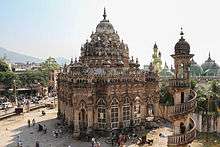
The Shri Swaminarayan Mandir temple in Junagadh was constructed on land presented by Jinabhai (Hemantsingh) Darbar of Panchala, and dedicated on 1 May 1828. Swaminarayan appointed Gunatitanand Swami as the first mahant (religious and administrative head of temple), who served in this role and preached there for over 40 years.[10][11]
Accession to India
During the period spanning the independence and partition of India and Pakistan in 1947, the 562 princely states that had existed outside British India under British suzerainty were given a choice of acceding to either India or Pakistan or remaining outside them. Although the states were theoretically free to choose, Earl Mountbatten stated that "geographic compulsions" meant that most of them would choose India. Mountbatten took the position that only states that shared a common border with Pakistan should choose to accede to it, but he had no power to impose this point of view on the states.
- 15 Aug 1947 Accedes to Pakistan.
- 15 Sep 1947 Accession to Pakistan accepted.
- 9 Nov 1947 Occupied by India.
- 10 Nov 1947 Rescinds accession to Pakistan, accedes to India
- 24 Feb 1948 Referendum approves accession to India.
- 25 Feb 1948 Accession to India in effect.
On September 15, 1947, Nawab Mohammad Mahabat Khanji III of Junagadh, a princely state located on the south-western end of Gujarat and having no common border with Pakistan, chose to accede to Pakistan ignoring Mountbatten's views, arguing that Junagadh could access Pakistan by sea. The rulers of two states that were subject to the suzerainty of Junagadh — Mangrol and Babariawad — reacted by declaring their independence from Junagadh and acceding to India. In response, the nawab of Junagadh militarily occupied the two states. Rulers of the other neighbouring states reacted angrily, sending troops to the Junagadh frontier, and appealed to the Government of India for assistance. A group of Junagadhi people, led by Samaldas Gandhi, formed a government-in-exile, the Aarzi Hukumat ("temporary government").[12]
India asserted that Junagadh was not contiguous to Pakistan and believed that if Junagadh was permitted to accede to Pakistan, communal tension already simmering in Gujarat would worsen, and refused to accept the Nawab's choice of accession. The government pointed out that the state was 96% Hindu, and called for a plebiscite to decide the question of accession. India cut off supplies of fuel and coal to Junagadh, severed air and postal links, sent troops to the frontier, and occupied the principalities of Mangrol and Babariawad that had acceded to India.[13]
Pakistan agreed to discuss a plebiscite, subject to the withdrawal of Indian troops, a condition India rejected. On 26 October, the Nawab and his family fled to Pakistan following clashes with Indian troops.
On 7 November, Junagadh's court, facing collapse, invited the Government of India to take over the State's administration. The Dewan of Junagadh, Sir Shah Nawaz Bhutto, the father of the more famous Zulfiqar Ali Bhutto, decided to invite the Government of India to intervene and wrote a letter to Mr. Buch, the Regional Commissioner of Saurashtra in the Government of India to this effect.[14]
The government of India rejected the protests of Pakistan and accepted the invitation of the Dewan to intervene.[15] A plebiscite was conducted in February 1948, but it was not internationally monitored and Pakistan claims was not based on the plebiscite but on the logic of Kashmir Annexation, which went almost unanimously in favour of accession to India.[16] Junagadh became a part of the Indian state of Saurashtra until 1 November 1956, when Saurashtra became part of Bombay state. In 1960, Bombay state was split into the linguistic states of Maharashtra and Gujarat, in which Junagadh was located.
Time periods of various rulers
| Various Rulers | Time Period[17] |
|---|---|
| Maurya Dynasty ruled over Junagadh | in 319 BC |
| Kalinga Dynasty ruled over Junagadh | in 185 BC |
| Greeks ruled over Junagadh | in 73-70 BC |
| Shaka (Scythians) ruled over Junagadh | 100-275 AD |
| Kshatrapa ruled over Junagadh | 276-455 AD |
| Gupta ruled over Junagadh | 456-770 AD |
| The Chinese Traveller Hu-en-Tsang had visited Junagadh | 640 AD |
| Chudasama ruled over Junagadh | 875-1472 AD |
| Turkic Rulers Mohammed Begada, Khalil Khan | 1472-1572 AD |
| Mughals ruled over Junagadh | 1573-1730 AD |
| Nawabs of Junagadh Khanji (Babi Pathan) ruled over | 1730-1949 |
Geography
Junagadh is located at 21°31′N 70°28′E / 21.52°N 70.47°E. It has an average elevation of 107 metres (351 ft).
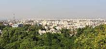
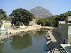
Junagadh is situated at the foot of Mount Girnar. Junagadh has Arabian sea to its southwest, Porbandar to its north and Amreli to its east. Junagadh city is divided into number of areas Main city is clustered around M.G. Road and Kalwa Chowk. Other areas are Gandhigram, Zanzarda Road, Talaw Darwaza, Bus-stand, Sakkar Baug, Timbawadi, Joshipara and Girnar Taleti. These areas comes under the administration of Junagadh Municipal Corporation.
Junagadh city has two rivers namesd Sonrakh and Kalwo. However Kalwo is facing major pollution problem because city sewers. Junagadh city has many lakes named Narsinh Mehta Sarovar, Damodarji, Sudarshan Lake etc. There are man made dams around Junagadh named Willingdon dam, Hasnapur Dam, Anandpur Weir. These are the main water sources for the city. Apart from that ground water supply is very widely available in the city so wells are scattered all across the city.
Junagadh city has pretty much similar soil as whole Junagadh district. It is Deep- Medium black coastal alluvium.[19] It is because proximity of sea and long shore line and also because of the Girnar mountain ridge. Because of many fault lines in proximity Junagadh is in seismically active zone. Junagadh lies in Seismic Zone III region[20] which means earthquake up to magnitude 6.5 on the Richter-scale may be expected.
Climate[21]
Junagadh has a tropical wet and dry climate, with three distinct seasons observed, a mild winter from November to February, a hot summer from March to June, and a monsoon from July to October. The Arabian Sea and the Gulf of Cambay are also influential factors affecting the climate and weather of Junagadh. Junagadh faces adverse climatic conditions in the summer months with the temperature ranging from 28° Celsius to 38° Celsius. In the winter months, the temperature ranges from 10° Celsius to 25° Celsius. The city is drained by the south-west monsoon from June to September. It records a rainfall of 1000 to 1200 mm annually. Various factors such as its close proximity to the sea influence the weather of Junagadh. The latent winds from the sea affect the climatic conditions in the region. Highest rainfall in a calendar year was recorded back in 1983 and it was 2800 mm.[22]
| Climate data for Junagadh | |||||||||||||
|---|---|---|---|---|---|---|---|---|---|---|---|---|---|
| Month | Jan | Feb | Mar | Apr | May | Jun | Jul | Aug | Sep | Oct | Nov | Dec | Year |
| Average high °C (°F) | 27.2 (81) |
28.3 (82.9) |
31.4 (88.5) |
32.7 (90.9) |
33.4 (92.1) |
32.9 (91.2) |
30 (86) |
29.3 (84.7) |
30.1 (86.2) |
32.5 (90.5) |
31.6 (88.9) |
28.7 (83.7) |
30.68 (87.22) |
| Average low °C (°F) | 13.1 (55.6) |
14.7 (58.5) |
18.1 (64.6) |
21.6 (70.9) |
25.2 (77.4) |
26.5 (79.7) |
25.7 (78.3) |
24.7 (76.5) |
23.9 (75) |
21.9 (71.4) |
18.3 (64.9) |
14.9 (58.8) |
20.72 (69.3) |
| Average precipitation mm (inches) | 0 (0) |
0 (0) |
2 (0.08) |
1 (0.04) |
3 (0.12) |
118 (4.65) |
372 (14.65) |
191 (7.52) |
116 (4.57) |
19 (0.75) |
5 (0.2) |
1 (0.04) |
828 (32.62) |
| Source: Climate-Data.org[23] | |||||||||||||
Annual average of weather parameter during 2008[22]
| Total rainfall (rainy days) | 1690.7 mm (71) |
| Maximum temperature | 44.5 'C (21/05/2010) |
| Minimum temperature | 7.4 'C (11/12/2010) |
| Wind speed (km/hrs) | 5.6 kmph |
| Evaporation (mm) | 5.5 mm |
| Bright sunshine (hrs) | 6.8 hr/day |
| Onset of monsoon | 3 June 2008 |
| Withdrawal of monsoon | 13 September 2008 |
Economy
Due to its mountainous region and forest reserves, Junagadh lacks major industries or plants. However main earning sectors for Junagadh are mineral-based cement industry, agriculture-based industry and power sector. Presence of huge reserves of limestone makes the cement industry a thriving industrial sector. Major crops produced in the district are wheat, oil seeds, cotton, mango, banana, onion and brinjal. Total production of oilseeds in Junagadh in 2006-07 was 4,64,400 MT[24] which was the highest in the state. Junagadh is the largest producer of groundnut and garlic in the state contributing 26% and 34% to total production respectively. Junagadh has Asia's largest ground nut research laboratory. Mango and onions are produced in large quantities in the district.
Some of the large scale industry present in Junagadh are Mother Dairy Fruit & Vegetable Pvt Ltd (Popularly known as Junagadh Dairy in the region), Agro Marine Exports, Creative Castings Ltd., Austin Engineering. With an investment of INR 4,000 crore (USD 975.6million), JSW Power Co. propose to set up coal-based power plant at Simar in Junagadh.[25] The economy of Junagadh is mainly based on agriculture. With the new Government policy of biotechnology, Junagadh has been identified as one of the agriculture biotechnology zone. This will boost setting up of agro-biotech industries in the district.
Junagadh boasts of some of the best tourist destinations in the state so tourism is considered to be a progressing sector. The State Government has sanctioned the project for development of Circuit Tourism project at Junagadh.[26]
Politics
Politics of Junagadh city has always been closely contested between Indian National Congress and Bharatiya Janta Party. Other national parties with limited activities are Bahujan Samaj Party, Communist Party of India, Nationalist Congress Party. Other state parties active in Junagadh is Mahagujarat Janta Party, Samata Party, Republic Party of India. Junagadh has 194,196 registered voters including 100,050 Male and 94,146 Female.
Junagadh has one state assembly constituencies. BJP has always been a strong party in this arena. BJP won this seat in 2007 election. Total number of voters participated were 118,888. BJP got 52.36% of votes and nearest competitor was INC with 26.32%.[27] Election for the state assembly is held every 5 years.
Junagadh Municipal Corporation has 17 wards and total of 51 seats. In 2009 elections INC won on 26 seats, BJP won 21 seats, BSP won 3 seats and 1 went to Independent out of 51. Majority went to INC although all in all BJP got more votes which were 134,739 votes which were 45.62% of total, on the other end INC got 120,533 which were 40.81% of total.[28] The Mayor, Deputy Mayor has terms of 2 and a half years.
Road
Junagadh is connected to Rajkot and Ahemadabad by National Highway NH8D which also connects Junagadh to Veraval and Somnath. Junagadh city Bypass on NH8D obviates the need for through vehicles to enter the city. In the south, Junagadh is connected to Bilkha and Sasan Gir Lion Sanctuary. Kalwo river runs through Junagadh; Ferguson bridge is built over it to connect the two parts of the city. A bridge is also constructed on river Sonrakh in the northern outskirts of the city. Mount Girnar is connected with Junagadh by road. Rickshaws are generally preferred as mode of transportation.
Utility services
Junagadh city has a population of 320,250 and at present the water demand is 30 million litres per day. Water is supplied through 25,000 tap connections by three major surface water sources namely Aanandpur Weir, Hasanapur dam and Wellingdon dam and 32 wells. Junagadh city has more than 1000 hand pumps and 200 stand posts as ground water sources situated all over the city area. Junagadh city area limit were extended in January 2004 increasing its area from 13.47 km2. to 57 km2. Eight Nos. for Grampanchayats and One Municipality was merged in Junagadh city limit. Newly merge area has its individual ground water supply system through bore wells.[29]
Daily generation of solid waste in city approximately 150 tonnes. Thus the total waste is within the range of 400 gm per capita per day of domestic waste. The above solid waste is being collected by deploying 400 wheel barrows (six containers) as per the guidelines of Hon'ble supreme court by MSW rule 2000. JMC has set up 800 community bins for solid waste collection.[30] It covers 90% of city area. Junagadh city's drainage system is 62 km long but it covers only 67% of total area and 60% of total population.[31]
Electricity is provided and distributed by P.G.V.C.L. which is a state run company. Telecom service is available in the city. It is provided mainly by B.S.N.L., while other service providers include Reliance and Tata. Cell phone coverage is extensive and main service providers are Vodafone, B.S.N.L., Airtel, Idea and Tata Docomo. B.S.N.L. also provides broadband service.
City has a good network of street lights. There are total 12,545 tube lights and 1523 central sodium lighting. Solar light project is also approved for the Narsinh Mehta Sarovar.[32]
Demographics
As of the 2011 census, Junagadh municipality had a population of 320,250.[1] The municipality had a sex ratio of 952 females per 1,000 males and 8.5% of the population were under six years old.[1] Effective literacy was 88.63%; male literacy was 93.23% and female literacy was 83.83%.[1]
Junagadh has relatively low to medium housing and land costs in comparison to cities like Rajkot. The city is rapidly expanding and available land inside the limits of Municipal Corporation are now limited. Total area under slums is 19.5 km2 (14.5% of total municipal area) and total slum population accounts for around 25% of total population.[33]
The religions represented in Junagadh includes Hindus, Muslims, Jains, Christians, Buddhists. Among these Hindus are majority and Muslims are the largest minority group. Jains and Christians are also in considerable numbers. Sikhs and Parsis are very few in numbers. There are Tibetan migrants who practice Buddhism. Main linguistic group is Gujarati. Other groups are Hindi, Sindhi. Small community of African origins known as siddis are also resides in and around Gir Sanctuary but some of them migrated to Junagadh city. There are around 8816[34] Siddi in the state and 65% of them resides in Junagadh.[35] Swaminarayan Faith is also widely followed in the city. There are two Swaminarayan temples in the city: the older temple is managed by the Vadtal diocese and the newer temple is managed by Bochasanwasi Shri Akshar Purushottam Swaminarayan Sanstha.[36]
Culture
Junagadh has a zoo named Sakkarbaug Zoological Garden known as Sakkarbaug Zoo established in 1863 in the area of around 200 hectares. The zoo provides purebred Asiatic lions for the Indian and the international endangered species captive breeding program for the critically endangered species. Currently, it is the only zoo in the country to hold African cheetahs.[37] The zoo also has museum of natural history.
Junagadh has witnessed rules of many famous dynasties like Babi Nawabs, Vilabhis, Kshatraps, Mauryas, Chudasamas, Gujarat Sultans and several others. It has also seen major religious upsurges. All these have greatly influenced the architectural developments of Junagadh.

Junagadh Buddhist Cave Groups, with their intricately carved gateways, Chaitya halls, sculptured pillars and sanctums are classic examples of rock cut architectural style. The Chudama Rajputs have left specimens of their architectural style in Nabghan Kuvo and Adi Kadi Vav. Religious monuments like Jami Masjid remind us of the glorious Muslim architectural patterns. The Ashokan Edicts is a classic example of old rock engraving styles. The Maqbaras and numerous age-old palaces in Junagadh tell the story of its rich historical and architectural past.[38]
About 2 km east of Junagadh and 3 km from the foot of Girnar Hill, between the two places, is an edict of Emperor Ashoka inscribed on a rock dating from the 3rd century BC. The Ashokan edicts impart moral instructions on dharma, harmony, tolerance, and peace. An uneven rock, with a circumference of seven metres and a height of ten metres, bears inscriptions in Brāhmī script etched with an iron pen.[39]
The people of Junagadh celebrate both western and Indian festivals. Diwali, Maha Shivratri, Holi, Janmastami, Muharram, Navratri, Christmas, Good Friday, Dussera, Moharram, Ganesh Chaturthi, are some of the popular festivals in the city.[40]
Shivratri Mela is organized at the foot of Mount Girnar (Talati) in the month of MAHA (9th day of the month of Maagha). The mela lasts for the next five days. About 500,000 people visits Junagadh on this occasion.[41] Girnar Parikrama is also organized annually. It starts in the month of Kartik and draws 1 to 1.5 million people. People walk the periphery of the Girnar Hills on foot (about 32 km) to enjoy the religious and natural beauty.[42] Apart from these religious and national festivals, Junagadh also celebrates its accession to India on 9 November 1947 annually and it is celebrated as independence day of the city.[43] 1 May is Gujarat day, to celebrate the formation of Gujarat state on 1 May 1960.[44]
Education
Schools in Junagadh are either "municipal schools" (run by the JMC) or private schools (run by trusts or individuals), which in some cases receive financial aid from the government. The schools are either affiliated with Gujarat Secondary and Higher Secondary Education Board, Central Board of Secondary Education or International General Certificate of Secondary Education. English or Gujarati is the predominant language of instruction. The government run public schools lack many facilities, but are the only option for poorer residents who cannot afford the more expensive private schools.
Junagadh has many colleges named Bahauddin Govt. Arts & Science College,[45] Commerce and law college, Matru Kesarben college for B.Ed, Civil Hospital School of Nursing. Junagadh is also home to the Junagadh Agricultural University which offers courses in Agriculture Engineering, Fishery science and Agricultural Science. N.R. Vekariya college of Business Management Studies, Noble Engineering College, Vivek Bharti Trust Degree Pharmacy college, Junagadh Veterinary college are some of the other colleges.
Swami Vivekananda Vinay Mandir is one of the oldest secondary and higher secondary schools of Gujarat. The founder of Reliance Industries, Mr. Dhirubhai Ambani studied here.[46]
Junagadh is home to the Directorate of Groundnut Research which is Asia's largest ground nut research facility.[47]
Sports
Cricket is the most popular sport in the city. Cricket is played in various modified versions (generally referred to as gully cricket) are played everywhere. Junagadh is affiliated to Saurashtra Cricket Association.[48] The all-time great batsman of Pakistan, Hanif Mohammad is from Junagadh. Junagadh had a first-class level cricket stadium until 1973/74, called Jafar Maidan, where Ranji Trophy matches were played. But with time the ground became a grassland. Since then the city hasn't got a cricket ground. After nearly four decades, now a domestic-level cricket ground is being developed at Vivekanand School Ground.[49]
Junagadh Gymkhana was established before independence by Nawab of Junagadh. It has various sports facilities such as Indoor Badminton wooden court, several Tennis clay courts, Billiards room, Table tennis room, Carom and Chess room and a cards room. Gymkhana holds annual tournaments of Tennis, Badminton, Billiards and Teble Tennis. In summer they provide cricket coaching to young cricketers.
Junagadh also has horse riding club run by Junagadh Police.[50] Police Training College in Junagadh organises various horses shows, many state police tournaments annually.
See also
- Asiatic lion
- Girnar
- Gir Forest National Park
- Indian Integration of Junagadh
- Nawab of Junagadh
- Siddis
- Shree Swaminarayan Mandir Junagadh
- Gunatitanand Swami
- Baradiya
References
- 1 2 3 4 "Provisional Population Totals, Census of India 2011; Cities having population 1 lakh and above" (pdf). Office of the Registrar General & Census Commissioner, India. Retrieved 27 March 2012.
- ↑ "PIN Code: Junagadh, Gujarat, India". findpincode.net.
- ↑ Gopal, Madan (1990). K.S. Gautam, ed. India through the ages. Publication Division, Ministry of Information and Broadcasting, Government of India. p. 179.
- ↑ M1 Ranchodji Amarji, Târikh-i-Soraṭh: A History of the Provinces of Soraṭh and Hâlâr in Kâthiâwâd, pp. 36-46, Trubner & Co. (1882) - translation of the edicts.
- ↑ "Junagadh Rock Inscription of Rudradaman", Project South Asia.
- ↑ Shaurastra ni Rashdhar book by Javerchand Meghani
- ↑ Junagadh Princely State (13 gun salute)
- ↑ Nawabs of Junagadh British Library.
- ↑ Desai, Shambhuprasad Harprasd (1990). Saurashtrano Itihas. pp. 746–748.
- ↑ Williams, Raymond (2001). An Introduction To Swaminarayan Hinduism. United Kingdom: Cambridge University Press. p. 38. ISBN 0-521-65422-X.
- ↑ Ishwarcharandas, Sadhu (2007). Aksharbrahma Gunatitanand Swami. Ahmedabad: Swaminarayan Aksharpith. p. 94. ISBN 81-7526-302-4.
- ↑ Lumby 1954, pp. 237–238
- ↑ Lumby 1954, p. 238
- ↑ "Letter Inviting India to Intervene". Retrieved 16 October 2011.
- ↑ Lumby 1954, pp. 238–239
- ↑ Furber 1951, p. 359
- ↑ "History of Junagadh". Retrieved 22 June 2010.
- ↑ http://members.iinet.net.au/~royalty/ips/j/junagadh.html
- ↑ "Soil Condition" (PDF). Government of Gujarat. Retrieved 16 October 2011.
- ↑ "Junagadh District Profile" (PDF). Government Of Gujarat.
- ↑ "Junagadh weather maximum temperature in 2012 was 47 degrees Celsius and minimum recorded was 1 degree". Maps of India. Retrieved 16 October 2011.
- 1 2 "Annual weather report" (PDF). Junagadh Agriculture University. Retrieved 16 October 2011.
- ↑ "Climate Data for Junagadh". Retrieved 7 April 2013.
- ↑ "Junagadh District Profile, Agriculture" (PDF). Government Of Gujarat.
- ↑ "Spotlight to be on energy sector". The Times of India. 11 January 2005.
- ↑ "Junagadh District Profile, Tourism" (PDF). Government Of Gujarat.
- ↑ "STATISTICAL REPORT ON GENERAL ELECTION, 2007 TO THE LEGISLATIVE ASSEMBLY OF GUJARAT ELECTION COMMISSION OF INDIA NEW" (PDF). Election Commission of India.
- ↑ "MUNICIPAL CORPORATION ELECTIONS: JULY-2009" (PDF). Election Commission of Gujarat.
- ↑ "Water works". Water works department, Junagadh.
- ↑ "Solid waste management". Junagadh Municipal Corporation.
- ↑ "Drainage system". JMC.
- ↑ "Street Lights". Junagadh Municipal Corporation.
- ↑ "Housing and Slums". Engineering Works.
- ↑ "BRIEF PROFILE OF PTG COMMUNITIES IN GUJARAT" (PDF).
- ↑ "African Settlements in India" (PDF). ABDULAZIZ Y. LODHI, Uppsala University, Sweden.
- ↑ "Shree Swaminarayan Mandir". Shree Swaminarayan Mandir, Junagadh.
- ↑ "Cheetahs". Junagadh city district news.
- ↑ "Junagadh Architecture". Maps of India.
- ↑ Keay, John (2000). India: A History. New York: Grove Press. pp. 129–131. ISBN 0-8021-3797-0.
- ↑ "Festivals celebrated in Gujarat". Gujarat state Tourism.
- ↑ "Shivaratri Fair". Festivals of India.
- ↑ "Girnar Parikrama". Hitesh Ramoliya's Blog.
- ↑ "Junagadh City District Independence day November 9, 1947(Junagadh Aazad Din-Divas)". Historical Junagadh.
- ↑ "Parlianmentary Details". Retrieved 18 October 2011.
- ↑ "The Bahauddin College". British Library Board.
- ↑ "Dhirubhai Ambani, An ordinary man with extra ordinary talent". dhirubhai.net.
- ↑ "Directorate of Groundnut Research".
- ↑ "SCA affiliates". Saurashtra Cricket Association.
- ↑ "Junagadh to have a new Cricket stadium". DeshGujarat. Retrieved 13 May 2009.
- ↑ "Junagadh police start horse riding club for public". The Times of India. 25 January 2011. Retrieved 25 Jan 2011.
External links
| Wikimedia Commons has media related to Junagadh. |
-
 Junagadh travel guide from Wikivoyage
| Topics | 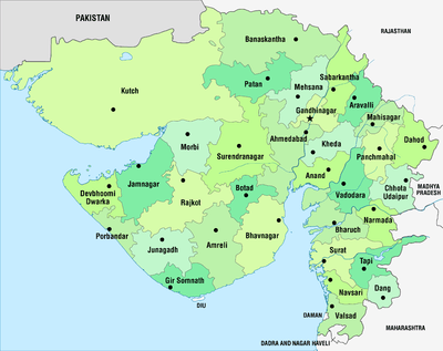 | |
|---|---|---|
| Regions of Gujarat |
| |
| Districts | ||
| Major cities | ||
| Ecoregions | ||
| Economy |
| |
| ||