Jukskei River
| Jukskei River | |
| River | |
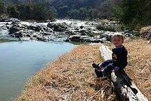
 Jukskei flowing past Gillooly's Farm | |
| Country | South Africa |
|---|---|
| Province | Gauteng |
| Source | Natural Spring |
| - location | Ellis Park [1], Johannesburg, South Africa |
| - coordinates | 26°11′46″S 28°03′50″E / 26.196°S 28.064°E |
| Mouth | Crocodile River |
| - elevation | 1,234 m (4,049 ft) |
| - coordinates | 25°52′34″S 27°55′38″E / 25.87611°S 27.92722°ECoordinates: 25°52′34″S 27°55′38″E / 25.87611°S 27.92722°E |
| Discharge | for Crocodile River |
| - average | 0 m3/s (0 cu ft/s) |
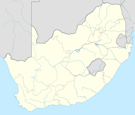 Location of the Jukskei River mouth | |
The Jukskei River[2] is one of the largest rivers in Johannesburg, South Africa. It is the southernmost river in the Crocodile River (West) basin.[3]
Course
The Jukskei begins in Ellis Park in Johannesburg. Its original spring was on the former Doornfontein farm, which measured at 18,000 liters per hour, but has since disappeared under subsequent urban development.[4] Now the first surface expression of the Jukskei is in Bertrams at the intersection of Queen Street and Sports Avenue where it emerges from a storm drain. From there the river flows through Bezuidenhout Valley and is dammed in Bruma. It then meanders in a northerly direction through Bedfordview and Edenvale, Gauteng before flowing through Alexandra Township. It then turns east and flows through Modderfontein, Buccleuch, Leeuwkop Prison, Lone Hill, Dainfern and Steyn City before joining the Crocodile River (Limpopo) outside Lanseria.[4]
Tributaries
The Jukskei River is joined by numerous streams along its course with its major tributaries being the Modderfontein Spruit, Braamfontein Spruit and Klein Jukskei River. The Jukskei River provides the largest amount of water, by discharge, into the Crocodile River (Limpopo) Basin.[4]
Character
The Jukskei is mostly shallow and not deep enough for transportation. It is also heavily polluted by urban runoff. Lack of infrastructure maintenance has let raw waste flow into the river on a daily basis. Outbreaks of cholera are prevalent. The river receives a large inflow from the Northern Waste Water Treatment Plant in northern Johannesburg. The Jukskei River is one of the largest contributing factors of the eutrophication problems facing Hartbeespoort Dam further down stream. Tons of waste such as plastic, metal and rubber flow down the river annually.[5][6]
The banks are prone to bursting,[7] especially in summer when rainfalls are the heaviest for the year regionally. This spells disaster for the impoverished residents of the Alexandra Township who often build makeshift shacks along the river banks owing to overcrowding and the need for access to water for washing, drinking, and cooking.
See also
References
- ↑ "Water, water... everywhere". City of Johannesburg. Retrieved 2008-06-20.
- ↑ "Exact location of Juksei River". Open Street Map.
- ↑ Crocodile/Marico WMA 3
- 1 2 3 Christie, Sean (3 January 2014). "Searching for the soul of the Jukskei". Mail and Guardian. South Africa. Archived from the original on 3 January 2014.
- ↑ "Statement by minister Ronnie Kasrils, Minister of water affairs and forestry". South African Government. Retrieved 2008-06-20.
- ↑ "Cholera found in Alexandra's Jukskei River". Daily Dispatch. Retrieved 2008-06-20.
- ↑ "Gauteng residents warned to be cautious in floods". Gauteng Provincial Government. 2006-01-12. Retrieved 2008-06-20.