Judaean Mountains
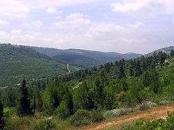
The Judaean Mountains (Hebrew: הרי יהודה Harei Yehuda, Arabic: جبال الخليل Jibal Al Khalil), is a mountain range in Israel and the West Bank where Jerusalem and several other biblical cities are located. The mountains reach a height of 1,000 m.[1] The Judean Mountains can be separated to a number of sub-regions, including the Mount Hebron ridge, the Jerusalem ridge and the Judean slopes. These mountains formed the heartland of the Kingdom of Judah, where the earliest Jewish settlements emerged.
Geography

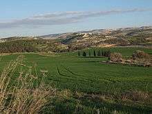
Running north to south, the Judaean mountains encompass Jerusalem, Hebron, Bethlehem and Ramallah. The range forms a natural division between the Shephelah coastal plains to the west and the Jordan Rift Valley to the east. The Judaean Mountains were heavily forested in antiquity. The range is mostly composed of terra rossa soils over hard limestones.[1][2]
Geology and history
The Judaean Mountains are the surface expression of a series of monoclinic folds which trend north-northwest through Israel. The folding is the central expression of the Syrian Arc belt of anticlinal folding that began in the Late Cretaceous Period in northeast Africa and southwest Asia. The Syrian Arc extends east-northeast across the Sinai, turns north-northeast through Israel and continues the east-northeast trend into Syria. The Israeli segment parallels the Dead Sea Transform which lies just to the east.[3][4]
In prehistoric times, animals no longer found in the Levant region were found here, including elephants, rhinoceri, giraffes and wild Asian water buffalo.[5]
The range has karst topography including a stalactite cave in Nahal Sorek National Park between Jerusalem and Beit Shemesh and the area surrounding Ofra, where fossils of prehistoric flora and fauna were found.
In ancient times the Judean mountains were the allotment of the Tribe of Judah and the heartland of the former Kingdom of Judah.[6][7]
Transportation
An Israel Railways line runs from Beit Shemesh along the Brook of Sorek and Valley of Rephaim into Jerusalem Malha Train Station.
References
- 1 2 Peter N. Peregrine, Melvin Ember (ed.). Encyclopedia of Prehistory: South and Southwest Asia. 8. Retrieved 2012-02-13.
- ↑ Arieh Singer (2007). The Soils of Israel. Springer. pp. 129,143.
- ↑ E. Abd El-Motaal and T.M. Kusky, 2003, Tectonic Evolution of the Intraplate S-Shaped Syrian Arc Fold-Thrust Belt of the Middle East Region in the Context of Plate Tectonics, The Third International Conference on the Geology of Africa, Vol. (2), pp. 139-157
- ↑ Flexor, A., el al., Late Cretaceous evolution of the Judean Mountains as indicated by ostracodes. Terra Nova, Volume 1, Issue 4, pages 349–358, July 1989
- ↑ "History of Jerusalem from Its Beginning to David". Biu.ac.il. 1997-03-06. Retrieved 2012-02-13.
- ↑ "Cambridge History of Judaism". Cambridge.org. p. 210. Retrieved 16 August 2011. "In both the Idumaean and the Ituraean alliances, and in the annexation of Samaria, the Judaeans had taken the leading role. They retained it. The whole political–military–religious league that now united the hill country of Palestine from Dan to Beersheba, whatever it called itself, was directed by, and soon came to be called by others, 'the Ioudaioi'"
- ↑ A History of the Jewish People, edited by Haim Hillel Ben-Sasson, page 226, "The name Judea no longer referred only to...."
External links
| Wikimedia Commons has media related to Judaean Mountains. |
| Wikivoyage has a travel guide for Judaean Mountains. |
- Pictures
- Judaean Mountains & Jerusalem
- Symbolism and Landscape: The Etzion Bloc in the Judaean Mountains, Yossi Katz and John C. Lehr
Coordinates: 31°40′N 35°10′E / 31.667°N 35.167°E