Jleeb Al-Shuyoukh
| Jleeb Al-Shuyoukh جليب الشيوخ Jalīb Al-Shuyūkh | |
|---|---|
| Nickname(s): Abassiya | |
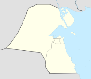 Jleeb Al-Shuyoukh Location of Jleeb Al-Shuyoukh in Kuwait | |
| Coordinates: 29°16′0″N 47°56′0″E / 29.26667°N 47.93333°ECoordinates: 29°16′0″N 47°56′0″E / 29.26667°N 47.93333°E | |
| Country | Kuwait |
| Governorate | Farwaniyah |
| Time zone | EAT (UTC+3) |
Jleeb Al-Shuyoukh (Arabic: جليب الشيوخ Transliteration: Jalīb Al-Shuyūkh) is a town in Kuwait. It is the closest town to Kuwait International Airport and is largely inhabited by expatriate workers from South Asia and Arab countries such as Egypt and Syria. Jleeb Al-Shuyoukh is located at 29°16′N 47°56′E.[1] New neighborhoods are coming up around the town. The United States State Department travel advice for Kuwait describes Jleeb Ash Shuyoukh as a 'high-crime area' and advises US citizens to avoid the area, especially at night.[2]
Schools
A number of schools reside in various locations of Jleeb Al-Shuyoukh, of which majority of them are Indian Schools.
The Indian Schools in Jleeb Al-Shuyoukh:
- Indian Educational School, Bharatiya Vidya Bhavan
- Indian Central School
- United Indian School Abbassiya
- Integrated Indian School Abbassiya
- Kuwait Indian School Abbassiya
- Al-Rashed Indian School
- Indian Learners Own Academy
The Pakistani Schools in Jleeb Al-Shuyoukh:
- Pakistan English School & College
Transports
Jleeb Al-Shuyoukh has a large population that utilises the public transport systems run by Kuwait Public Transport Company (KPTC) and Citybus, although a large number of illegal and cheap transport systems are available in these regions.
The town is flanked by major roads - Ghazali Expressway and the 6th Ring Road and is less than 5 km from the Kuwait International Airport.
References
- ↑ "Jleeb Al-Shuyoukh World City Database". WorldCityDB.com. Retrieved 2007-11-28.
- ↑ https://travel.state.gov/content/passports/en/country/kuwait.html
- ↑ List of schools in Kuwait