Jiangxia District
| Jiangxia 江夏区 | ||||||||||||||||||||||||||||||||||||
|---|---|---|---|---|---|---|---|---|---|---|---|---|---|---|---|---|---|---|---|---|---|---|---|---|---|---|---|---|---|---|---|---|---|---|---|---|
| District | ||||||||||||||||||||||||||||||||||||
|
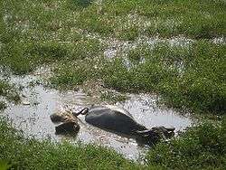
Most of Jiangxia is rural | ||||||||||||||||||||||||||||||||||||
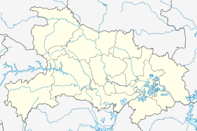 Jiangxia Location in Hubei | ||||||||||||||||||||||||||||||||||||
| Coordinates: 30°20′23″N 114°18′37″E / 30.3397°N 114.3104°ECoordinates: 30°20′23″N 114°18′37″E / 30.3397°N 114.3104°E[1] | ||||||||||||||||||||||||||||||||||||
| Country | People's Republic of China | |||||||||||||||||||||||||||||||||||
| Province | Hubei | |||||||||||||||||||||||||||||||||||
| Sub-provincial city | Wuhan | |||||||||||||||||||||||||||||||||||
| Area[2] | ||||||||||||||||||||||||||||||||||||
| • Total | 2,010.00 km2 (776.07 sq mi) | |||||||||||||||||||||||||||||||||||
| Population (2010)[3] | ||||||||||||||||||||||||||||||||||||
| • Total | 644,835 | |||||||||||||||||||||||||||||||||||
| • Density | 321/km2 (830/sq mi) | |||||||||||||||||||||||||||||||||||
| Time zone | China Standard (UTC+8) | |||||||||||||||||||||||||||||||||||
| Postal code | 4302XX | |||||||||||||||||||||||||||||||||||
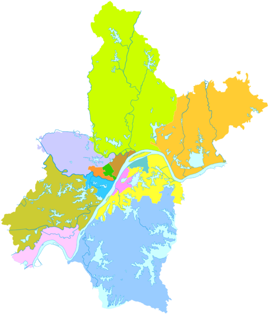
| Wuhan district map |
| |||||||||||||||||||||||||||||||||||
| Website |
jiangxia | |||||||||||||||||||||||||||||||||||
Jiangxia District (simplified Chinese: 江夏区; traditional Chinese: 江夏區; pinyin: Jiāngxià qū) is one of 13 districts of Wuhan, the capital of Hubei province, People's Republic of China, situated on the eastern (right) bank of the Yangtze River. Jiangxia district has an area of 2,009 square kilometres (776 sq mi) and a population of 680,000.[4] It is the southernmost and most sparsely populated of Wuhan's districts.[3] It borders the districts of Caidian and Hannan across the Yangtze and Hongshan to the north, as well as the prefecture-level cities of Ezhou to the east, Huangshi to the southeast, and Xianning to the south.

Unlike most other districts into which the City of Wuhan is divided, Jingxia, until recently included no part of Wuhan's main urban core. However, in the first decades of the 21st century urban development in the southeastern part of Wuhan's urban area (south of Guanggu Circle) has spilled over from Hongshan District into Jiangxia District as well.
Most of Jiangxia District still consists of the rural area south of the Wuhan city center. Jingxia has its own urban core, which is a large residential area called Zhifang (纸坊) some 20 kilometres (12 mi) south of Wuhan proper.
The Longquanshan Scenic Area (龙泉山), which contains the tombs of the Ming Princes of Chu (Wuchang-based descendants of the Hongwu Emperor) is located in the northeastern part of Jiangxi District. That area must have been quite rural, and remote from the provincial capital, Wuchang, in the Ming days; but today's Wuhan has spread to within a few kilometers of Longquanshan.
Transport
The Wulongquan East Railway Station (presently, no passenger service) of the Wuhan-Guangzhou High-speed Railway is located within the district.
The Wuhan–Xianning Intercity Railway, the region's first dedicated commuter rail line, opened in the late 2013, has several stations in the district. In particular, the Zhifang East Station (纸坊东站; 30°21′22″N 114°20′21″E / 30.356176°N 114.339223°E) serves the district's urban core. It takes 40-50 min by commuter train from Zhifang East to Wuhan's Wuchang Railway Station.[5]
As of 2012, the authorities were considering repurposing the military Shanpo Airfield (山坡机场; 30°05′17″N 114°18′52″E / 30.08806°N 114.31444°E), located in the district's Shanpo Township, as a commercial cargo airport. The possibility for dual civil and military use is considered as well. If the plans are implemented, Shanpo will become Wuhan's second airport (after Tianhe).[6]
References
- ↑ Google (2014-07-02). "Jiangxia" (Map). Google Maps. Google. Retrieved 2014-07-02.
- ↑ "Wuhan Statistical Yearbook 2010" (PDF). Wuhan Statistics Bureau. Retrieved 31 July 2011.p. 15
- 1 2 "武汉市2010年第六次全国人口普查主要数据公报". Wuhan Statistics Bureau. 10 May 2011. Retrieved 11 July 2011.
- ↑ "Profile of Jiangxia District" (in Chinese). Official website of Jiangxia District Government. 2007-05-28. Retrieved 2008-10-15.
- ↑ Zhifang East train schedule (Chinese)
- ↑ 武汉第二机场项目已上报发改委 江夏山坡机场开始“控违” (The plan for Wuhan's second airport has been submitted to the National Development and Reform Commission. Shanpo Airfield, in Jiangxia District, started to be considered), 2012-11-21
External links
| Wikimedia Commons has media related to Jiangxia District. |
- (Chinese) Jiangxia government official website