Jezkazgan
| Jezkazgan Жезқазған Жезказган | ||
|---|---|---|
 | ||
| ||
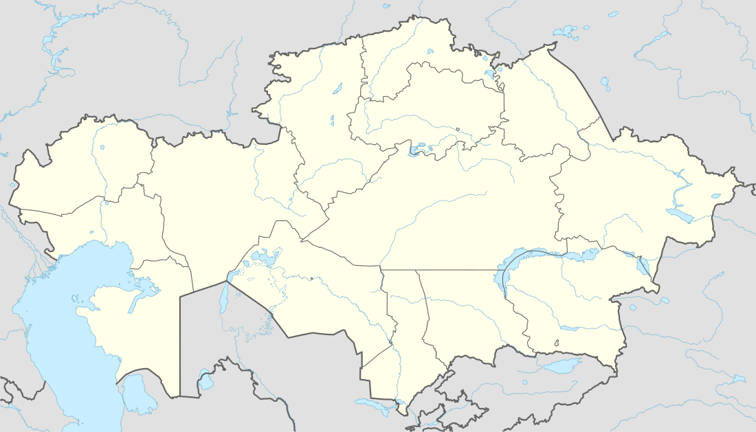 Jezkazgan Location in Kazakhstan | ||
| Coordinates: 47°47′0″N 67°42′0″E / 47.78333°N 67.70000°E | ||
| Country | Kazakhstan | |
| Region | Karaganda Region | |
| Founded | 1938 | |
| Government | ||
| • Akim (mayor) | Batyrlan Akhmetov | |
| Elevation | 300 m (1,000 ft) | |
| Population (2009) | ||
| • City | 86,227 | |
| • Urban | 90,661 | |
| Time zone | ALMT (UTC+6) | |
| Postal code | 100600 | |
| Area code(s) | +7 7102 | |
| Website | http://www.jezkazgan.kz | |
Jezkazgan or Zhezkazgan (Kazakh: Жезқазған / Jezqazğan/ جەزقازعان), formerly known as Dzhezkazgan (Russian: Джезказган, until 1992), is a city in Karaganda Region, Kazakhstan, on a reservoir of the Kara-Kengir River. Population: 86,227 (2009 Census results);[1] 90,001 (1999 Census results).[1] Its urban area includes the neighbouring mining town of Satpayev, for a total city population of 148,700.
55% of Jezkagan population are Kazakhs, 30% Russians, with smaller minorities of Ukrainians, Germans, Chechens and Koreans.
Geography and climate
Jezkazgan is situated in the very heart of the Kazakh upland, far away from a big river. It has an extremely continental semi-arid climate (BSk); rain is frequent but never heavy and monthly rainfall has never reached 100 millimetres (4 in). The average temperature ranges from 24 °C (75 °F) in July to −16 °C (3 °F) in January, whilst extremes ranges from 43 °C (109 °F) in June 1988 to −41.1 °C (−42.0 °F) in February 1951.
| Climate data for Dzhezkazgan | |||||||||||||
|---|---|---|---|---|---|---|---|---|---|---|---|---|---|
| Month | Jan | Feb | Mar | Apr | May | Jun | Jul | Aug | Sep | Oct | Nov | Dec | Year |
| Record high °C (°F) | 5.0 (41) |
9.0 (48.2) |
27.4 (81.3) |
34.2 (93.6) |
37.2 (99) |
43.0 (109.4) |
42.2 (108) |
42.4 (108.3) |
39.9 (103.8) |
30.5 (86.9) |
22.0 (71.6) |
9.8 (49.6) |
43.0 (109.4) |
| Average high °C (°F) | −8.5 (16.7) |
−7.1 (19.2) |
0.6 (33.1) |
15.7 (60.3) |
23.4 (74.1) |
29.9 (85.8) |
31.3 (88.3) |
29.8 (85.6) |
23.2 (73.8) |
13.7 (56.7) |
2.2 (36) |
−5.7 (21.7) |
12.4 (54.3) |
| Daily mean °C (°F) | −13.0 (8.6) |
−12.3 (9.9) |
−4.5 (23.9) |
8.6 (47.5) |
16.2 (61.2) |
22.6 (72.7) |
24.4 (75.9) |
22.5 (72.5) |
15.2 (59.4) |
6.3 (43.3) |
−2.8 (27) |
−10.2 (13.6) |
6.1 (43) |
| Average low °C (°F) | −17.6 (0.3) |
−17.3 (0.9) |
−9.0 (15.8) |
2.2 (36) |
8.7 (47.7) |
14.5 (58.1) |
16.8 (62.2) |
14.4 (57.9) |
7.1 (44.8) |
−0.1 (31.8) |
−7.1 (19.2) |
−14.6 (5.7) |
−0.2 (31.6) |
| Record low °C (°F) | −40.0 (−40) |
−41.1 (−42) |
−36.1 (−33) |
−15.6 (3.9) |
−6.6 (20.1) |
−2.2 (28) |
3.9 (39) |
−2.6 (27.3) |
−11.4 (11.5) |
−19.0 (−2.2) |
−37.2 (−35) |
−40.0 (−40) |
−41.1 (−42) |
| Average precipitation mm (inches) | 19 (0.75) |
16 (0.63) |
16 (0.63) |
17 (0.67) |
19 (0.75) |
17 (0.67) |
18 (0.71) |
11 (0.43) |
5 (0.2) |
16 (0.63) |
17 (0.67) |
16 (0.63) |
187 (7.36) |
| Average rainy days | 1 | 2 | 4 | 6 | 9 | 8 | 8 | 5 | 4 | 6 | 5 | 2 | 60 |
| Average snowy days | 17 | 13 | 7 | 2 | 0.3 | 0 | 0 | 0 | 0.03 | 2 | 8 | 14 | 63 |
| Average relative humidity (%) | 78 | 76 | 75 | 56 | 48 | 40 | 41 | 40 | 43 | 60 | 76 | 79 | 59 |
| Source: погода и климат[2] | |||||||||||||
History
The city was created in 1938 in connection with the exploitation of the rich local copper deposits. In 1973 a large mining and metallurgical complex was constructed to the southeast to smelt the copper that until then had been sent elsewhere for processing. Other metal ores mined and processed locally are manganese and iron.
During the Soviet era, Jezkazgan was the site of a Gulag labor camp, Kengir, mentioned in Aleksandr Solzhenitsyn's book The Gulag Archipelago, and Alexander Dolgun's "An American In The Gulag", and the period of forced resettlement of Koreans from the Russian Far East here.
Industry
Today the city is the headquarters of the copper conglomerate Kazakhmys, the city's main employer. The company has subsidiaries in China, Russia and the United Kingdom and is listed on the London Stock Exchange. There is a power station, Kazakhmys Power Plant with generation capacity of 207 MW and a 220 metres tall main chimney.
Transport
Although Jezkazgan is centrally located in the country, it has limited connections to the other regions by rail. There is a rail line to the regional capital city Karaganda. In addition, after opening the branch Zheskasgan-Beineu, Zheskazgan is on the strategic line of the railway corridor passes along the route, "China's border port of Aktau-Baku-Georgia-Europe" opened on August 22 2014[3]
Jezkazgan is connected by road to the cities Karaganda (by class-B European route E018), Kyzylorda and Arkalyk (both by the European route E123). The city is accessible by air via Zhezkazgan Airport.
Spacecraft landings
Soyuz spacecraft returning cosmonauts from outer space land in the remote flat countryside surrounding Jezkazgan. The Baikonur Cosmodrome lies 400 kilometres (250 mi) to the southwest and, by tradition, every cosmonaut plants a tree on Jezkazgan's Seyfullin-Boulevard to mark his or her safe return from space.
Persons associated with Jezkazgan
- Pyotr Klimuk, cosmonaut (an honorary citizen, not a local)
- Kaisar Nurmagambetov, flatwater canoer
- Vitaliy Savin, former Soviet athlete
- Oleg Yankovsky, Russian actor
References
- 1 2 "Население Республики Казахстан" (in Russian). Департамент социальной и демографической статистики. Retrieved 8 December 2013.
- ↑ "Weather and Climate - The Climate of Jezkazgan" (in Russian). Weather and Climate (Погода и климат). Archived from the original on 25 November 2016. Retrieved 25 November 2016.
- ↑ Kazakhstan's President launches two new railway links
External links
Capital: Karaganda | ||
| Districts |  | |
| Major cities | ||
| Capital |  | |
|---|---|---|
| Other cities | ||
Coordinates: 47°47′N 67°42′E / 47.783°N 67.700°E