Jeparit
| Jeparit Victoria | |||||||
|---|---|---|---|---|---|---|---|
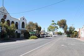 Roy Street, the main street of Jeparit | |||||||
 Jeparit | |||||||
| Coordinates | 36°08′0″S 141°59′0″E / 36.13333°S 141.98333°ECoordinates: 36°08′0″S 141°59′0″E / 36.13333°S 141.98333°E | ||||||
| Population | 632 (2011 census)[1] | ||||||
| Postcode(s) | 3423 | ||||||
| Elevation | 85 m (279 ft) | ||||||
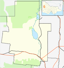
| Location |
| ||||||
| LGA(s) | Shire of Hindmarsh | ||||||
| State electorate(s) | Lowan | ||||||
| Federal Division(s) | Mallee | ||||||
| |||||||
Jeparit (/dʒəˈpærɪt/ jə-PARR-it) is situated on the Wimmera River in Western Victoria, Australia, 370 kilometres (230 mi) north west of Melbourne. At the 2011 census Jeparit had a population of 632.
History
The area around Jeparit had been home to the Gromiluk Aborigines prior to European settlement. The name Jeparit is believed to be derived from a Gromiluk word meaning "home of small birds". European settlement began in the 1880s when German Lutheran immigrants began to settle and grow wheat.
The town was surveyed in 1883 and gazetted in 1889, the post office opening on 31 August 1889 [2] though known as Lake Hindmarsh until December. Two earlier post offices called Lake Hindmarsh had existed in the area at various times since 1861 to serve a smaller population of graziers.
Jeparit’s most famous son is former Australian Prime Minister and founder of the Liberal Party, Sir Robert Menzies, who was born in the town in 1894. He is commemorated with a spire and a memorial bust installed at the town square. The spire is topped with a monument resembling a Scotch Thistle which contains the ashes of Sir Robert Menzies. The spire is inscribed:
This spire has been erected by the people of Jeparit and district, to honour Sir Robert Menzies. The spire symbolises the rise to world recognition of a boy who was born in Jeparit and who rose by his own efforts to become Australia's Prime Minister and a statesman recognised and honoured throughout the world.
With its neighbouring township, Rainbow, Jeparit has a football team (Jeparit-Rainbow) competing in the Mallee Football League.
Golfers play at the course of the Jeparit Golf Club on Nhill Road.[3]
Jeparit is the setting for Peter Carey's 1985 novel Illywhacker.
References
- ↑ Australian Bureau of Statistics (31 October 2012). "Jeparit (State Suburb)". 2011 Census QuickStats. Retrieved 18 October 2012.
- ↑ Premier Postal History, Post Office List, retrieved 11 April 20081 Check date values in:
|access-date=(help) - ↑ Golf Select, Jeparit, retrieved 11 May 2009
External links
![]() Media related to Jeparit at Wikimedia Commons
Media related to Jeparit at Wikimedia Commons
- Further information about Jeparit and surrounding areas
- Wimmera-Mallee Pioneer Museum
- Lake Hindmarsh