Jarabulus
| Jarabulus جرابلس Cerablus | |
|---|---|
| City | |
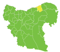
 Jarabulus Location of Jarabulus in Syria | |
| Coordinates: 36°49′03″N 38°00′40″E / 36.8175°N 38.0111°ECoordinates: 36°49′03″N 38°00′40″E / 36.8175°N 38.0111°E | |
| Country |
|
| Governorate | Aleppo |
| District | Jarabulus |
| Subdistrict | Jarabulus |
| Elevation | 367 m (1,204 ft) |
| Population (2004)[1] | 11,570 |
| Time zone | EET (UTC+2) |
| • Summer (DST) | EEST (UTC+3) |
| Geocode | C2227 |
Jarabulus (Arabic: جرابلس / ALA-LC: Jarābulus; Turkish: Cerablus, North Syrian Arabic: Jrāblos), is a Syrian city administratively belonging to Aleppo Governorate. Jarabulus, also known as Jerablus, lies on the western bank of the river Euphrates. In the 2004 census, the city had a population of 11,570.[1]
Ethnically, the city is composed of Arabs and Turkmens.[2][3]
It is located north of Lake Assad, just south of the Syrian-Turkish border and the Turkish town of Karkamış.
History
In the Bronze and Iron Ages, the archaeological site lying just North of Jarabulus (half of which is now in Turkey) was called "Karkemish", in Greek and Roman times the ancient name of the city was "Europos" (Εὐρωπός), which must have been at the origin of the modern form of the toponym Jerabis.
The original 18th century form of the toponym seems to have been "Djerabis", later found however as "Djeraboolos" or "Djerablus", probably deriving from Hierapolis (modern-day Manbij, to the South-West).
Being on the southern side of the Istanbul-Baghdad railway, Jarabulus became a border town with Turkey based on the Treaty of Lausanne in the aftermath of World War I.
Following the outbreak of the Syrian civil war, the Syrian opposition took it over along with its border post with Turkey on July 20, 2012. However, since early July 2013, the town has been controlled by the Islamic State of Iraq and the Levant.[4][5] By January 2014, rebels were engaging in clashes with ISIL and seized the town, but ISIL was able to recapture it within hours.[6]
An article published by The Guardian said that attempts by the Kurdish YPG to seize Jarabulus were prevented by President Erdoğan, who, according to media reports, had threatened in 2015 to attack the YPG using Turkish Armed Forces if they moved against Jarabulus. This threat secured ISIL control of the town.[7]
Operation Euphrates Shield
On August 24, 2016 around 4:00 AM (local time), Turkey, Ankara-backed rebels and Turkish Land Forces launched an operation to take Jarabulus from ISIL. The operation is being supported by the Turkish Air Force along with US-led coalition aircraft in an attempt to clear a passage for the troops. As of the 24th of August, Jarabulus and many neighboring towns has been claimed by the Free Syrian Army.[8] The FSA, backed by Turkish tanks, is attempting to connect Jarablus to al-Rai to push ISIL forces away from the Turkish border.
Proposed governance after the operation
On 6 September, the local council of Jarabulus based in Turkey, formed 2 years ago, accused Turkey of attempting to replace them with a newly formed council consisting of pro-Turkish Turkmen separatists. The Sultan Murad Division denied the accusations and accused the local council of being PYD "collaborators", although it did confirm forming a "council of elders" in the city. Harakat Nour al-Din al-Zenki's political leader Yasser Ibrahim al-Yusuf, son of the perpetrator of the Aleppo Artillery School massacre, also said that the city will be governored by a newly formed council.[9] The head of the Syrian Interim Government based in Turkey, Jawad Abu Hatab, has met with the Jarabulus local council on the same day.[10]
On 1 October the Syrian Turkmen Assembly head Dr. Emin Bozoğlan visited Jarablus along with other Turkmen and Turkish officials and pointed in his statement that "advance should continue until all Turkmen regions are under control", also congratulating the setting up of the Turkmen-composed police brigade Sultan Suleyman Shah Brigade for the public order in the city of Jarabulus and its vicinity.[11]
Electric infrastructure
After the Turkish operation in August and September 2016, Turkish authorities planned the building of a three-kilometre (1.9-mile) cable from Karkamış to Jarabulus in order to restore electricity in the city, with two kilometres (1.2 miles) being in Syrian territory. The electricity and potable water will be provided for free to the residents of Jarabulus.[12]
On 26 September, following the visits of Turkish officials from Gaziantep Municipality including its mayor and connecting of Jarabulus to the Turkish electrical power grid, a former school in Jarabulus was turned into a hospital and started servicing and was seen with an official Turkish sign reading "Turkish Ministry of Health - Jarablus Hospital" with a flag of Turkey.[13]
Climate
Jarabulus has a hot-summer Mediterranean climate, with influences of a continental climate during winter, hot dry summers, and cool wet and occasionally snowy winters. The average high temperature in January is 7.8 °C (46.0 °F) and the average high temperature in August is 38.1 °C (100.6 °F). The snow falls usually in January, February or December.
| Climate data for Jarabulus | |||||||||||||
|---|---|---|---|---|---|---|---|---|---|---|---|---|---|
| Month | Jan | Feb | Mar | Apr | May | Jun | Jul | Aug | Sep | Oct | Nov | Dec | Year |
| Average high °C (°F) | 8.0 (46.4) |
10.5 (50.9) |
16.1 (61) |
23.4 (74.1) |
28.7 (83.7) |
34.3 (93.7) |
37.7 (99.9) |
38.5 (101.3) |
34.2 (93.6) |
26.8 (80.2) |
16.3 (61.3) |
9.9 (49.8) |
23.7 (74.66) |
| Average low °C (°F) | −1.2 (29.8) |
−0.6 (30.9) |
4.3 (39.7) |
7.2 (45) |
12.5 (54.5) |
15.1 (59.2) |
19.9 (67.8) |
20.9 (69.6) |
16.3 (61.3) |
12.4 (54.3) |
6.4 (43.5) |
−0.5 (31.1) |
9.39 (48.89) |
| Average precipitation mm (inches) | 71 (2.8) |
49 (1.93) |
39 (1.54) |
35 (1.38) |
20 (0.79) |
3 (0.12) |
0 (0) |
0 (0) |
3 (0.12) |
21 (0.83) |
32 (1.26) |
64 (2.52) |
337 (13.29) |
| Average rainy days | 12 | 8 | 6 | 4 | 4 | 1 | 0 | 0 | 1 | 3 | 5 | 10 | 54 |
| Average snowy days | 2.0 | 1.0 | 0 | 0 | 0 | 0 | 0 | 0 | 0 | 0 | 0 | 1.5 | 4.5 |
| Average relative humidity (%) | 75 | 67 | 60 | 56 | 42 | 40 | 35 | 35 | 44 | 47 | 55 | 74 | 52.5 |
| Source: Weather Online, Weather Base, BBC Weather and My Weather 2 | |||||||||||||
References
- 1 2 "2004 Census Data for Nahiya Jarabulus" (in Arabic). Syrian Central Bureau of Statistics. Retrieved 15 October 2015. Also available in English: UN OCHA. "2004 Census Data". Humanitarian Data Exchange. Retrieved 4 December 2015.
- ↑ "ARGUMENTS ON SAFE HAVENS IN SYRIA: RISKS, OPPORTUNITIES AND SCENARIOS FOR TURKEY" (PDF). ORSAM. CENTER FOR MIDDLE EASTERN STRATEGIC STUDIES. Archived from the original (PDF) on April 2012.
- ↑ Khalifa, Mustafa. "The impossible partition of Syria" (PDF). Thematic Studies. Arab Reform Initiative. Archived from the original (PDF) on December 27, 2013. Retrieved 27 December 2013.
- ↑ The Islamic State of Iraq and ash-Sham Expands Into Rural Northern Syria Joshualandis.com, 18 July 2013
- ↑ The secret jihadi smuggling route through Turkey CNN, 5 November 2013
- ↑ "Syrian rebels push Qaeda affiliate from northwest stronghold". Chicago Tribune (Reuters). 17 January 2014. Archived from the original on January 18, 2014.
- ↑ Graeber, David (18 November 2015). "Turkey could cut off Islamic State's supply lines. So why doesn't it?". The Guardian.
- ↑ https://www.rt.com/news/356911-turkey-syria-rebels-jarabulus-isis/
- ↑ "Jarablus and the local council". Yalla Souriya. 6 September 2016.
- ↑ "Free Syria Army withdraws from Jarablus bases, cites disagreements with separatists". Al-Masdar News. 6 September 2016.
- ↑ . Emin Bozoğlan. 2 October 2016 https://twitter.com/DrEminBozoglan/status/782547004585107456. Retrieved 2 October 2016. Missing or empty
|title=(help) - ↑ "Turkey sends power lines into Syrian town cleared of IS". Middle East Eye. 8 September 2016.
- ↑ "Cerablus'ta atıl okul binası hastaneye dönüştürüldü". Anadolu Agency. 26 September 2016. Retrieved 27 September 2016.
- Barrington Atlas of the Greek and Roman World

Capital: Aleppo | ||||||||
|  | |||||||
|
| ||||||||
| ||||||||
| ||||||||
| ||||||||
| ||||||||