Jangpura
Jangpura is a neighbourhood in South Delhi district of Delhi. Beginning from the east and moving clockwise, it is bordered by the Mathura Road, Ring Railway line, Silver Oak Park beyond the Defence Colony Flyover, and the Barapulla Nullah. It encompasses the residential areas of Jangpura A and B on either side of the Mathura Road, Bhogal village extending west from the Mathura Road until Jangpura Extension, which in turn extends along the northern side of the Ring Railway line to the east side of the Defence Colony Flyover on Josip Broz Tito Marg. The small colony of Pant Nagar along the Barapulla Nullah is contiguous with Jangpura Extension.
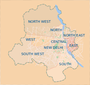
Jangpura is a Delhi Legislative Assembly constituency within the East Delhi Lok Sabha seat, following the delimitation of the parliamentary constituencies, since 2008, prior to which it was part of the New Delhi constituency.
History
One Colonel Young, tasked with moving the villagers of Raisina – a village soon to disappear to make way for the grand edifices of state to come up along Rajpath, established the colony of 'Youngpura', which was colloquialised as Jangpura. Later, in 1950–51, it grew to add Jangpura Extension to accommodate many of the refugees who arrived in Delhi at the time of Partition of India.[1] That accounts for Jangpura Extension's high Punjabi and Sikh population to date. This includes people from the villages in Rawalpindi district, including Thoa Khalsa, which witnessed a mass suicide by women during the Rawalpindi riots in March 1947, apart from Thamali and Mator Nara villages.[2] Each year, the Sikh community commemorates the event as Shahidi Diwas (Martyrs' Day) on March 13.[3]
Another version of the story is that British Raj named the town for "Jang Bahadur Rana of Nepal" for his friendship to the British during his 38-year rule in Nepal.
Its image along with neighbouring Lajpat Nagar across the railway line as a haven for refugees continues, with several Afghan and Iranian refugees, among others, finding shelter in the cheap housing offered in Bhogal and Lajpat Nagar. Bhogal's many old Punjabi eateries today share space with Afghan bakeries, and new Punjabi arrivals such as Giani's, an ice-cream parlour set up by a rabri purveyor of Old Delhi. In the 1970s, as artists living in Jangpura Extension grew, it became a well-known artists’ colony.[4]
Jangpura-Bhogal is home to a number of places of worship which represent every major religion, including St. Michael's Church, Shahi Masjid, Gurudwara Singh Sabha, Sanatan Dharm Mandir, the Sanatan Da Dera Gurudwara and the Bhogal Buddha Vihar.
There are also stories about transformation of name from kamina basti to youngpura to bhogal and now jungpura.
Landmarks
- Jawed Habib Hair and Beauty
- Mediplex health
- Rama Tent House
- SONU ELECTRICAL & ELECTRONICS, Masjid Road, Bhogal, Jangpura
- Eros Cinema
- Om Hotel
- Hawker's House, aka Novelty Store
- Kadimi Chaat
- Netram Puranmal
- Sanatan Dharam Mandir, (Gufa wala) Pant Nagar
- Arun Bhardwaj Lawyer Supreme Court
- Barbeque Nation
- Mc Donald's
- PUSHKARJEE JEWELLERS
Transport links
Jangpura Station is on the Violet Line of the Delhi Metro, which runs from I.T.O. to Badarpur, Delhi. It is the 4th and last underground station on the line. The entrance to the Metro station is next to Silver Oak Park, adjacent to the Pant Nagar Bus Stop on the east side of Tito Marg. The Pant Nagar Bus Stop has DTC bus services to Palam, Greater Kailash, Ambedkar Nagar, Delhi Main Railway Station, AIIMS, Safdarjung, Jawaharlal Nehru Stadium, among others. Jangpura is also served by Lajpat Nagar Station on the Ring Railway service of the Delhi Suburban Railway. It also is close to the Hazrat Nizamuddin Railway Station, which lies in Nizamuddin East.
An exit for Jangpura is currently being constructed on the Barapulla Elevated Highway, which was built in 2010 for the XIXth Commonwealth Games to link Jawaharlal Nehru Stadium with Sarai Kale Khan on the Outer Ring Road.
Vicinity
- Dargah of Hazrat Nizamuddin Auliya in Nizamuddin West
- Tomb of Humayun, 2nd Mughal Emperor, a UNESCO World Heritage Site
- Chausath Khamba, tomb of Mirza Aziz Koka
- Barakhamba
- Jawaharlal Nehru Stadium
- Lodhi Gardens
- Khan Market
- Defence Colony
Further reading
- jangpura as palimpsest, post by blogger Anand Vivek Taneja
- Blogger Lesley A. Esteves on the travails of renting in Jangpura
- Outlook Traveller editor Kai Friese on the remaking of the old Eros cinema
- Indian Express journalist Chinky Sinha on the Afghan bakers of Bhogal
- Rahul Verma of The Hindu visits Bhogal's Kabul Restaurant
- Rahul Verma again, on the sandwiches of Hawker's House
References
- ↑ Kaur, Ravinder (2007). Since 1947: Partition Narratives among Punjabi Migrants of Delhi. Oxford University Press. ISBN 978-0-19-568377-6.
- ↑ Bhutalia, p. 156
- ↑ Bhutalia, p. 287
- ↑ Pablo Bartholomew (August 13, 2012). "The death of a man so young, in the prime of his life". Hindustan Times. Retrieved August 17, 2012.
External links
- Urvashi Butalia (2000). The other side of silence: voices from the partition of India. C. Hurst & Co. Publishers. ISBN 1-85065-533-2.
Coordinates: 28°35′N 77°15′E / 28.583°N 77.250°E