Janapar
Janapar is a marked trail through mountains, valleys and villages of Nagorno-Karabakh. The trail passes by monasteries and fortresses along its route. The trail is broken into day hikes, taking hikers to a different village each night.[1] Hikers can either stay with a village family or set up camp nearby. The paths have existed for centuries, but now are marked specifically for hikers.[2]
Janapar Trail Route
The Janapar Trail, marked in 2007, leads from the southern town of Hadrut to the capital of Stepanakert over the course of a week, and from there continues north to the region of Shahumian, and on to Vardenis in Armenia. Important sites along this hike include Dadivank monastery, Gandzasar monastery, Shushi, the Karkar Canyon with its high cliffs, the astonishing[3] Zontik Waterfall and ruins of Hunot, as well as the 2,000-year-old tree of Skhtorashen, Azykh Cave and Gtichavank monastery. There are also hot springs in Zuar, a geyser near Karvachar city and other springs and waterfalls along the way.
All of the Janapar Trail can be followed using the Viewranger app. The entire southern portion of the route from Hadrut to Stepanakert and on to Kolatak is marked with blue painted blazes. North of Kolatak is not marked and hikers must rely on the Viewranger app, or a GPS with the downloaded tracks, or the topographic maps made available on the Janapar website.
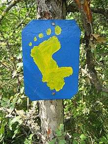
Janapar symbol
The symbol of the trail is an outline of Nagorno-Karabakh Autonomous Oblast, with five circles of increasing size on top, which take on the appearance of a footprint.
Gallery
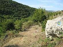
Some photos from along the Janapar
.jpg) The views from the Janapar tourist route. Section between the cities Shushi/Shusha and Stepanakert/Xankəndi
The views from the Janapar tourist route. Section between the cities Shushi/Shusha and Stepanakert/Xankəndi.jpg) The view from the Janapar tourist route. Section between Karintak/Dashalty village and the city of Shushi/Shusha
The view from the Janapar tourist route. Section between Karintak/Dashalty village and the city of Shushi/Shusha.jpg) Minarets of Ashaghi Govhar Agha Mosque in Shushi/Shusha
Minarets of Ashaghi Govhar Agha Mosque in Shushi/Shusha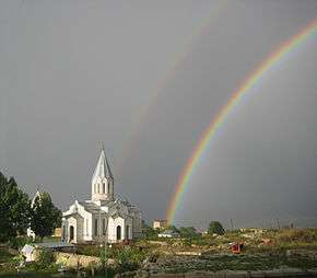 Cathedral of Shushi
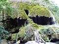 Zontik Waterfall in Karkar Canyon
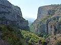 Karkar Canyon
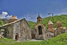 Dadivank Monastery
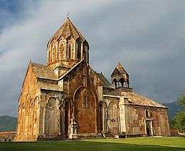 Gandzasar Monastery
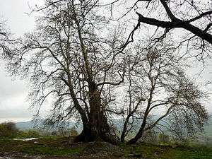 2,000 year old Skhtorashen tree
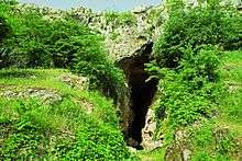 Azokh Cave
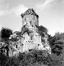 Gtichavank (old photo)
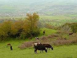 Fields near Karmir Shuka
References
- ↑ Huffington Post, 01/27/2012, Nagorno Karabakh: The Black Garden. Olivia Katrandjian.
- ↑ Walk, the magazine of The Ramblers, Summer 2009, "Up the Garden Path" p 67-69. Laurence Mitchell.
- ↑ New York Times, 04/08/2015, A Warm Welcome in the Caucasus Mountains. Seth Kugel.
- Destination Janapar - Yerevan Magazine, May-June 2013
- Le Janapar Trail - Nouvelle d'Arménie, April 2013 (No. 195, pp. 68-73)
- נגורנו קראבאך: מסע בארץ מצולקת
External links
| Wikivoyage has a travel guide for Janapar Trail. |