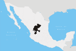
Jalpa, Zacatecas
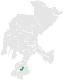
Jalpa is located in the Mexican state of Zacatecas, close to the border with Jalisco and Aguascalientes and about a three-hour drive south of the capital city, Zacatecas. Jalpa is a colonial-style city, with cobble stone streets, narrow walkways, two main churches: El Señor de Jalpa and La Parroquia de San Antonio, and two plazas. Jalpa was modeled by the French in the 18th century. In the middle of the plaza is a kiosk which remains in good shape today, after hundreds of years. Most houses are painted in bright colors just as in colonial times. The houses are made of adobe and share common walls and most have flat roofs.
The original indigenous natives were the Caxcan, Chichimeca and Huichol people.
History
Founded in the early 16th Century (1530s) by Spanish explorers in search of gold and silver, Jalpa was spelled "Xalpa" by its native Caxcan, Chichimeca and Huichole people. Conquered by the Spanish, the Indian population inter-mixed with Spanish and other European peoples to form today's mestizos. Mestizo is a term traditionally used in Latin America for people of mixed European and Native American heritage or descent. The term originated as a racial category in the Casta system that was in use during the Spanish empire's control of its American colonies; it was used to describe those who had one European-born parent and one who was member of an indigenous American population. In the Casta system mestizos had fewer rights than European born persons called "Peninsulares", and "Criollos" who were persons born in the new world of two European born parents.
During the colonial period, mestizos quickly became the majority group in much of what is today Latin America and the southwestern United States (which used to belong to Mexico); and when the colonies started achieving independence from Spain, the mestizo group often became dominant. In some Latin American countries, such as Mexico, the concept of the "mestizo" became central to the formation of a new independent identity that was neither wholly Spanish nor wholly indigenous and the word mestizo acquired its current double meaning of mixed cultural heritage and actual racial descent.
Population
The population is between ten and twelve thousand with most living within the town and surrounding communities. The population continues to grow since Jalpa is a significant transportation hub between the cities of Guadalajara, Aguascalientes, and Zacatecas. A large percentage of the population is older than 50 years; and there are significantly more females than males in the younger age bracket; the overall female to male ratio is about 60% to 40%. This disproportion is because more males migrate to the United States, where as females usually stay.
Economy
Much of the growth in Jalpa is fed by remittances in US dollars from former residents who have emigrated to the United States. Almost every family has at least one member, usually male, residing in the US. Most family members receive money from those living in the United States. There are no known factories in this town that export goods. Farming activity has also been decreasing due to water table shortage in the region's aquifer. Most of Zacatecas lies within two high sierras, hence its dry climate and poor rain seasons. Many traditional plantations/farms that grow guayaba and sugar cane in the 70s, 80s, and early 90s, have been now replaced with agave fields- since these plants require minimal water for growth. Other current farmed crops are: maize (corn), bean, sugar cane, alfalfa, calabaza (pumpkin), and wild cactus (nopales) which gives a fruit called Tuna (prickly pear in the US).
Zacatecas (capital) | ||
| Municipalities and (municipal seats) |
|  |
Coordinates: 21°38′N 100°51′W / 21.633°N 100.850°W