Jagodnjak
| Jagodnjak Јагодњак (Serbian)[1] | |||
|---|---|---|---|
| Municipality | |||
| Municipality of Jagodnjak Općina Jagodnjak | |||
|
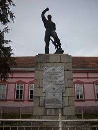
Jagodnjak Municipal Building | |||
| |||
 Jagodnjak Location of Jagodnjak in Croatia | |||
| Coordinates: 45°42′N 18°35′E / 45.700°N 18.583°E | |||
| Country |
| ||
| County |
| ||
| Government | |||
| • Municipal mayor | Anđelko Balaban | ||
| Area | |||
| • Total | 105 km2 (41 sq mi) | ||
| Population (2011) | |||
| • Total | 2,040 | ||
| • Density | 19/km2 (50/sq mi) | ||
| Time zone | CET (UTC+1) | ||
| • Summer (DST) | CEST (UTC+2) | ||
| Postal codes |
31323 Bolman 31324 Jagodnjak | ||
| Area code(s) | +031 | ||
| Official languages | Croatian, Serbian[2] | ||
| Website |
www | ||


Jagodnjak (Serbian Cyrillic: Јагодњак) is a village and a municipality in the Osijek-Baranja County, Croatia. Jagodnjak development index is less than 50% of the Croatian average,[3] which classifies them into 10% of the poorest municipalities. Therefore, the municipality is part of the Areas of Special State Concern.[4]
Name
Jagodnjak name is derived from the Croatian word "jagoda" ("strawberry" in English). In other languages, the village in German is known as Katschfeld and in Hungarian as Kácsfalu, and is written as Јагодњак in Serbian Cyrillic.[5]
Geography
The municipality of Jagodnjak includes the following settlements:
- Jagodnjak
- Bolman
- Majške Međe
- Novi Bolman
Demographics
Population
There are 2,537 inhabitants in the municipality (2001 census), including:
- Serbs (64.72%)
- Croats (26.65%)
- Hungarians (2.88%)
- Romani (1.18%)
Before World War II there was a substantial Danube Swabian minority here but they were all expelled by the Communist regime of Josip Broz Tito after 1945.
Languages
Due to the local minority population, the Jagodnjak municipality prescribe the use of not only Croatian as the official language, but the Serbian language and Serbian Cyrillic alphabet as well.[5][6]
Politics
Multilateral cooperation
Jagodnjak municipality is one of seven member municipalities of Joint Council of Municipalities, inter-municipal sui generis organization of Serbian community in eastern Croatia.
Notable natives and residents
See also
- Osijek-Baranja County
- Baranja
- Joint Council of Municipalities
- Church of St Nicholas, Jagodnjak
- List of Croatian municipalities with minority languages in official use
References
- ↑ Government of Croatia (October 2013). "Peto izvješće Republike Hrvatske o primjeni Europske povelje o regionalnim ili manjinskim jezicima" (PDF) (in Croatian). Council of Europe. p. 36. Retrieved 30 November 2016.
- ↑ Četvrto izvješće Republike Hrvatske o primjeni Europske povelje o regionalnim ili manjinskim jezicima, Zagreb, 2009
- ↑ http://www.zadra.hr/ugovori/odluka_o_razvrstavanju_jedinica_lokalne_i_podrucne_(regionalne)_samouprave_prema_stupnju_razvijenosti.pdf
- ↑ http://www.pravo.unizg.hr/_download/repository/Zakon_o_PPDS.pdf
- 1 2 http://www.nipp.hr/UserDocsImages/Registar%20geografska%20imena%20nacionalnih%20manjina%20RH.pdf
- ↑ Izvješće o provođenju ustavnog zakona o pravima nacionalnih manjina i o utošku sredstava osiguranih u državnom proračunu Republike Hrvatske za 2008. godinu za potrebe nacionalnih manjina, Zagreb, 2009.
External links
| Wikimedia Commons has media related to Jagodnjak. |
- Official website (Croatian)


 |
Petlovac | Petlovac Beli Manastir |
Beli Manastir Čeminac |
|
| Belišće | |
Darda | ||
| ||||
| | ||||
| Valpovo | Petrijevci | Darda |
Coordinates: 45°42′N 18°35′E / 45.700°N 18.583°E