Jaco Island

Jaco Island, sometimes spelt Jako, is an uninhabited island in East Timor, a country occupying the eastern end of the island of Timor in the Lesser Sunda Islands of Wallacea. It lies within Nino Konis Santana National Park.
Overview

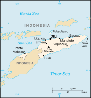
Jaco lies just off the eastern end of the island of Timor, part of the Tutuala subdistrict in Lautém District, and is separated from the mainland in front of Valu Beach by a 700-metre-wide (2,300-foot) channel navigable by small vessels. It is low lying, with an area of 11 square kilometres (4.2 square miles) and a maximum elevation of about 100 metres (330 feet). It is covered mainly by tropical dry forest, fringed by strand vegetation and sandy beaches. There are some low cliffs on the southern coast.
History
The Limestone Island was formed from Coral and is surrounded by limestone cliffs and coral reefs. There was one lighthhouse on the island built by the Indonessian but in 2010 the 35-metre-high (115-foot) structure was removed. To the locals the island is considered sacred due to the two seas meeting. As Banda Sea and Timor Sea meet the island is technically not allowed to be visited but locals will happily take you to the island for US$10 on one of the fishing boats.
Geography
The average annual temperature is roughly 27 °C (81 °F). On average the island receives 1,436 millimetres (56.5 inches) of rain and the north and east coast of the small island is somewhat drier.
Wildlife
The island supports populations of bar-necked cuckoo-doves, black cuckoo-doves, pink-headed imperial pigeons, streak-breasted honeyeaters, fawn-breasted whistlers, blue-cheeked flowerpeckers, flame-breasted sunbirds and Timor sparrows.
The Javan rusa native deer can also be founded on the island and unlike mainland deer they have become accustomed to drinking salt water due to the lack of freshwater on the island.
See also
References
Coordinates: 8°25′30″S 127°19′30″E / 8.42500°S 127.32500°E