Jabal al-Akrad
| Jabal al Akrad | |
|---|---|
| Çiyayê Kurdan | |
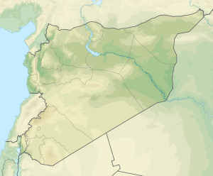 Jabal al Akrad Location in Syria | |
| Highest point | |
| Elevation | 400–1,000 m (1,300–3,300 ft) |
| Geography | |
| Location | Latakia, Idlib, Syria |
Jabal al Akrad (Kurdish: Çiyayê Kurdan, چیای کوردان; Arabic: جبل الأكراد Jabal al-Akrād) literally Mountain of the Kurds is a rural mountainous region with an elevation that ranges from 400 to 1,000 meters above sea level, in northwestern Syria along the Coastal Mountain Range. It is located in the northeastern Latakia Governorate, near the borders with Idlib Governorate and Turkey. The Mountain of the Kurds should not be confused with the neighboring Kurd Mountains (Kurd-Dagh), which are located further northeast.
Its major towns are Salma and Kinsabba. It includes about 60 villages with a population of about 150,000. The inhabitants of the area are of Kurdish descent who in recent years have shifted to speaking the Arabic language and belong primarily to the following four tribes: Mushan in Salma, Duwarin, Tartiah; 'Ujan in Kinsabba, Nahsheba, Ard al-Wati; Kikhia in Majdal Kikhia, Tauma, Beroma, Duwairka, and Shekhan in Wadi al-Shekhan, Qasatil and al-Ido. Each tribe in turn is divided to several clans. The inhabitants of Jabal al-Akrad are predominantly Sunni Muslims, in contrast with the inhabitants of the greater Latakia District who are 80% Alawites.[1]
Jabal al-Akrad is rich in forests and natural resources. As a result of the Syrian civil war the region has seen numerous military clashes between the armed opposition groups and the Syrian army.
References
- ↑ Balanche, 2006, p. 60.
External links
Coordinates: 35°39′N 36°12′E / 35.650°N 36.200°E