Ives Peak
| Ives Peak | |
|---|---|
 Ives Peak | |
| Highest point | |
| Elevation | 7,920 ft (2,414 m) [1] |
| Prominence | 760 ft (232 m) [1] |
| Coordinates | 46°30′11″N 121°26′49″W / 46.50306°N 121.44694°WCoordinates: 46°30′11″N 121°26′49″W / 46.50306°N 121.44694°W [2] |
| Geography | |
| Location | Goat Rocks, Washington, U.S. |
| Parent range | Cascade Range |
| Topo map | USGS Old Snowy Mountain |
| Climbing | |
| Easiest route | Scramble |
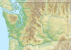
Ives Peak (7,920 feet (2,410 m) is located in the Goat Rocks on the border of Lewis and Yakima Counties, in the U.S. state of Washington. Ives Peak is within the Goat Rocks Wilderness and the McCall Glacier on its eastern slopes. Additionally, the Pacific Crest National Scenic Trail is near the west slopes of the peak.[3]
References
- 1 2 "Ives Peak, Washington". Peakbagger.com. Retrieved 2012-11-17.
- ↑ "Ives Peak". Geographic Names Information System. United States Geological Survey. Retrieved 2012-11-17.
- ↑ Old Snowy Mountain, WA (Map). TopoQwest (United States Geological Survey Maps). Retrieved 2012-11-17.
This article is issued from Wikipedia - version of the 8/24/2016. The text is available under the Creative Commons Attribution/Share Alike but additional terms may apply for the media files.