Isfara
| Isfara Исфара Boston Isfara | |
|---|---|
|
A sign welcoming travellers to Isfara | |
 Isfara | |
| Coordinates: 40°07′N 70°38′E / 40.117°N 70.633°E | |
| Country |
|
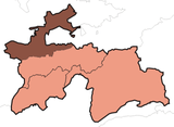
| Province | Sughd |
| District | Isfara |
| Incorporated | 1933 |
| Government | |
| • Mayor | Dilshod Rasulzoda |
| Area | |
| • Total | 832 km2 (321 sq mi) |
| Elevation | 863 m (2,831 ft) |
| Population (2008) | |
| • Total | 40,600 |
| Postcode | 735920 |
| Website | http://isfara.tj |

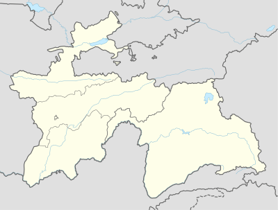
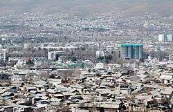
Isfara (Tajik: Исфара, Persian: اسفره) is a city in Sughd Province in northern Tajikistan, situated on the border with Kyrgyzstan. It has a population of 40,600 (2008 est.).[1] The city is the capital of the Isfara district.
History
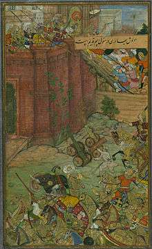
Isfara is one of the oldest ancient towns in Central Asia, its first name was Asbara. The town is mentioned in Tabari's history from the 10th century, when it was an important stop on the northern branch of the Silk Road. Around 20 km south of the town centre in Churku village, the mausoleum Hazrati Shoh Mausoleum,[2] is carved from wood, partly dating back to the 8th century,[3] a structure that is unique in Central Asia. By the 11th and 12th centuries Isfara had a developed economy, and it was considered by Babur (1482-1530) to be one of the region's main towns. The 16th century saw the construction of large public buildings, notably mosques and medreseh. In the 17th century Isfara was part of the Kokand Khanate.
Demographics
The population of Isfara is mostly Tajik.
| Year | Population | Type |
|---|---|---|
| 1989 | 34,500 | census |
| 2000 | 37,000 | census |
| 2008 | 40,600 | estimate[1] |
Geography
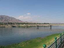
Isfara is situated near the border junction of three independent states Tajikistan, Uzbekistan and Kyrgyzstan, at a height of 863m above sea level. Its territory is 832 km².
Climate
The Köppen Climate Classification sub-type classification for Isfara is "Bwk" or a Tropical and Subtropical Desert Climate. The average temperature is 11.8°C (53.2°F) with the warmest month being July with an average temperature of 25°C (77°F) and the coldest month being January with an average temperature of -2.7°C (27.1°F). The average amount of precipitation is 544.6mm (21.4") and there are on average 74.3 days of participation.[4]
| Climate data for Isfara | |||||||||||||
|---|---|---|---|---|---|---|---|---|---|---|---|---|---|
| Month | Jan | Feb | Mar | Apr | May | Jun | Jul | Aug | Sep | Oct | Nov | Dec | Year |
| Daily mean °C (°F) | −2.7 (27.1) |
−0.6 (30.9) |
6.2 (43.2) |
13.6 (56.5) |
18.3 (64.9) |
22.9 (73.2) |
25 (77) |
23.2 (73.8) |
18.4 (65.1) |
11.9 (53.4) |
5.4 (41.7) |
0.1 (32.2) |
11.8 (53.2) |
| Average precipitation mm (inches) | 56.9 (2.24) |
62.6 (2.465) |
89.9 (3.539) |
83.8 (3.299) |
68.3 (2.689) |
18.7 (0.736) |
10.8 (0.425) |
3 (0.12) |
5.4 (0.213) |
43.7 (1.72) |
47.1 (1.854) |
54.4 (2.142) |
544.6 (21.441) |
| Average precipitation days (≥ 0.1 mm) | 7.9 | 8.5 | 10.1 | 9.7 | 9 | 4.3 | 2.6 | 1.5 | 1.9 | 5.3 | 6.1 | 7.4 | 74.3 |
| Average relative humidity (%) | 74.2 | 72.3 | 65 | 58.6 | 51.4 | 40.5 | 39.9 | 43 | 45.9 | 55.9 | 65.1 | 73.2 | 57.1 |
| Source: "The Climate of Karakol". Weatherbase. Retrieved 31 July 2014. | |||||||||||||
Economy

Some 20 industrial companies in Isfara produce electrical equipment, chemical and metallurgical products, construction materials, food products and others.
Isfara is famous for its apricot orchards.
See also
| Wikimedia Commons has media related to Isfara. |
External links
- Isfara Online Portal
- Travel to Isfara
- Relief International Schools Online Internet Learning Center in Isfara - Archive.org
- "Welcome to Isfara"
- A roadside teahouse in Isfara
- Habib Borjian, "Esfara", in Encyclopaedia Iranica, Columbia University (enter keyword "Esfara" in search field to access the article).
References
- 1 2 Population in the Republic of Tajikistan as of 1 January 2008, State Statistical Committee, Dushanbe, 2008
- ↑ Hazrati Shoh mausoleum
- ↑ p181 Middleton & Thomas, Tajikistan (Odyssey Guide)
- ↑ "Weatherbase.com". http://www.weatherbase.com. Retrieved 1 August 2014. External link in
|website=(help)
Coordinates: 40°07′N 70°38′E / 40.117°N 70.633°E
| Rank | Name | Administrative division | Pop. | ||||||
|---|---|---|---|---|---|---|---|---|---|
 Dushanbe 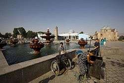 Khujand |
1 | Dushanbe | Dushanbe | 775,800 | 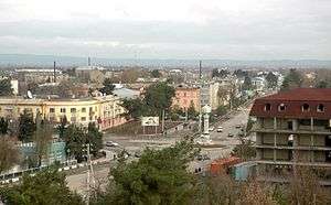 Qurghonteppa  Kulob | ||||
| 2 | Khujand | Sughd | 169,700 | ||||||
| 3 | Qurghonteppa | Khatlon | 101,600 | ||||||
| 4 | Kulob | Khatlon | 99,700 | ||||||
| 5 | Istaravshan | Sughd | 58,600 | ||||||
| 6 | Vahdat | Region of Republican Subordination | 52,900 | ||||||
| 7 | Tursunzoda | Region of Republican Subordination | 50,900 | ||||||
| 8 | Konibodom | Sughd | 48,900 | ||||||
| 9 | Isfara | Sughd | 45,900 | ||||||
| 10 | Panjakent | Sughd | 40,000 | ||||||