Irodo River
| Irodo River | |
| River | |
 Ambohitra Massif river system | |
| Country | |
|---|---|
| Region | Diana - Sava |
| City | Maromokotra |
| Source | |
| - location | Ambohitra Massif, Diana |
| - elevation | 1,100 m (3,609 ft) |
| Mouth | Indian Ocean |
| - location | Diana |
| - elevation | 0 m (0 ft) |
| - coordinates | MG 12°48′40″S 49°39′40″E / 12.81111°S 49.66111°ECoordinates: MG 12°48′40″S 49°39′40″E / 12.81111°S 49.66111°E |
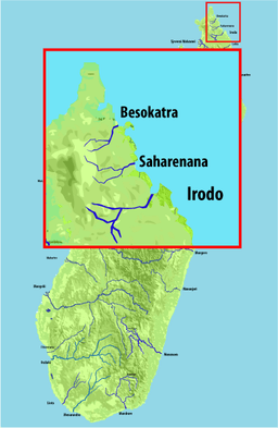
The Irodo River is located in northern Madagascar. Its sources are situated in the Ambohitra Massif and flows into the Indian Ocean. Near Sadjoavato it formed the Tsingy Rouge,[1] a stone formation of red laterite formed by erosion.[2]
References
This article is issued from Wikipedia - version of the 3/21/2016. The text is available under the Creative Commons Attribution/Share Alike but additional terms may apply for the media files.